Safety Score: 3,0 of 5.0 based on data from 9 authorites. Meaning we advice caution when travelling to United Kingdom.
Travel warnings are updated daily. Source: Travel Warning United Kingdom. Last Update: 2024-08-13 08:21:03
Explore Rowley Regis
Rowley Regis in Sandwell (England) with it's 1,001 inhabitants is located in United Kingdom about 106 mi (or 170 km) north-west of London, the country's capital.
Local time in Rowley Regis is now 01:30 PM (Friday). The local timezone is named Europe / London with an UTC offset of zero hours. We know of 8 airports in the wider vicinity of Rowley Regis, of which 5 are larger airports. The closest airport in United Kingdom is Birmingham International Airport in a distance of 13 mi (or 20 km), East. Besides the airports, there are other travel options available (check left side).
There are several Unesco world heritage sites nearby. The closest heritage site in United Kingdom is Pontcysyllte Aqueduct and Canal in a distance of 50 mi (or 80 km), North-West. Also, if you like golfing, there are multiple options in driving distance. We found 1 points of interest in the vicinity of this place. If you need a place to sleep, we compiled a list of available hotels close to the map centre further down the page.
Depending on your travel schedule, you might want to pay a visit to some of the following locations: Oldbury, Dudley, Walsall, Wolverhampton and Birmingham. To further explore this place, just scroll down and browse the available info.
Local weather forecast
Todays Local Weather Conditions & Forecast: 8°C / 46 °F
| Morning Temperature | 5°C / 40 °F |
| Evening Temperature | 7°C / 44 °F |
| Night Temperature | 5°C / 41 °F |
| Chance of rainfall | 0% |
| Air Humidity | 75% |
| Air Pressure | 1027 hPa |
| Wind Speed | Light breeze with 5 km/h (3 mph) from North-East |
| Cloud Conditions | Overcast clouds, covering 100% of sky |
| General Conditions | Overcast clouds |
Saturday, 16th of November 2024
9°C (48 °F)
6°C (43 °F)
Light rain, gentle breeze, overcast clouds.
Sunday, 17th of November 2024
7°C (45 °F)
2°C (36 °F)
Light rain, moderate breeze, overcast clouds.
Monday, 18th of November 2024
5°C (40 °F)
-0°C (32 °F)
Snow, moderate breeze, overcast clouds.
Hotels and Places to Stay
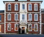
Copthorne Merry Hill Dudley
RAMADA PARK HALL HOTEL & CONFERENCE CTR
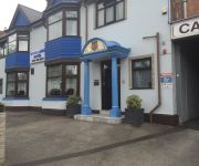
The Woodlands Hotel
RAMADA OLDBURY BIRMINGHAM
Travellers Inn
Bay Rooms
Quality Hotel Dudley
Village Hotel Birmingham Dudley
M5 J1 Park Inn By Radisson Birmingham West
TRAVELODGE BIRMINGHAM DUDLEY
Videos from this area
These are videos related to the place based on their proximity to this place.
Driving On The M5 From J3 (Birmingham West & Central) To J2 (Dudley, Oldbury, Sandwell), England
Driving on the M5 motorway from Junction 3 (A456 Birmingham West & Central) to Junction 2 (A4123 Dudley, Wolverhampton, Sandwell), Oldbury, West Midlands, England Videoed on Friday,10th...
Arriving in the UK
Some of our international students describe arriving in the UK before they studied at Birmingham City University For more on arriving in the UK http://www.bcu.ac.uk/international/before-you-trav...
Volunteering for Loaves 'n' Fishes
An insight into how our staff members at Black Country Housing Group support Loaves 'n' Fishes.
TITFORD CANAL
TITFORD CANAL Along the old mainline canal at oldbury is a junction which Is a nice two and half mile strole along the cut. The canal starts underneath the M5 moterway, At the oldbury locks...
Driving On The M5 From J3 (Birmingham West & Central) To J2 (Dudley, Oldbury, Sandwell), England
Driving on the M5 motorway from Junction 3 (A456 Birmingham West & Central) to Junction 2 (A4123 Dudley, Wolverhampton, Sandwell), Oldbury, West Midlands, England Videoed on Saturday,14th ...
Introduction to Loaves 'n' Fishes
An introduction to our chosen charity for our 40th year featuring the co-founders, Anna & Steve Hartland.
Loaves 'n' Fishes: Steven's story
Steven talks about his inspirational story of how Loaves 'n' Fishes helped him and how they help the local community.
Amanda: Secretary of Loaves 'n' Fishes
We talk to Amanda about how she found out about Loaves 'n' Fishes, what she gains from it and how much the charity benefits the local community.
Videos provided by Youtube are under the copyright of their owners.
Attractions and noteworthy things
Distances are based on the centre of the city/town and sightseeing location. This list contains brief abstracts about monuments, holiday activities, national parcs, museums, organisations and more from the area as well as interesting facts about the region itself. Where available, you'll find the corresponding homepage. Otherwise the related wikipedia article.
Hill, West Midlands
Hill was a township in what is now the metropolitan county of West Midlands in England. The township was situated between Halesowen and Blackheath, and covered an area including Coombeswood, Mucklow Hill and the Halesowen Golf Club. It was originally associated with the Halesowen parish, a detached part of Shropshire, which was transferred to the jurisdiction of Worcestershire in 1844 by the Counties (Detached Parts) Act 1844.
Turners Hill, West Midlands
This article is about Turners Hill, West Midlands. For the village of that name in West Sussex, see Turners Hill. Turners Hill {{#invoke:InfoboxImage|InfoboxImage|image=Turner's Hill - geograph. org. uk - 369602.
Old Hill railway station
Old Hill railway station serves the Old Hill area of Sandwell, in the West Midlands of England. The station is managed by London Midland, who provide the majority of train services; Chiltern Railways also operate a small number of trains. It is situated on the Birmingham-Stourbridge line.
Rowley Regis railway station
Rowley Regis railway station serves the town of Blackheath and the Rowley Regis area of Sandwell, in the West Midlands of England. It is located on the Birmingham to Worcester via Kidderminster Line. The station is managed by London Midland, who provide the majority of train services; there are also occasional services provided by Chiltern Railways.
Old Hill High Street railway station
Old Hill High Street railway station was a station on the former Great Western Railway's Bumble Hole Line between Blowers Green and Old Hill. It was the second of the two stations in Old Hill, and its location in reference to the town centre was significantly more convenient than the station which exists today. It opened in 1905 and closed in 1964.
Oldbury Athletic F.C
Oldbury Athletic F.C. was a football club based in Oldbury, England. They were established in 1981. For the 2010–11 season, they were due to be playing in the West Midlands (Regional) League Premier Division, but resigned 3 weeks before the start of the season and folded.
Coombs Holloway Halt railway station
Coombs Holloway Halt railway station was a railway station in Halesowen, England, on the Great Western Railway & Midland Railway's Joint Halesowen Railway line from Old Hill to Longbridge. The station was intermediate stopping point between Halesowen and Old Hill, and was only ¾ of a mile from Old Hill station. It had a short lived life as a station of only 22 years.
Rowley Regis Hospital
Rowley Regis Community Hospital is a hospital in Rowley Regis. It was opened in 1994 by the Duchess of Kent. It provides continuing care, rehabilitation and respite care. It also has a range of outpatient and diagnostic facilities. In 2002 Rowley Regis Hospital joined up with City Hospital, Birmingham and Sandwell Hospital, West Bromwich to become one trust, Sandwell and West Birmingham Hospitals NHS Trust.


