Safety Score: 3,0 of 5.0 based on data from 9 authorites. Meaning we advice caution when travelling to United Kingdom.
Travel warnings are updated daily. Source: Travel Warning United Kingdom. Last Update: 2024-08-13 08:21:03
Discover New Hey
New Hey in Rochdale (England) is a place in United Kingdom about 166 mi (or 268 km) north-west of London, the country's capital city.
Current time in New Hey is now 01:54 PM (Tuesday). The local timezone is named Europe / London with an UTC offset of zero hours. We know of 9 airports near New Hey, of which 5 are larger airports. The closest airport in United Kingdom is Manchester Woodford Airport in a distance of 18 mi (or 29 km), South. Besides the airports, there are other travel options available (check left side).
There are several Unesco world heritage sites nearby. The closest heritage site in United Kingdom is Liverpool – Maritime Mercantile City in a distance of 46 mi (or 74 km), East. Also, if you like playing golf, there are a few options in driving distance. If you need a hotel, we compiled a list of available hotels close to the map centre further down the page.
While being here, you might want to pay a visit to some of the following locations: Oldham, Rochdale, Mossley, Ashton-under-Lyne and Manchester. To further explore this place, just scroll down and browse the available info.
Local weather forecast
Todays Local Weather Conditions & Forecast: 12°C / 54 °F
| Morning Temperature | 8°C / 47 °F |
| Evening Temperature | 12°C / 53 °F |
| Night Temperature | 10°C / 50 °F |
| Chance of rainfall | 0% |
| Air Humidity | 70% |
| Air Pressure | 1022 hPa |
| Wind Speed | Light breeze with 3 km/h (2 mph) from North |
| Cloud Conditions | Overcast clouds, covering 89% of sky |
| General Conditions | Overcast clouds |
Wednesday, 6th of November 2024
14°C (58 °F)
12°C (53 °F)
Broken clouds, calm.
Thursday, 7th of November 2024
14°C (58 °F)
11°C (52 °F)
Scattered clouds, light breeze.
Friday, 8th of November 2024
13°C (55 °F)
9°C (48 °F)
Overcast clouds, light breeze.
Hotels and Places to Stay
Moss Lodge
The White Hart
247Hotel.com
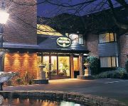
Best Western Broadfield Park
Best Western Hotel Smokies Park
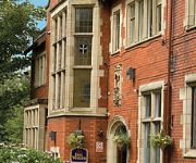
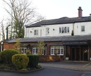
Victoria Hotel By Compass Hospitality
Rochdale
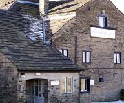
The Waggon Inn
Oldham (Broadway)
TRAVELODGE OLDHAM
Videos from this area
These are videos related to the place based on their proximity to this place.
Rochdale MTB Ride It Feb 7th 2015
Another cracking off road sportive up in the dales of Rochdale. Had to do the medium route as the maximum route had been closed off due to snow and ice. Having trundled through some rock hard...
Littleborough Lancashire from the Pennine Mountains
Here's a view of Littleborough from The Pennine Way.
Canon HG 10 Test
Testing my Canon HG10. Hollingworth Lake near Littleborough. It's a lovely place to visit when the weather is good.
From sunny to gloomy - never trust the weather in the UK
A short ride that started bright and sunny in Manchester, but quickly turned into a grey, misty, foggy, gloomy view as I went along the M62 motorway to Leeds. Shows you how quickly the weather...
Richard Bathrooms, Rochdale - 21
small bathroom renovation project for Damian and Julie. http://www.richardbathrooms.co.uk.
Oliver! Crossgates Primary School Christmas Pantomime 1990
Crossgates Primary School, Milnrow, Rochdale. Christmas Pantomime - Oliver! 1990.
Ogden to Blackstone Edge to Rishworth Moor & Return
A 16 mile hike from Ogden Reservoir to Blackstone Edge then Rishworth Moor and return, With Paul Connelly. Mentioned in dispatches Wayne Mills and Greg Francis. This hike was training for...
Angel - Trailer - A2 Media Studies
This is a trailer for an imagined horror film called Angel. And is a piece of coursework that we created for A2 Media Studies. Go and see our other shorts: http://www.youtube.com/FranticFilmUK.
Videos provided by Youtube are under the copyright of their owners.
Attractions and noteworthy things
Distances are based on the centre of the city/town and sightseeing location. This list contains brief abstracts about monuments, holiday activities, national parcs, museums, organisations and more from the area as well as interesting facts about the region itself. Where available, you'll find the corresponding homepage. Otherwise the related wikipedia article.
Oldham West and Royton (UK Parliament constituency)
Oldham West and Royton is a constituency represented in the House of Commons of the UK Parliament since 1997 by Michael Meacher of the Labour Party who has been an MP for most of the area since 1970.
Oldham East and Saddleworth (UK Parliament constituency)
Oldham East and Saddleworth is a constituency in outer Greater Manchester represented in the House of Commons of the UK Parliament since January 2011 by Debbie Abrahams of the Labour Party.
Crompton Hall
Crompton Hall was a historic house in Crompton, Lancashire, England. It was situated at Crompton Fold. Crompton Hall was in the township for hundreds of years.
Newhey Metrolink station
Newhey Metrolink station is a stop on the Oldham and Rochdale Line (ORL) of Greater Manchester's light-rail Metrolink system. It opened to passengers on 28 February 2013 and is located in Newhey, a suburban village the Metropolitan Borough of Rochdale, England. The station sits on the site of New Hey railway station, a regional rail station which opened on 2 November 1863 and closed on 3 October 2009 for conversion from heavy rail to light rail.
Royton Urban District
Royton was, from 1863 to 1974, a local government district in Lancashire, England which covered the modern-day town of Royton, and its suburbs and districts. It covered a significant area to the north-west of the County Borough of Oldham, and formed part of the Oldham parliamentary constituency (abolished in 1950).
Butterworth (ancient township)
Butterworth was a township occupying the southeastern part of the parish of Rochdale, in the hundred of Salford, Lancashire, England. It encompassed 12.1 square miles of land by the South Pennines which spanned the settlements of Belfield, Bleaked-gate-cum-Roughbank, Butterworth Hall, Clegg, Firgrove, Haughs, Hollingworth, Lowhouse, Milnrow, Newhey, Ogden, Rakewood, Smithy Bridge, Tunshill and Wildhouse.
Ogden Reservoir (Greater Manchester)
Ogden Reservoir is a reservoir in the Piethorne Valley, close to Milnrow and Newhey in the Metropolitan Borough of Rochdale, within Greater Manchester, England.
Brushes Clough Reservoir
Brushes Clough Reservoir is on Crompton Moor in Shaw and Crompton, Greater Manchester, England. It was created in the 19th century by the damming of Leornardin Brook. The outlet of the reservoir flows through Brushes Clough to merge with Old Brook, a tributary of the River Beal.
Trent Mill
Trent Mill was a cotton spinning mill on Duchess Street in Shaw and Crompton, Greater Manchester, England. It was built by F.W. Dixon & Son in 1908. It closed and was taken over by the Lancashire Cotton Corporation in 1929 reopened in 1938 and closed again in 1962, and was demolished in 1967.
Hawk Mill, Shaw
Hawk Mill, Shaw is a cotton spinning mill in Shaw, Oldham, Greater Manchester. It was built in 1908. It was taken over by the Lancashire Cotton Corporation in the 1931 and passed to Courtaulds in 1964. The machinery was scapped in 1964c, and the mill demolished in 1991.


