Safety Score: 3,0 of 5.0 based on data from 9 authorites. Meaning we advice caution when travelling to United Kingdom.
Travel warnings are updated daily. Source: Travel Warning United Kingdom. Last Update: 2024-08-13 08:21:03
Explore Kingston Blount
Kingston Blount in Oxfordshire (England) with it's 506 inhabitants is a city in United Kingdom about 37 mi (or 59 km) west of London, the country's capital.
Local time in Kingston Blount is now 05:24 AM (Friday). The local timezone is named Europe / London with an UTC offset of zero hours. We know of 10 airports in the vicinity of Kingston Blount, of which 5 are larger airports. The closest airport in United Kingdom is RAF Benson in a distance of 9 mi (or 14 km), South-West. Besides the airports, there are other travel options available (check left side).
There are several Unesco world heritage sites nearby. The closest heritage site in United Kingdom is Blenheim Palace in a distance of 16 mi (or 26 km), North-East. Also, if you like golfing, there are multiple options in driving distance. We found 1 points of interest in the vicinity of this place. If you need a place to sleep, we compiled a list of available hotels close to the map centre further down the page.
Depending on your travel schedule, you might want to pay a visit to some of the following locations: Remenham, Aylesbury, Hurley, Wargrave and Bisham. To further explore this place, just scroll down and browse the available info.
Local weather forecast
Todays Local Weather Conditions & Forecast: 8°C / 46 °F
| Morning Temperature | 4°C / 40 °F |
| Evening Temperature | 6°C / 43 °F |
| Night Temperature | 4°C / 40 °F |
| Chance of rainfall | 0% |
| Air Humidity | 81% |
| Air Pressure | 1028 hPa |
| Wind Speed | Light breeze with 4 km/h (3 mph) from North-East |
| Cloud Conditions | Overcast clouds, covering 100% of sky |
| General Conditions | Overcast clouds |
Saturday, 16th of November 2024
7°C (45 °F)
7°C (45 °F)
Broken clouds, gentle breeze.
Sunday, 17th of November 2024
8°C (46 °F)
3°C (37 °F)
Light rain, moderate breeze, broken clouds.
Monday, 18th of November 2024
6°C (42 °F)
5°C (41 °F)
Moderate rain, moderate breeze, overcast clouds.
Hotels and Places to Stay
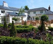
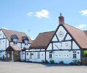
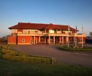
Mercure Thame Lambert Hotel
Fox Country Hotel Main Road
Kings
Peacock
Fox Country Inn
The Spread Eagle
The Oxfordshire
TREE AT CADMORE
Videos from this area
These are videos related to the place based on their proximity to this place.
Count the potholes!
Taken during a Sportive this year (2010, ignore the camera date!), this stretch of road from Christmas Common to Stokenchurch in Oxfordshire was rutted with lethal potholes! The rear-facing...
Chiltern Valley Vintage Tractor Run 2012
On a lovely weekend in May, 58 Tractors took part to do a 24 mile trip through 6 Estates in the Chiltern Hills to raise money for the Thames Valley and Chiltern Air Ambulance, we raised in...
My Brother's Keeper (1948) showing Aston Rowant railway station on the Watlington Branch Line, Oxon
Some more shots of the railway station at Aston Rowant, (this time from My Brother's Keeper (1948)) followed by a short chase sequence which is probably filmed on the same line. Features Jack...
Chinnor Windmill gets its Sails - September 2014
Chinnor Windmill Society would like to thank the volunteers and supporters over the years: Volunteers: Tony Blay Geoff Giles Roman Drozyk George Evans Adrian Marshall John White Colin...
Chinnor windmill is lifted onto its post
Chinnor windmill, Oxfordshire was built in 1789, grinding flour until 1923, but was bulldozed in 1967 to make way for housing. Volunteers recovered some parts and based on these timbers, and...
121023 leaving Chinnor on the Chinnor and Princes Risborough Railway, 05/10/2013.
Preserved 'Bubble Car' class 121 DMU no. 121023 (W55023) makes a smokey departure from Chinnor on the Chinnor and Princes Risborough Railway during the 'Haversham and Friends' gala, 5th ...
Hedroom live at chinnor village hall
Hedroom live at Chinnor Village Hall, gig promoted and filmed by Crash Records, rocking Chinnor, those were the days.
Driver's eye view of the Chinnor and Princes Risborough Railway
1369 from the South devon railway is the loco,it is an 0-6-0 pannier tank with outside cylinders, in this video, you can see 'most' of what the driver sees when driving from Thame jcn to Chinnor....
Cinders getting dirty in the mud on the Icknield Way, Chinnor, Chilterns, Oxfordshire
A short video of our dog who is presently aged 3 3/4 years old and is a German Shepherd Collie Cross. She loves puddles no matter what the temperature!
Videos provided by Youtube are under the copyright of their owners.
Attractions and noteworthy things
Distances are based on the centre of the city/town and sightseeing location. This list contains brief abstracts about monuments, holiday activities, national parcs, museums, organisations and more from the area as well as interesting facts about the region itself. Where available, you'll find the corresponding homepage. Otherwise the related wikipedia article.
Chiltern Hills
The Chiltern Hills form a chalk escarpment in South East England. They are known locally as "the Chilterns". A large portion of the hills was designated officially as an Area of Outstanding Natural Beauty in 1965.
Chinnor and Princes Risborough Railway
Watlington and Princes Risborough Railway Legend x20px x20px x20px x20px Bicester Cut-off line to Banbury x20px x20px x20px x20px Princes Risborough to Aylesbury Line x20px x20px x20px x20px Thame Jct.
Stokenchurch BT Tower
Stokenchurch BT Tower is a telecommunication tower built of reinforced concrete at Stokenchurch, Buckinghamshire, England. It is one of the few British towers built of reinforced concrete. Located 242 metres above sea level, it dates from 1963 and is 97.5 metres tall. There are four platforms at the top that are used to attach microwave transmission drums and other antennas.
Stokenchurch Gap
The Stokenchurch Gap, also known as the Aston Rowant Cutting or Aston Hill cutting (from the nearby village of Aston Rowant), or locally "The Canyon" is a steep chalk cutting, constructed through the Chiltern Hills in Oxfordshire, England during the early 1970s for the M40 motorway. It is 1,200 metres long and a maximum of 47 metres deep, and is located approximately eight miles (13 km) from High Wycombe and close to the village of Stokenchurch.
Aston Rowant railway station
Aston Rowant railway station was opened in 1872 and was a part of the Watlington and Princes Risborough Railway. Having closed in 1961, there have been proposals to reopen the station not only to the heritage services of the Chinnor and Princes Risborough Railway, but also National Rail commuter services operated by Chiltern Railways.
Kingston Crossing Halt railway station
Kingston Crossing Halt railway station was a halt on the Watlington and Princes Risborough Railway which the Great Western Railway opened in 1906 to serve the Oxfordshire village of Kingston Blount. The opening of the halt was part of a GWR attempt to encourage more passengers on the line at a time when competition from bus services was drawing away patronage.
Aston Rowant NNR
Aston Rowant Nature Reserve is located on the western escarpment of the Chiltern Hills near Stokenchurch on the Oxfordshire - Buckinghamshire border in the Chilterns Area of Outstanding Natural Beauty The reserve is in several sections, divided by the M40 motorway in the Aston Rowant Cutting. Most of the reserve is in the parishes of Aston Rowant and Lewknor in Oxfordshire; smaller sections are in the parish of Stokenchurch in Buckinghamshire.
Butt's Way
Butt's Way is a cricket ground between the villages of Aston Rowant and Kingston Blount, Oxfordshire. The first recorded match on the ground was in 1987, when Oxfordshire played their first Minor Counties Championship match on the ground against Buckinghamshire. From 1987 to 1998, the ground hosted 5 Minor Counties Championship matches. The ground has also held 4 MCCA Knockout Trophy matches, the last of which came in 2007 against Buckinghamshire.


