Safety Score: 3,0 of 5.0 based on data from 9 authorites. Meaning we advice caution when travelling to United Kingdom.
Travel warnings are updated daily. Source: Travel Warning United Kingdom. Last Update: 2024-08-13 08:21:03
Explore Kingston Bagpuize
Kingston Bagpuize in Oxfordshire (England) with it's 2,349 inhabitants is a city in United Kingdom about 57 mi (or 91 km) west of London, the country's capital.
Local time in Kingston Bagpuize is now 01:33 AM (Friday). The local timezone is named Europe / London with an UTC offset of zero hours. We know of 11 airports in the vicinity of Kingston Bagpuize, of which 5 are larger airports. The closest airport in United Kingdom is RAF Brize Norton in a distance of 8 mi (or 14 km), North-West. Besides the airports, there are other travel options available (check left side).
There are several Unesco world heritage sites nearby. The closest heritage site in United Kingdom is City of Bath in a distance of 23 mi (or 37 km), South-West. Also, if you like golfing, there are multiple options in driving distance. We found 1 points of interest in the vicinity of this place. If you need a place to sleep, we compiled a list of available hotels close to the map centre further down the page.
Depending on your travel schedule, you might want to pay a visit to some of the following locations: Frilford, Farnborough, Oxford, Welford and Winterbourne. To further explore this place, just scroll down and browse the available info.
Local weather forecast
Todays Local Weather Conditions & Forecast: 8°C / 47 °F
| Morning Temperature | 4°C / 40 °F |
| Evening Temperature | 6°C / 43 °F |
| Night Temperature | 5°C / 40 °F |
| Chance of rainfall | 0% |
| Air Humidity | 79% |
| Air Pressure | 1028 hPa |
| Wind Speed | Light breeze with 5 km/h (3 mph) from North-East |
| Cloud Conditions | Overcast clouds, covering 100% of sky |
| General Conditions | Overcast clouds |
Saturday, 16th of November 2024
8°C (47 °F)
7°C (45 °F)
Broken clouds, gentle breeze.
Sunday, 17th of November 2024
7°C (45 °F)
4°C (38 °F)
Light rain, gentle breeze, overcast clouds.
Monday, 18th of November 2024
6°C (43 °F)
9°C (47 °F)
Moderate rain, gentle breeze, overcast clouds.
Hotels and Places to Stay
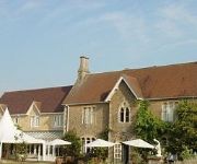
Fallowfields Country House
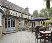
The Rose Revived
Videos from this area
These are videos related to the place based on their proximity to this place.
Sierril Vinagger Sierra @ London city 2009
Que deleite internacional y cosmopolita el de nuestro compadre Sierra. Esta vez embriagado a lo más vinagger vinagger... es lo que tierne arrimarse a Felicia...
A Bit of a Do in Hurst
The village hall was rocking in Hurst on Saturday 4th October 2008. Fab time had by all!
The Best Perfume and Body Fragrances for Summer!
These are my favourite Perfumes/Body Sprays for the summer!!! 1.Taihian Holiday, Avon, £12.99 2.Secret Fantasy , Avon £11 3.So Enternal , Bundle Pack , Varies Shops 4.Impuse Pop Star-...
Suzuki VanVans ride upon England's green & muddy lanes
Dave, Mark, Alan and Nick explore some green lanes SW of Oxford. Filmed with DRIFT HD170 at 720p.
Standlake Arena 8th June 2012 - Pre 70 Under Bangers Heat One
Not a lot of action on the day, but still some epic racing from the Pre 70 Under Bangers at the Mike Hook Memorial Meeting.
Standlake Arena - Heavy Metal Classic 2014 (05/01/14)
Here are highlights featuring Under 1800cc and Unlimited Bangers with both classic races for Unders & Overs at Standlake Arena.
Standlake Arena 8th July 2012 - Pre 70 Over Bangers Dash into DD.
Jethro and Gazza's cat and mouse chase in the Over Bangers DD defiantly made up for the quiet day... Apart from when it went silent!
Archimedean Hydro Screw installed by Hallidays Hydropower
www.hallidayshydropower.com The 6m working length Hydro Screw at the Grade II listed Dandridge's Mill, generating 30000kWh of Green Electricity per year. The screw was installed by Hallidays...
Videos provided by Youtube are under the copyright of their owners.
Attractions and noteworthy things
Distances are based on the centre of the city/town and sightseeing location. This list contains brief abstracts about monuments, holiday activities, national parcs, museums, organisations and more from the area as well as interesting facts about the region itself. Where available, you'll find the corresponding homepage. Otherwise the related wikipedia article.
Moreton, Oxfordshire
There are several places in Oxfordshire called Moreton (meaning "habitation on a marsh"): The two neighbouring villages of North and South Moreton in the old Moreton Hundred. The current small settlement (but in previous times a larger village) of Moreton, a mile to the South-West of Northmoor, at coordinates {{#invoke:Coordinates|coord}}{{#coordinates:51|42|38|N|1|24|20|W|type:city(50)_region:GB | |name= }}. The small hamlet of Moreton, near Thame.
Cherbury Camp
Cherbury Camp is the name given to the 'multi-vallate' hill-fort-like earthworks, situated at grid reference SU374963, 1 mile to the north of Charney Bassett, in the Vale of White Horse district of Oxfordshire, England. It is joined to the village by a footpath. This appears to be an Iron Age fortification but is far away from any hill or other vantage point. It is, nonetheless, larger than its counterpart, Uffington Castle, on the nearby Berkshire Downs.
Hinton Waldrist Castle
Hinton Waldrist Castle was in Hinton Waldrist about 7.5 miles north of Wantage. Hinton Waldrist spent most of its history in Berkshire until in 1974 it was transferred to Oxfordshire. The castle was originally a motte and bailey with a moat. The first castle was built of timber by the St. Valery family after the Norman conquest of England. In the Middle Ages the castle was rebuilt in stone when it belonged to the Bohuns, the Earls of Hereford.
Newbridge, Oxfordshire
Newbridge is a 14th-century bridge carrying the A415 road over the River Thames in Oxfordshire, between Abingdon and Witney, close to the Thames' confluence with the River Windrush. It is one of the two oldest surviving bridges across the Thames and is a Grade II* listed building. There is a public house at either end of the bridge: The Rose Revived on the north bank, and The Maybush on the south bank.
Hart's Weir Footbridge
Hart's Weir Footbridge is a single-span concrete footbridge across the River Thames in Oxfordshire, England. Locally, it is also known as Rainbow Bridge, due to its rainbow-arc appearance as seen from the horizon. It is situated on the reach above Northmoor Lock, the nearest village being Appleton, Oxfordshire to the east. The bridge was built in 1879 on the site of a weir that was removed a year later.
Kingston Bagpuize with Southmoor
Kingston Bagpuize with Southmoor is a civil parish in the English county of Oxfordshire, England. It was formed on 1 April 1971 by merging the two villages of Kingston Bagpuize and Southmoor. In 1974 it was transferred from Berkshire.
Longworth House
Longworth House is an historic country house at Longworth in the English county of Oxfordshire. It was owned by the Marten family during the 16th and 17th centuries. Former residents include Sir Henry Marten, Judge of the Admiralty Court.
Fyfield and Tubney
Fyfield and Tubney is a civil parish in the The Vale of White Horse district of Oxfordshire, England. It includes the village of Fyfield which is about 4.5 miles west of Abingdon and Tubney, which is about 4 miles west of Abingdon. The parish was part of Berkshire until the 1974 boundary changes transferred it to Oxfordshire.


