Safety Score: 3,0 of 5.0 based on data from 9 authorites. Meaning we advice caution when travelling to United Kingdom.
Travel warnings are updated daily. Source: Travel Warning United Kingdom. Last Update: 2024-08-13 08:21:03
Touring Headington
Headington in Oxfordshire (England) is a town located in United Kingdom about 50 mi (or 80 km) west of London, the country's capital place.
Time in Headington is now 02:47 AM (Monday). The local timezone is named Europe / London with an UTC offset of zero hours. We know of 11 airports nearby Headington, of which 5 are larger airports. The closest airport in United Kingdom is Oxford (Kidlington) Airport in a distance of 7 mi (or 11 km), North-West. Besides the airports, there are other travel options available (check left side).
There are several Unesco world heritage sites nearby. The closest heritage site in United Kingdom is Blenheim Palace in a distance of 26 mi (or 41 km), East. Also, if you like the game of golf, there are several options within driving distance. Need some hints on where to stay? We compiled a list of available hotels close to the map centre further down the page.
Being here already, you might want to pay a visit to some of the following locations: Oxford, Frilford, Farnborough, Upper Basildon and Winterbourne. To further explore this place, just scroll down and browse the available info.
Local weather forecast
Todays Local Weather Conditions & Forecast: 8°C / 46 °F
| Morning Temperature | 8°C / 46 °F |
| Evening Temperature | 7°C / 44 °F |
| Night Temperature | 10°C / 50 °F |
| Chance of rainfall | 7% |
| Air Humidity | 83% |
| Air Pressure | 1012 hPa |
| Wind Speed | Fresh Breeze with 14 km/h (8 mph) from North-East |
| Cloud Conditions | Overcast clouds, covering 100% of sky |
| General Conditions | Moderate rain |
Tuesday, 19th of November 2024
3°C (38 °F)
-0°C (32 °F)
Light rain, fresh breeze, overcast clouds.
Wednesday, 20th of November 2024
4°C (39 °F)
2°C (36 °F)
Rain and snow, moderate breeze, clear sky.
Thursday, 21st of November 2024
3°C (38 °F)
1°C (34 °F)
Snow, fresh breeze, broken clouds.
Hotels and Places to Stay
Old Bank
George Street Hotel
Macdonald Randolph
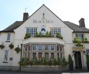
The Black Boy Pub & Hotel
The Head of the River
Cotswold Lodge A Classic British Hotel
Ethos
Vanbrugh House Hotel
Malmaison Oxford
Hill Farm
Videos from this area
These are videos related to the place based on their proximity to this place.
Oxford Calling — by EF International Language Centers
Oxford is calling - study English at EF Oxford! Learn more at http://www.ef.com/ef-oxford Study English with EF International Language Centres in the world's number one student city. You'll...
This is the Cowley Road - This is Carnival
' This film, created by Nicola Armitage to celebrate and promote Cowley Road Carnival, was made as part of the CUSP artists project funded by Arts Council of England in 2014. Nicola, has sought...
Secret Oxford: A Cowley Road Story
Tom Skelton, director of the Oxford Imps, discusses Oxford's Cowley Road and his first visit to the Excelsior Cafe.
Nikki Loy, Che, Colin - Cape of Good Hope Cowley Road Carnival
Nikki Loy, Che and Colin performing at the Cowley Road Carnival 2014.
Hawaiian Hoe-down
The City of Oxford Youth Band play Hawaiian Hoe-down in 1976. The conductor was Terry Brotherhood.
EF Oxford - Teaser
Learn more about EF Oxford at http://www.ef.com/ef-oxford Study English with EF International Language Centres in the world's number one student city. You'll be surrounded by the university's...
Larkin Poe bully 3
Larkin Poe at The Bullingdon Cowley Road, Oxford 10/04/2016. Video unusual as it is in portrait format so you will just have to view on your side. I was sitting on the floor next to the left...
Jeune Street apartments -OXFORD_OX4 1BN
Situated in the heart of St Clements, Jeune street offers modern well presented apartments that are both comfortable and modern. The location is excellent for those wishing to rent near...
Videos provided by Youtube are under the copyright of their owners.
Attractions and noteworthy things
Distances are based on the centre of the city/town and sightseeing location. This list contains brief abstracts about monuments, holiday activities, national parcs, museums, organisations and more from the area as well as interesting facts about the region itself. Where available, you'll find the corresponding homepage. Otherwise the related wikipedia article.
Oxford Brookes University
Oxford Brookes University is a new university in Oxford, England. It can trace its origins to 1865. Formerly known as Oxford City Technical School (1891) and Oxford Polytechnic (1970), it was renamed in 1992 to honour its former principal, John Brookes. The university's Department of Architecture is one of the largest in Britain.
Rye St Antony School
Rye St Antony School is an independent Roman Catholic boarding and day school for girls aged 3 to 18 and boys up to age 8 in Headington, Oxford, England. It is commonly abbreviated and referred to by both pupils and staff as 'Rye'. Rye is unique as a girls’ independent Catholic school founded by lay women rather than by a religious order.
Headington School, Oxford
Headington School is an independent girls' school in Headington, Oxford, England, founded by a group of evangelical Christians in 1915. The school motto is 'AΓΩNIZOY TON KAΛON AΓΩNA THΣ ΠIΣTEΩΣ', a quotation from 1 Timothy 6.12, meaning 'Fight the Good Fight of Faith'. 'Fight the Good Fight' is also the school song. The Good Schools Guide called Headington "A delightful school, [which which] nurtures and entertains its pupils while at the same time achieving excellent academic results.
Manor Ground, Oxford
The Manor Ground was a football stadium in Oxford, England, that was the home of Oxford United (previously known as Headington United) between 1925 and 2001. It hosted United's record crowd of 22,750 against Preston North End in an FA Cup 6th Round match on 29 February 1964.
John Radcliffe Hospital
The John Radcliffe Hospital is a large tertiary teaching hospital in Oxford, England. It is the main teaching hospital for Oxford University and Oxford Brookes University. As such, it is a well-developed centre of medical research. It also incorporates the Medical School of the University of Oxford. It is part of Oxford University Hospitals NHS Trust. It was named after John Radcliffe, an 18th-century physician who graduated from Oxford University.
School of Architecture, Oxford Brookes University
The Oxford School of Architecture was originally founded in 1927 Forming part of the Oxford City Technical School, this became the Oxford College of Technology in 1956, the Oxford Polytechnic in 1970 and Oxford Brookes University in 1992. Now called the School of Architecture in the Faculty of Technology, Design & the Environment, it is one of the largest architecture schools in the UK, with around 600 students and 70 staff.
Churchill Hospital
The Churchill Hospital is a teaching hospital in Oxford, England. The hospital is primarily a centre for the treatment of cancer patients, but also houses research and teaching facilities for the University of Oxford and Oxford Brookes University. It is part of Oxford Radcliffe Hospitals NHS Trust. It was named after Clementine Churchill, wife of Winston Churchill, the Prime Minister of the United Kingdom when a hospital was first built on the site in 1940.
Warneford Hospital
The Warneford Hospital is a hospital in east Oxford, England. The Warneford and the Littlemore Hospital are the major mental health hospitals serving Oxford. The hospital opened as the Oxford Lunatic Asylum in July 1826 and subsequently (but no longer) was named the Radcliffe Lunatic Asylum and then the Warneford Lunatic Asylum. It was designed by Richard Ingleman (1777–1838) and built of Headington stone. The name commemorates the philanthropist Samuel Wilson Warneford.
Pullens Lane
Pullens Lane is in Headington, east Oxford, England. It is located at the top of Headington Hill, leading north off Headington Road to Jack Straw's Lane and Harberton Mead. The cul-de-sac Pullens Field leads off west from Pullens Lane.
The Vines, Oxford
The Vines is on Pullens Lane, Headington, a suburb in east Oxford, England. It was the first house to be built on the west side of the lane, on land that was originally owned by the Morrell family, local brewers. The house is built of red brick with stone dressings. The house was built in 1889–90 for Professor Sydney Howard Vines (1849–1934). It was designed by the Victorian architect Harry Wilkinson Moore (1850–1915).
Sandfield Road
Sandfield Road is a road in the suburb of Headington, Oxford, England. It is close to the John Radcliffe Hospital.
Wellcome Trust Centre for Human Genetics
The Wellcome Trust Centre for Human Genetics is a human genetics research centre at the University of Oxford, funded by the Wellcome Trust among others. The centre at the Henry Wellcome Building of Genomic Medicine cost £20 million and was officially opened in June 2000 with Anthony Monaco as the director.


