Safety Score: 3,0 of 5.0 based on data from 9 authorites. Meaning we advice caution when travelling to United Kingdom.
Travel warnings are updated daily. Source: Travel Warning United Kingdom. Last Update: 2024-08-13 08:21:03
Delve into Garford
Garford in Oxfordshire (England) is located in United Kingdom about 55 mi (or 89 km) west of London, the country's capital town.
Current time in Garford is now 03:58 PM (Thursday). The local timezone is named Europe / London with an UTC offset of zero hours. We know of 11 airports close to Garford, of which 5 are larger airports. The closest airport in United Kingdom is RAF Brize Norton in a distance of 10 mi (or 17 km), North-West. Besides the airports, there are other travel options available (check left side).
There are several Unesco world heritage sites nearby. The closest heritage site in United Kingdom is City of Bath in a distance of 22 mi (or 36 km), South-West. Also, if you like playing golf, there are some options within driving distance. If you need a hotel, we compiled a list of available hotels close to the map centre further down the page.
While being here, you might want to pay a visit to some of the following locations: Frilford, Farnborough, Oxford, Welford and Winterbourne. To further explore this place, just scroll down and browse the available info.
Local weather forecast
Todays Local Weather Conditions & Forecast: 2°C / 35 °F
| Morning Temperature | 1°C / 33 °F |
| Evening Temperature | 0°C / 33 °F |
| Night Temperature | 1°C / 34 °F |
| Chance of rainfall | 0% |
| Air Humidity | 64% |
| Air Pressure | 1000 hPa |
| Wind Speed | Moderate breeze with 11 km/h (7 mph) from East |
| Cloud Conditions | Overcast clouds, covering 100% of sky |
| General Conditions | Overcast clouds |
Friday, 22nd of November 2024
5°C (40 °F)
1°C (34 °F)
Few clouds, moderate breeze.
Saturday, 23rd of November 2024
7°C (44 °F)
14°C (56 °F)
Moderate rain, strong breeze, overcast clouds.
Sunday, 24th of November 2024
14°C (58 °F)
14°C (58 °F)
Moderate rain, high wind, near gale, overcast clouds.
Hotels and Places to Stay
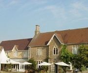
Fallowfields Country House
The Rose Revived
Oxford Abingdon
Abingdon
Videos from this area
These are videos related to the place based on their proximity to this place.
Sierril Vinagger Sierra @ London city 2009
Que deleite internacional y cosmopolita el de nuestro compadre Sierra. Esta vez embriagado a lo más vinagger vinagger... es lo que tierne arrimarse a Felicia...
Monk's Farm, Grove, Oxfordshire
One of the prime building sites in our village - under water on 16 February 2014. The rushes in the middle distance set the context nicely for this pond, but of course grew in hot summer of...
A Bit of a Do in Hurst
The village hall was rocking in Hurst on Saturday 4th October 2008. Fab time had by all!
The Best Perfume and Body Fragrances for Summer!
These are my favourite Perfumes/Body Sprays for the summer!!! 1.Taihian Holiday, Avon, £12.99 2.Secret Fantasy , Avon £11 3.So Enternal , Bundle Pack , Varies Shops 4.Impuse Pop Star-...
HMC 2012 UNDERS HEAT 3 STANDLAKE ARENA 8TH JAN 2012.mov
HMC UNDERS HEAT 3 STANDLAKE ARENA 8TH JAN 2012.
Archimedean Hydro Screw installed by Hallidays Hydropower
www.hallidayshydropower.com The 6m working length Hydro Screw at the Grade II listed Dandridge's Mill, generating 30000kWh of Green Electricity per year. The screw was installed by Hallidays...
McKinley Railway Overview (lo-res 320x240)
A computer controlled OO scale layout based on England in the 1960s. It was built using DCC principles from the outset. Part one of four in a series of videos describing McKinley Railway....
an elephant's trip animation
an elephant's trip is a short animation on a bored friday afternoon, the soundtrack was made on garage band and the animating on istopmotion anyway, enjoy.
Videos provided by Youtube are under the copyright of their owners.
Attractions and noteworthy things
Distances are based on the centre of the city/town and sightseeing location. This list contains brief abstracts about monuments, holiday activities, national parcs, museums, organisations and more from the area as well as interesting facts about the region itself. Where available, you'll find the corresponding homepage. Otherwise the related wikipedia article.
Wantage Road railway station
Wantage Road railway station was on the Great Western Main Line in the Vale of White Horse. The station was actually at the village of Grove, Oxfordshire, more than two miles north of Wantage.
Kingston Bagpuize with Southmoor
Kingston Bagpuize with Southmoor is a civil parish in the English county of Oxfordshire, England. It was formed on 1 April 1971 by merging the two villages of Kingston Bagpuize and Southmoor. In 1974 it was transferred from Berkshire.
Thames Water Abingdon Reservoir
The Thames Water Abingdon Reservoir was a proposal, made in 2006 by Thames Water, to build a large cleanwater reservoir to the south west of Abingdon, Oxfordshire. In 2007 the Environment Agency noted that need for the reservoir was not proven.
Denman College
Denman College is a residential adult education college centred on Marcham Park at Marcham in the English county of Oxfordshire. The college is owned and operated by the National Federation of Women's Institutes (The WI).
Fyfield and Tubney
Fyfield and Tubney is a civil parish in the The Vale of White Horse district of Oxfordshire, England. It includes the village of Fyfield which is about 4.5 miles west of Abingdon and Tubney, which is about 4 miles west of Abingdon. The parish was part of Berkshire until the 1974 boundary changes transferred it to Oxfordshire.
Frilford Heath Golf Club
Frilford Heath Golf Club is a 54 hole golf club in Frilford, Oxfordshire and is set amongst 500 acres of heathland to the south of Oxford city.


