Safety Score: 3,0 of 5.0 based on data from 9 authorites. Meaning we advice caution when travelling to United Kingdom.
Travel warnings are updated daily. Source: Travel Warning United Kingdom. Last Update: 2024-08-13 08:21:03
Explore Dry Sanford
Dry Sanford in Oxfordshire (England) is a city in United Kingdom about 53 mi (or 85 km) west of London, the country's capital.
Local time in Dry Sanford is now 12:21 PM (Thursday). The local timezone is named Europe / London with an UTC offset of zero hours. We know of 11 airports in the vicinity of Dry Sanford, of which 5 are larger airports. The closest airport in United Kingdom is Oxford (Kidlington) Airport in a distance of 9 mi (or 15 km), North. Besides the airports, there are other travel options available (check left side).
There are several Unesco world heritage sites nearby. The closest heritage site in United Kingdom is City of Bath in a distance of 26 mi (or 42 km), South-West. Also, if you like golfing, there are multiple options in driving distance. If you need a place to sleep, we compiled a list of available hotels close to the map centre further down the page.
Depending on your travel schedule, you might want to pay a visit to some of the following locations: Frilford, Oxford, Farnborough, Winterbourne and Welford. To further explore this place, just scroll down and browse the available info.
Local weather forecast
Todays Local Weather Conditions & Forecast: 2°C / 36 °F
| Morning Temperature | 1°C / 33 °F |
| Evening Temperature | 0°C / 33 °F |
| Night Temperature | 1°C / 34 °F |
| Chance of rainfall | 0% |
| Air Humidity | 63% |
| Air Pressure | 1000 hPa |
| Wind Speed | Moderate breeze with 11 km/h (7 mph) from East |
| Cloud Conditions | Overcast clouds, covering 100% of sky |
| General Conditions | Overcast clouds |
Friday, 22nd of November 2024
5°C (40 °F)
1°C (34 °F)
Few clouds, moderate breeze.
Saturday, 23rd of November 2024
7°C (45 °F)
13°C (56 °F)
Moderate rain, strong breeze, overcast clouds.
Sunday, 24th of November 2024
14°C (58 °F)
14°C (58 °F)
Moderate rain, strong breeze, overcast clouds.
Hotels and Places to Stay
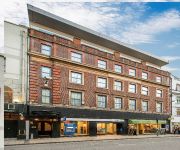
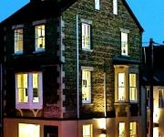
Old Bank
Macdonald Randolph
George Street Hotel
Mercure Oxford Eastgate Hotel
Cotswold Lodge A Classic British Hotel
Ethos
Malmaison Oxford
Vanbrugh House Hotel
The Head of the River
Oxford Spires Hotel
Videos from this area
These are videos related to the place based on their proximity to this place.
2013 Abingdon Carnival Sprint
Four runs on the Bentley course followed by four runs on the Abingdon course at the Abingdon Carnival Sprint - two sprints in one day! I didn't have enough lock for the last left-hander of...
Videos provided by Youtube are under the copyright of their owners.
Attractions and noteworthy things
Distances are based on the centre of the city/town and sightseeing location. This list contains brief abstracts about monuments, holiday activities, national parcs, museums, organisations and more from the area as well as interesting facts about the region itself. Where available, you'll find the corresponding homepage. Otherwise the related wikipedia article.
Abingdon Rural District
Abingdon was a rural district in the administrative county of Berkshire from 1894 to 1974. It was formed under the Local Government Act 1894 based on that part of the Abingdon rural sanitary district which was in Berkshire. It nearly entirely surrounded, but did not include, the municipal borough of Abingdon, and in the north was close to Oxford.
St. Helen Without
St Helen Without is a civil parish in the Vale of White Horse district in the English county of Oxfordshire. In 1974 it was transferred from Berkshire. It is immediately west of Abingdon and includes the villages of Dry Sandford and Shippon. A large part of the parish is occupied by Dalton Barracks and its associated airfield. According to the 2001 census the parish had a population of 2,623. The parish was created by the Local Government Act 1894, by the division of the parish of Abingdon St.
Cumnor Hurst
Cumnor Hurst, also known as Hurst Hill, is a wooded hill in the neighbourhood of the village of Cumnor, Oxfordshire, England. It lies to the north of Boars Hill. In 1974 it was transferred from Berkshire. The hill is a landmark on the ridge of Corallian limestone that is topped by Lower Greensand and Kimmeridge Clay. The Kimmeridge Clay provided bricks and tiles, from clay extracted at the Chawley Brick and Tile Works.
Cothill House
Cothill House is a boarding boys' independent school for preparatory pupils in Cothill, Oxfordshire, which houses around 230 boys from the ages 8–13.
Parklands Campus
Parklands Campus is an independent special school for boys and girls aged 11 to 16, near Abingdon, Oxfordshire, England. It is run by children's charity Action for Children. Formerly Bessels Leigh School, it was taken over by children's charity Action for Children and relaunched as Spires School during the summer of 2009. In 2011 it was rebranded as Parklands Campus.
Faringdon Rural District
Faringdon was a rural district in the administrative county of Berkshire from 1894 to 1974. It was formed under the Local Government Act 1894 based on that part of the Faringdon rural sanitary district which was in Berkshire, however it also included for a time Lechlade a small market town in Gloucestershire. It is around the north west region of historic Berkshire now south west Oxfordshire since it was transferred in 1974.
Henwood
Henwood is a hamlet about 3.5 miles south-west of Oxford, England. Henwood is in Wootton civil parish in the Vale of White Horse District. Historically Henwood was a single farm in the parish of Cumnor, until Wootton was created a separate parish in the 19th century. Since then there has been ribbon development along the B4017 road. Henwood was in Berkshire until the 1974 boundary changes transferred it to Oxfordshire. Henwood Farmhouse dates back to the 17th century.
McTimoney College of Chiropractic
McTimoney College of Chiropractic is an chiropractic college, managed and operated by BPP University College in Abingdon, Oxfordshire, England. Alongside the University of Glamorgan and Anglo-European College of Chiropractic, the college is one of only three United Kingdom institutions to offer degrees recognized by the General Chiropractic Council, and the only one to specialize in the McTimoney method.


