Safety Score: 3,0 of 5.0 based on data from 9 authorites. Meaning we advice caution when travelling to United Kingdom.
Travel warnings are updated daily. Source: Travel Warning United Kingdom. Last Update: 2024-08-13 08:21:03
Touring Toton
Toton in Nottinghamshire (England) is a town located in United Kingdom about 108 mi (or 174 km) north-west of London, the country's capital place.
Time in Toton is now 09:59 PM (Friday). The local timezone is named Europe / London with an UTC offset of zero hours. We know of 10 airports nearby Toton, of which 5 are larger airports. The closest airport in United Kingdom is East Midlands Airport in a distance of 6 mi (or 10 km), South-West. Besides the airports, there are other travel options available (check left side).
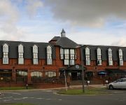
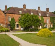
There are several Unesco world heritage sites nearby. The closest heritage site in United Kingdom is Derwent Valley Mills in a distance of 32 mi (or 52 km), East. Also, if you like the game of golf, there are several options within driving distance. Need some hints on where to stay? We compiled a list of available hotels close to the map centre further down the page.
Being here already, you might want to pay a visit to some of the following locations: Nottingham, Derby, Glenfield, Leicester and Netherseal. To further explore this place, just scroll down and browse the available info.
Local weather forecast
Todays Local Weather Conditions & Forecast: 9°C / 47 °F
| Morning Temperature | 5°C / 42 °F |
| Evening Temperature | 7°C / 44 °F |
| Night Temperature | 5°C / 42 °F |
| Chance of rainfall | 0% |
| Air Humidity | 80% |
| Air Pressure | 1026 hPa |
| Wind Speed | Gentle Breeze with 6 km/h (4 mph) from East |
| Cloud Conditions | Broken clouds, covering 80% of sky |
| General Conditions | Broken clouds |
Saturday, 16th of November 2024
10°C (51 °F)
6°C (43 °F)
Overcast clouds, gentle breeze.
Sunday, 17th of November 2024
7°C (45 °F)
2°C (35 °F)
Light rain, moderate breeze, scattered clouds.
Monday, 18th of November 2024
2°C (35 °F)
1°C (33 °F)
Rain and snow, moderate breeze, overcast clouds.
Hotels and Places to Stay
VILLAGE NOTTINGHAM
Hilton East Midlands Airport
DoubleTree by Hilton Nottingham - Gateway
East Midlands Airport Radisson Blu Hotel
Best Western Premier East Midlands Airport Yew Lodge Hotel
THE NOTTINGHAM BELFRY-QHOTELS
Risley Hall Hotel and Spa
De Vere Venues The Orchard
Kegworth Hotel & Conference Centre
Novotel Nottingham Derby
Videos from this area
These are videos related to the place based on their proximity to this place.
solar eclipse live 2015 watch again.
Solar eclipse live stream from The Long Eaton School. Leave us a comment on our blog at http://www.mpole.org.uk and tell us where you are! REMEMBER DO NOT look directly at the Sun, always use...
Long Eaton United 2-0 Westfields FC
Action from United's first ever MFL league game 2014/15 Saturday 2nd August.
Long Eaton Salvation Army History Video!
This video brefily goes through time with The Long Eaton Salvation Army! Amen!!
Long Eaton Fencing Ltd
www.lefs.co.uk We believe we're the best domestic fencing company in the Midlands. We only use top quality raw materials to manufacture our fencing products and the results speak for themselves....
Colas Rail Class 60 60002 passing Meadow Lane LC in Long Eaton 09/02/15
Colas Rail Freight Class 60 60002 passes Meadow Lane Level Crossing on the 6E38 13:54 Colnbrook - Lindsey Oil Sdgs empty TDA tanks in the dark. This operates from Lindsey Oil Refinery to ...
60054 Passes Long Eaton Town's North Erewash Level Crossing on 04/09/13
DB Schenker 60054 passes North Erawash LC on the Ratcliffe PS - Arpley Sdgs on 04/09/14.
CHEAP WEDDING PHOTOGRAPHERS LONG EATON £50 PHOTOGRAPHY photos Trent Lock Golf Club
Cheap wedding photographer in Long Eaton. Prices £50 per hour with excellent reviews http://www.creamphoto.co.uk Photographs taken at a wedding at Christ Church and at the reception at Trent...
60035 & 60039 Pass through Long Eaton Town on 6G45 on 31/05/13
EWS 60035 & DB 60039 pass through Long Eaton Town's Huss's Lane Footbridge on the 6G45 Toton North Yard - Bescot engineers train on the 31st May 2013.
Videos provided by Youtube are under the copyright of their owners.
Attractions and noteworthy things
Distances are based on the centre of the city/town and sightseeing location. This list contains brief abstracts about monuments, holiday activities, national parcs, museums, organisations and more from the area as well as interesting facts about the region itself. Where available, you'll find the corresponding homepage. Otherwise the related wikipedia article.
River Erewash
The River Erewash is a river in England that flows roughly southwards through Derbyshire, close to its eastern border with Nottinghamshire.
Broxtowe (UK Parliament constituency)
Broxtowe is a constituency represented in the House of Commons of the UK Parliament since 2010 by Anna Soubry of the Conservative Party.
Long Eaton United F.C
Long Eaton United F.C. is a football club in Long Eaton, Derbyshire, England. They play in the Northern Counties East Football League Premier Division.
Stapleford Rural District
Stapleford was a rural district in Nottinghamshire, England from 1894 to 1935. It was formed under the Local Government Act 1894 from part of the Shardlow rural sanitary district in Nottinghamshire, and consisted of the parishes of Bramcote, Chilwell, Stapleford and Toton. Two other parishes of Shardlow RSD in Nottinghamshire were instead administered by Shardlow Rural District.
National Shell Filling Factory, Chilwell
The National Shell Filling Factory, Chilwell, was a World War I United Kingdom Government-owned explosives Filling Factory. Its formal title was National Filling Factory No. 6. It was located near Chilwell, at that time a village, in Nottinghamshire on the main road from Nottingham to Ashby de la Zouch. During the Great War it filled high explosives into some 19 million shells - some 50% of all shells fired.
Long Eaton Speedway
Several motorcycle speedway teams operated from 1950 until 1997 in Long Eaton, England. Teams have raced at the Station Road Stadium as the Long Eaton Archers, Long Eaton Rangers, Nottingham Outlaws and the Long Eaton Invaders. The Invaders returned in 2011, with home meetings taking place at Leicester Lions' track.
Recreation Ground, Long Eaton
The Recreation Ground was a multi-use sports ground in Long Eaton, Derbyshire.
St. Laurence's Church, Long Eaton
St. Laurence’s Church, Long Eaton is a Grade II* listed parish church in Long Eaton, England.


