Safety Score: 3,0 of 5.0 based on data from 9 authorites. Meaning we advice caution when travelling to United Kingdom.
Travel warnings are updated daily. Source: Travel Warning United Kingdom. Last Update: 2024-08-13 08:21:03
Delve into Skegby
Skegby in Nottinghamshire (England) is located in United Kingdom about 122 mi (or 196 km) north-west of London, the country's capital town.
Current time in Skegby is now 11:23 PM (Friday). The local timezone is named Europe / London with an UTC offset of zero hours. We know of 10 airports close to Skegby, of which 5 are larger airports. The closest airport in United Kingdom is Nottingham Airport in a distance of 16 mi (or 26 km), South-East. Besides the airports, there are other travel options available (check left side).
There are several Unesco world heritage sites nearby. The closest heritage site in United Kingdom is Liverpool – Maritime Mercantile City in a distance of 21 mi (or 34 km), North-East. Also, if you like playing golf, there are some options within driving distance. If you need a hotel, we compiled a list of available hotels close to the map centre further down the page.
While being here, you might want to pay a visit to some of the following locations: Nottingham, Wales, Todwick, Ulley and Orgreave. To further explore this place, just scroll down and browse the available info.
Local weather forecast
Todays Local Weather Conditions & Forecast: 8°C / 46 °F
| Morning Temperature | 5°C / 40 °F |
| Evening Temperature | 6°C / 43 °F |
| Night Temperature | 5°C / 41 °F |
| Chance of rainfall | 0% |
| Air Humidity | 76% |
| Air Pressure | 1026 hPa |
| Wind Speed | Gentle Breeze with 6 km/h (4 mph) from North-East |
| Cloud Conditions | Overcast clouds, covering 99% of sky |
| General Conditions | Overcast clouds |
Saturday, 16th of November 2024
10°C (50 °F)
6°C (43 °F)
Broken clouds, gentle breeze.
Sunday, 17th of November 2024
7°C (44 °F)
1°C (34 °F)
Light rain, moderate breeze, few clouds.
Monday, 18th of November 2024
1°C (34 °F)
-0°C (32 °F)
Rain and snow, moderate breeze, overcast clouds.
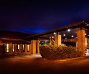
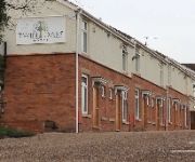
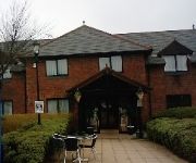
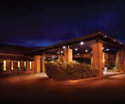
Hotels and Places to Stay
mour
The Derbyshire PH Hotels
Twin Oaks Hotel
TRAVELODGE MANSFIELD
Days Inn Chesterfield Tibshelf
Independent (SPHC) THE DERBYSHIRE HOTEL
Videos from this area
These are videos related to the place based on their proximity to this place.
(3x) Notts FRS Scania P270s on scene of AFA in Mansfield and EMAS Peugeot Boxer on 999 with BULLHORN
Copyright 2015 Gregoryemergencyvideos LIKE,COMMENT AND SUBSCRIBE! You can follow my Flickr page here: https://www.flickr.com/photos/130440310@N04/ You can also like my facebook page ...
EMAS Peugeot Boxer emergency ambulance on shout in Mansfield during strike, BULLHORN
Copyright 2015 Gregoryemergencyvideos LIKE,COMMENT AND SUBSCRIBE! You can also like my facebook page at www.facebook.com/gregoryemergencyvideos or find me on twitter! Recorded with ...
EMAS Skoda Octavia RRV on shout in Mansfield
Copyright 2015 Gregoryemergencyvideos LIKE,COMMENT AND SUBSCRIBE! You can also like my facebook page at www.facebook.com/gregoryemergencyvideos or find me on twitter! Recorded with ...
Arriva transport solutions Renault Master ambulance out and about in Mansfield
Copyright 2015 Gregoryemergencyvideos LIKE,COMMENT AND SUBSCRIBE! You can also like my facebook page at www.facebook.com/gregoryemergencyvideos or find me on twitter! Recorded with ...
Maiden United Children of the Damned The Diamond Sutton in Ashfield 09 12 12
Another amazing show from Maiden United with their unique acoustic take on Iron Maiden songs! Sorry about the sound, was right on top of the speaker!
Who needs a 2 second gap?
Sorry no sound! This is one of my older videos, I have previously run a cheap Chinese ebay camera in my rear window. The camera itself only lasted roughly 2 months. Not a good purchase! Anyway......
3RU - Freerunning Around Sutton
Me and Andy freerunning around Sutton, its a bit sketchy but it'll do... Andy would have had more clips but due to injury he was restricted...
Bert Holland and son waltzer POV 2012 at Sutton lawn fun fair
Bert Holland and son waltzer POV 2012 at Sutton lawn fun fair By me.
Alpine express at Ashfield show 2011
Alpine express at Ashfield show 2011 By Tina Haynes and Keiron Haynes.
Videos provided by Youtube are under the copyright of their owners.
Attractions and noteworthy things
Distances are based on the centre of the city/town and sightseeing location. This list contains brief abstracts about monuments, holiday activities, national parcs, museums, organisations and more from the area as well as interesting facts about the region itself. Where available, you'll find the corresponding homepage. Otherwise the related wikipedia article.
Mansfield 103.2 FM
Mansfield 103.2 FM is an Independent Local Radio station in Mansfield, Nottinghamshire. It is based at the Brunts Business Centre in Mansfield, Nottinghamshire and has a transmitter on Fishponds Hill between Sutton-in-Ashfield and Mansfield. Mansfield 103.2's Managing Director is Tony Delahunty and the Managing Editor is Ian Watkins. The station is Mansfield's only local radio station and is one of the town's major sources of news and sports coverage.
Ashfield (UK Parliament constituency)
Ashfield is a Nottinghamshire constituency represented in the House of Commons of the UK Parliament since 2010 by Gloria De Piero of the Labour Party.
Mansfield and Pinxton Railway
The Mansfield and Pinxton Railway was an early horse-drawn railway in the United Kingdom, completed in 1819 to transport coal to Mansfield from the head of the Pinxton branch of the Cromford Canal from collieries along the Erewash valley served by the Erewash Canal. (At that date the coal seams beneath Mansfield were unproven and would have been too deep to develop economically.
King's Mill Hospital
King's Mill Hospital (or King's Mill Centre) is a hospital situated in Sutton-in-Ashfield, UK. The Hospital serves the towns in the Mansfield Urban Area. The next nearest hospital is Queen's Medical Centre in Nottingham, where patients may be sent in the event that King's Mill cannot provide sufficient facilities. The hospital contains a full Accident & Emergency Department, as well as a helipad situated in the nature reserve to the rear of the hospital, where the air ambulance can land.
Sutton Parkway railway station
Sutton Parkway railway station serves the town of Sutton-in-Ashfield in Nottinghamshire, England. The station is 14 miles north of Nottingham on the Robin Hood Line.
Eastfield Side
Eastfield Side, also commonly known as Sutton Forest Side, is an area of the Nottinghamshire town, Sutton-in-Ashfield. During the mid 19th century Eastfield Side was a hamlet 1 mile to east of Sutton-in-Ashfield. However over time Sutton expanded eastwards along Tenter Lane (present day Outram Street), until there was no noticeable space between the 2 settlements. Today Eastfield Side shows no physical evidence of its existence, apart from the road it lent its name to.
St. Andrew's Church, Skegby
St. Andrew's Church, Skegby is a parish church in the Church of England in Skegby, Nottinghamshire. The church is Grade II listed by the Department for Culture, Media & Sport as it is a building of special architectural or historic interest.
Church of St. Mary Magdalene, Sutton-in-Ashfield
The Church of St. Mary Magdalene, Sutton-in-Ashfield is a parish church in the Church of England in Sutton-in-Ashfield, Nottinghamshire. The church is Grade II* listed by the Department for Culture, Media & Sport as it is a particularly significant building of more than local interest.


