Safety Score: 3,0 of 5.0 based on data from 9 authorites. Meaning we advice caution when travelling to United Kingdom.
Travel warnings are updated daily. Source: Travel Warning United Kingdom. Last Update: 2024-08-13 08:21:03
Delve into Kingston on Soar
Kingston on Soar in Nottinghamshire (England) is a town located in United Kingdom about 104 mi (or 167 km) north-west of London, the country's capital town.
Time in Kingston on Soar is now 09:55 AM (Saturday). The local timezone is named Europe / London with an UTC offset of zero hours. We know of 10 airports closer to Kingston on Soar, of which 5 are larger airports. The closest airport in United Kingdom is East Midlands Airport in a distance of 3 mi (or 5 km), West. Besides the airports, there are other travel options available (check left side).
There are several Unesco world heritage sites nearby. The closest heritage site in United Kingdom is Derwent Valley Mills in a distance of 33 mi (or 54 km), North-East. Also, if you like the game of golf, there are some options within driving distance. In need of a room? We compiled a list of available hotels close to the map centre further down the page.
Since you are here already, you might want to pay a visit to some of the following locations: Nottingham, Glenfield, Derby, Leicester and Netherseal. To further explore this place, just scroll down and browse the available info.
Local weather forecast
Todays Local Weather Conditions & Forecast: 8°C / 46 °F
| Morning Temperature | 2°C / 36 °F |
| Evening Temperature | 13°C / 56 °F |
| Night Temperature | 14°C / 57 °F |
| Chance of rainfall | 13% |
| Air Humidity | 94% |
| Air Pressure | 998 hPa |
| Wind Speed | Strong breeze with 19 km/h (12 mph) from North |
| Cloud Conditions | Overcast clouds, covering 100% of sky |
| General Conditions | Moderate rain |
Sunday, 24th of November 2024
16°C (60 °F)
10°C (50 °F)
Moderate rain, high wind, near gale, overcast clouds.
Monday, 25th of November 2024
9°C (48 °F)
7°C (45 °F)
Scattered clouds, strong breeze.
Tuesday, 26th of November 2024
9°C (48 °F)
8°C (47 °F)
Light rain, fresh breeze, few clouds.
Hotels and Places to Stay
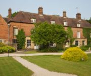
Burleigh Court
Hilton East Midlands Airport
East Midlands Airport Radisson Blu Hotel
VILLAGE NOTTINGHAM
Charnwood Lodge
Best Western Premier East Midlands Airport Yew Lodge Hotel
Kegworth Hotel & Conference Centre
The Cedars Hotel and Restauran
Risley Hall Hotel and Spa
RAMADA LOUGHBOROUGH HOTEL
Videos from this area
These are videos related to the place based on their proximity to this place.
47580 Union Jack & 57315 West Coast Pass Through Long Eaton Station on 14/06/14
47580 Union Jack & West Coast Railways 57315 pass through Long Eaton Station from Derby on 14/06/14.
67025 & 67008 Pass Long Eaton Station on a NR Test Train
EWS 67025 & 67008 pass Long Eaton Station on a Network Rail Test Train on the 28th May 2014.
Freightliner Class 66 66957 & Thameslink 387127 through Long Eaton 27/02/15
Freightliner Class 66 66957, a brand new Thameslink Class 387 387127 and various Freightliner wagons pass through Long Eaton Station on the 7X08 Derby Adtranz Litchurch Lane - Bletchly TMD...
Long Eaton Fencing Ltd
www.lefs.co.uk We believe we're the best domestic fencing company in the Midlands. We only use top quality raw materials to manufacture our fencing products and the results speak for themselves....
Network Rail DBSO 9703 & DRS 37604 pass Through Long Eaton 28/02/15
Network Rail DBSO no. 9703 & Direct Rail Services Class 37 no. 37604 pass through Long Eaton Station towards Derby RTC. 28/02/15.
Network Rail Grinder at Long Eaton Station 28/02/15
The Rail Grinder named 'Martin Elwood' operated by Network Rail calls at Long Eaton Station to drop off a worker. This was from Parkeston near Manningtree and it was going to Derby RTC. 28/02/15.
Colas Rail Class 60 60002 passing Meadow Lane LC in Long Eaton 09/02/15
Colas Rail Freight Class 60 60002 passes Meadow Lane Level Crossing on the 6E38 13:54 Colnbrook - Lindsey Oil Sdgs empty TDA tanks in the dark. This operates from Lindsey Oil Refinery to ...
60054 Passes Long Eaton Town's North Erewash Level Crossing on 04/09/13
DB Schenker 60054 passes North Erawash LC on the Ratcliffe PS - Arpley Sdgs on 04/09/14.
NR NMT 43062 & 43013 Pass Through Long Eaton
Network Rail's NMT passes through Long Eaton, consisting of 43062 977995 977994 977993 977814 977984 & 43013 on 29/05/14.
60035 & 60039 Pass through Long Eaton Town on 6G45 on 31/05/13
EWS 60035 & DB 60039 pass through Long Eaton Town's Huss's Lane Footbridge on the 6G45 Toton North Yard - Bescot engineers train on the 31st May 2013.
Videos provided by Youtube are under the copyright of their owners.
Attractions and noteworthy things
Distances are based on the centre of the city/town and sightseeing location. This list contains brief abstracts about monuments, holiday activities, national parcs, museums, organisations and more from the area as well as interesting facts about the region itself. Where available, you'll find the corresponding homepage. Otherwise the related wikipedia article.
River Soar
The River Soar is a tributary of the River Trent in the English East Midlands.
Kegworth
Kegworth (the w is sometimes silent by locals) is a large village (population of approximately 3,500) and civil parish in Leicestershire, England. Lying on the River Soar, it is situated on the A6 near junction 24 of the M1 motorway and is also close to East Midlands Airport. An air-crash incident in 1989 was just short of the airport's runway at the eastern side of the airport. Although this was outside the village, it has subsequently been referred to as the Kegworth air disaster.
Sutton Bonington
Sutton Bonington is a village and civil parish lying along the valley of the River Soar in the Borough of Rushcliffe, south west Nottinghamshire, England. The University of Nottingham has a 420 hectares site just to the north of the village: Sutton Bonington Campus. The parish covers some 2,183 acres and includes the hamlet of Zouch. The population is about 1,600, not including the students at the university campus who bring the total to over 2,200 in term time.
University Farm (Nottinghamshire)
University Farm is a 445 hectare (4.45 km²) commercial research farm attached to the Sutton Bonington Campus of the University of Nottingham, England. It lies across the parishes of Sutton Bonington and Kingston on Soar. There are two further blocks of land in Clifton on the north bank of the River Trent and at Bunny Park in the village of Bunny. Both these block are several miles from the main campus.
Kegworth railway station
Kegworth Railway Station was a station serving the village of Kegworth in Leicestershire, England. It was located nearer to the smaller village of Sutton Bonington however, and situated in Leicestershire. It was opened in 1840 for the Midland Counties Railway, which shortly joined the North Midland Railway and the Birmingham and Derby Junction Railway to form the Midland Railway. This line is now part of the Midland Main Line between Loughborough and Long Eaton.
St. Michael's Church, Sutton Bonington
St. Michael's Church is a parish church in the Church of England in Sutton Bonington, Nottinghamshire. The church is a 13th century Grade II Listed building.
St. Anne's Church, Sutton Bonington
St. Anne's Church is a parish church in the Church of England in Sutton Bonington, Nottinghamshire. The church is a 12th century Grade II* Listed building. It is located off the Main Street, at the top end of St Anne's Lane, and near to the Midland Main Line which was constructed past the village in 1840. Sutton Bonington's village hall & library is situated on the lane opposite.
St. Winifred's Church, Kingston on Soar
The Church of St. Winifred is a church in Kingston on Soar, Nottinghamshire. The church is a Grade I Listed building. Major restoration took place in 1900.


