Safety Score: 3,0 of 5.0 based on data from 9 authorites. Meaning we advice caution when travelling to United Kingdom.
Travel warnings are updated daily. Source: Travel Warning United Kingdom. Last Update: 2024-08-13 08:21:03
Discover Backworth
Backworth in Northumberland (England) with it's 1,399 citizens is a city in United Kingdom about 251 mi (or 404 km) north of London, the country's capital city.
Local time in Backworth is now 09:45 PM (Sunday). The local timezone is named Europe / London with an UTC offset of zero hours. We know of 9 airports in the vicinity of Backworth, of which 5 are larger airports. The closest airport in United Kingdom is Newcastle Airport in a distance of 6 mi (or 10 km), West. Besides the airports, there are other travel options available (check left side).
There are several Unesco world heritage sites nearby. The closest heritage site is Frontiers of the Roman Empire in Germany at a distance of 6 mi (or 10 km). The closest in United Kingdom is Durham Castle and Cathedral in a distance of 48 mi (or 10 km), South-East. Also, if you like golfing, there are a few options in driving distance. We discovered 1 points of interest in the vicinity of this place. Looking for a place to stay? we compiled a list of available hotels close to the map centre further down the page.
When in this area, you might want to pay a visit to some of the following locations: Wallsend, Cramlington, Blyth, South Shields and Gateshead. To further explore this place, just scroll down and browse the available info.
Local weather forecast
Todays Local Weather Conditions & Forecast: 5°C / 41 °F
| Morning Temperature | 4°C / 39 °F |
| Evening Temperature | 5°C / 40 °F |
| Night Temperature | 2°C / 36 °F |
| Chance of rainfall | 0% |
| Air Humidity | 77% |
| Air Pressure | 1012 hPa |
| Wind Speed | Moderate breeze with 10 km/h (6 mph) from East |
| Cloud Conditions | Few clouds, covering 22% of sky |
| General Conditions | Few clouds |
Monday, 18th of November 2024
3°C (38 °F)
3°C (37 °F)
Overcast clouds, light breeze.
Tuesday, 19th of November 2024
2°C (36 °F)
-0°C (32 °F)
Snow, moderate breeze, broken clouds.
Wednesday, 20th of November 2024
2°C (35 °F)
-1°C (31 °F)
Sky is clear, moderate breeze, clear sky.
Hotels and Places to Stay
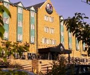
Village Hotel Newcastle
York House Hotel
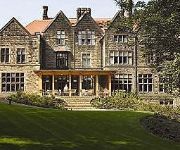
Jesmond Dene House Hotel
Park Lodge
Kensington House Aparthotel
Newcastle Jesmond Hotel
Holiday Inn NEWCASTLE - JESMOND
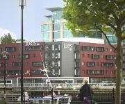
Jurys Inn Newcastle Gateshead Quays
Whites
The Kenilworth
Videos from this area
These are videos related to the place based on their proximity to this place.
Shine - Work in progress
Choreography - Olivia Hayes Performers - Katrina Wood, Feliciana Robles Acosta & Hannah Goggin A work in progress video for a piece based on the light we have inside us and the light we seek...
Dear Bix - Whitley Bay Jazz 2011
Andy Schumm & His Gang in an affectionate programme of early Beiderbeckiana; with Andy on cornet, Horman Field reeds, Kristoffer Kompen trombone, Martin Wheatley banjo/guitar, Paul Asaro piano, ...
Tyne and Wear Metro-Metrocars 4029 and 4010 departing Shiremoor
Tyne and Wear Metro-Metrocars 4029 and 4010 departing Shiremoor.
Tyne and Wear Metro-Metrocars 4090 and 4049 passing Bridge 1126 (Shiremoor)
Tyne and Wear Metro-Metrocars 4090 and 4049 passing Bridge 1126 (Shiremoor)
Tyne and Wear Metro-Metrocars 4002 and 4084 passing Bridge 1126 (Shiremoor)
Tyne and Wear Metro-Metrocars 4002 and 4084 passing Bridge 1126 (Shiremoor)
Tyne and Wear Metro-Metrocars 4026 and 4069 passing Bridge 1123 (Shiremoor)
Tyne and Wear Metro-Metrocars 4026 and 4069 passing Bridge 1123 (Shiremoor)
Tyne and Wear Metro-Metrocars 4056 and 4071 passing Bridge 1126 (Shiremoor)
Tyne and Wear Metro-Metrocars 4056 and 4071 passing Bridge 1126 (Shiremoor)
Tyne and Wear Metro-Metrocars 4038 and 4055 departing Shiremoor
Tyne and Wear Metro-Metrocars 4038 and 4055 departing Shiremoor.
Videos provided by Youtube are under the copyright of their owners.
Attractions and noteworthy things
Distances are based on the centre of the city/town and sightseeing location. This list contains brief abstracts about monuments, holiday activities, national parcs, museums, organisations and more from the area as well as interesting facts about the region itself. Where available, you'll find the corresponding homepage. Otherwise the related wikipedia article.
North Tyneside (UK Parliament constituency)
North Tyneside is a constituency represented in the House of Commons of the UK Parliament since 2010 by Mary Glindon of the Labour Party.
Shiremoor Metro station
Shiremoor Metro station is on the Yellow Line of the Tyne and Wear Metro, serving the village of Shiremoor, in North Tyneside, England. The station opened in 1980, as part of the first stage of the Metro system. It was a brand-new station, and replaced Backworth. In the 2008-9 period the station was used by around 375,000 passengers.
Palmersville Metro station
Palmersville is a station on the Tyne and Wear Metro system, named for the nearby community. It was not one of the original Metro stations, and was opened on March 19, 1986, nearly six years after the Metro line. It is situated on the opposite side of the Great Lime Road bridge to the short-lived Benton Square station (opened 1 July 1909, closed 20 September 1915). Previously, the gap between Benton and Shiremoor had been the longest distance between stations on the system.
Northumberland Park Metro station
Northumberland Park Metro station is a station on the Tyne and Wear Metro Yellow Line. It serves a new housing development known as Northumberland Park. It is situated between Palmersville and Shiremoor, close to where the single-track freight-only Network Rail line diverges northwards towards Ashington. The station has proved popular with over 320,000 passengers using the station in the 2008-9 period.
Wellfield Middle School
Wellfield Middle School is in Whitley Bay, North Tyneside serving the areas of Wellfield, Earsdon and West Monkseaton. It currently has about 230 pupils on its roll from the ages of 9 up to 13.
Tynemouth Rural District
Tynemouth was a rural district in the English county of Northumberland. It was created by the Local Government Act 1894 based on the Tynemouth rural sanitary district. It initially contained the following parishes: Backworth Bebside Burradon Earsdon East Hartford Hartley Holywell Horton Longbenton Murton Seaton Delaval West Hartford Willington In 1897 the parishes of Backworth, Earsdon, Holywell and Murton became an Earsdon Urban District.
Backworth railway station
Backworth railway station served part of Newcastle in the English county of Northumberland, later part of Tyne and Wear. The station opened as Hotspur, replacing another Backworth station on the line to Morpeth which had been opened as Holywell.
Killingworth bus station
Killingworth bus station serves the town of Killingworth, Tyne and Wear, England. The bus station is part of the Killingworth Centre, next to the town's Morrisons supermarket just off the Citadel E road. There are 4 stands and the main operators are Go North East, Stagecoach North East, Northumbria Coaches, Dunn Line and Classic Buses.


