Safety Score: 3,0 of 5.0 based on data from 9 authorites. Meaning we advice caution when travelling to United Kingdom.
Travel warnings are updated daily. Source: Travel Warning United Kingdom. Last Update: 2024-08-13 08:21:03
Explore Acomb
Acomb in Northumberland (England) with it's 1,106 inhabitants is located in United Kingdom about 254 mi (or 409 km) north of London, the country's capital.
Local time in Acomb is now 01:00 PM (Thursday). The local timezone is named Europe / London with an UTC offset of zero hours. We know of 9 airports in the wider vicinity of Acomb, of which 3 are larger airports. The closest airport in United Kingdom is Newcastle Airport in a distance of 17 mi (or 27 km), East. Besides the airports, there are other travel options available (check left side).
There are several Unesco world heritage sites nearby. The closest heritage site is Frontiers of the Roman Empire in Germany at a distance of 28 mi (or 46 km). The closest in United Kingdom is New Lanark in a distance of 47 mi (or 46 km), East. Also, if you like golfing, there are multiple options in driving distance. If you need a place to sleep, we compiled a list of available hotels close to the map centre further down the page.
Depending on your travel schedule, you might want to pay a visit to some of the following locations: Wall, Warden, Slaley, Birtley and Healey. To further explore this place, just scroll down and browse the available info.
Local weather forecast
Todays Local Weather Conditions & Forecast: 1°C / 34 °F
| Morning Temperature | -2°C / 28 °F |
| Evening Temperature | 1°C / 33 °F |
| Night Temperature | -1°C / 31 °F |
| Chance of rainfall | 0% |
| Air Humidity | 58% |
| Air Pressure | 999 hPa |
| Wind Speed | Moderate breeze with 13 km/h (8 mph) from East |
| Cloud Conditions | Clear sky, covering 2% of sky |
| General Conditions | Sky is clear |
Friday, 22nd of November 2024
3°C (37 °F)
1°C (33 °F)
Sky is clear, moderate breeze, clear sky.
Saturday, 23rd of November 2024
1°C (34 °F)
12°C (54 °F)
Rain and snow, strong breeze, overcast clouds.
Sunday, 24th of November 2024
10°C (50 °F)
9°C (48 °F)
Light rain, fresh breeze, overcast clouds.
Hotels and Places to Stay
The County Hotel
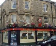
Tap And Spile B&B
The Rose and Crown
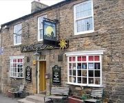
The Sun Inn
Travellers Rest
Videos from this area
These are videos related to the place based on their proximity to this place.
Northern Rail Class 142 'Pacers' at Hexham Railway Station, Northumberland, England - 20th Feb, 2015
This short film features arriving and departing Northern Rail Class 142 'Pacer' trains at historic Hexham railway station in Northumberland, England. As well as the trains, the film features...
Hexham Abbey Bells
The bells of Hexham Abbey, Northumberland, UK, during the ringing of a peal on 8 January 2012.
Big Dance 2012, The Sele Hexham Sunday 15th August
Step this Way Appalachian Cloggers and the Bones Creek Band perform 'Old Mother Flanagan' at the Bandstand in Hexham during the Big Dance 2012. The rain stopped just in time for our ...
Hexham Station in 1985
Old faded 8mm cine film shot in Hexham Station. Shows miscellaneous scenes of people and Class 101 DMUs. The day, Saturday 9th March 1985, marked the 150th anniversary of the Blaydon ...
Hexham Night Flying Display
Hexham Round Table Bonfire and Fireworks display attracts about 15000 people to the town. This year there was a display by Stanegate Flyers of the radio controlled GoFlyKite range.
Morris Dancing in Hexham 24.4.2010
Hexham Morris Dancers next to the Cathedral, celebrating St George's Day 2010.
Videos provided by Youtube are under the copyright of their owners.
Attractions and noteworthy things
Distances are based on the centre of the city/town and sightseeing location. This list contains brief abstracts about monuments, holiday activities, national parcs, museums, organisations and more from the area as well as interesting facts about the region itself. Where available, you'll find the corresponding homepage. Otherwise the related wikipedia article.
Battle of Hexham
The Battle of Hexham (15 May 1464) marked the end of significant Lancastrian resistance in the north of England during the early part of the reign of Edward IV. The battle was fought near the town of Hexham in Northumberland. John Neville, later to be 1st Marquess of Montagu, led a modest force of 3,000-4,000 men, routed the rebel Lancastrians.
Hexham Abbey
Hexham Abbey is a place of Christian worship dedicated to St Andrew and located in the town of Hexham, Northumberland, in northeast England. Since the Dissolution of the Monasteries in 1537, the Abbey has been the parish church of Hexham.
Hexham (UK Parliament constituency)
Hexham is a constituency in Northumberland represented in the House of Commons of the UK Parliament since 2010 by Guy Opperman, a Conservative.
A6079 road
The A6079 is a road in Northumberland, northern England, that runs eight miles (13 km) from Hexham to the A68 road. The road begins off the A69 road to the north of Hexham, before passing the villages of Acomb and Wall before meeting the B6318 road just to the south of Chollerford - unusually, traffic on the A6079 must give way to the traffic on the B6318, despite the fact that "A"-roads are more important than "B"-roads.
A695 road
A695 road is a road in northern England linking Newcastle upon Tyne, Tyne and Wear, with Hexham, Northumberland. It was part of the proposed A695(M) Shields Road Motorway.
Tynedale FM
Tynedale FM is the call sign of Tynedale Community Radio based in Hexham in Northumberland. The project grew from concept in March 2008 to fruition later that year, thanks to dedicated volunteers who worked hard to put together the station for its first Trial Broadcast Ofcom RSL License 28 November 2008 to 24 December 2008 on 87.7 FM. A second RSL was in mid 2009.
Milecastle 25
Milecastle 25 (Codlawhill) was a milecastle of the Roman Hadrian's Wall. Its remains exist as a low platform, and are located to the south of the B6318 Military Road (about 1 metre high), nearly 5 kilometres to the west of its junction with the A68.
Milecastle 26
Milecastle 26 (Planetrees) was a milecastle of the Roman Hadrian's Wall. Its position is slightly to the south of, but mostly covered by the B6318 Military Road. , and it is located around 700 metres east of the B6318 Military Road's junction with the A6079. No visible traces exist currently. The dimensions are the same as Milecastles 23, 24, and 25.


