Safety Score: 3,0 of 5.0 based on data from 9 authorites. Meaning we advice caution when travelling to United Kingdom.
Travel warnings are updated daily. Source: Travel Warning United Kingdom. Last Update: 2024-08-13 08:21:03
Discover Sibbertoft
Sibbertoft in Northamptonshire (England) is a town in United Kingdom about 74 mi (or 119 km) north-west of London, the country's capital city.
Current time in Sibbertoft is now 08:50 AM (Friday). The local timezone is named Europe / London with an UTC offset of zero hours. We know of 11 airports near Sibbertoft, of which 5 are larger airports. The closest airport in United Kingdom is Sywell Aerodrome in a distance of 13 mi (or 20 km), South-East. Besides the airports, there are other travel options available (check left side).
There are several Unesco world heritage sites nearby. The closest heritage site in United Kingdom is Blenheim Palace in a distance of 44 mi (or 71 km), South. Also, if you like playing golf, there are a few options in driving distance. Looking for a place to stay? we compiled a list of available hotels close to the map centre further down the page.
When in this area, you might want to pay a visit to some of the following locations: Northampton, Leicester, Glenfield, Ridlington and Brooke. To further explore this place, just scroll down and browse the available info.
Local weather forecast
Todays Local Weather Conditions & Forecast: 8°C / 47 °F
| Morning Temperature | 5°C / 41 °F |
| Evening Temperature | 6°C / 43 °F |
| Night Temperature | 5°C / 41 °F |
| Chance of rainfall | 0% |
| Air Humidity | 79% |
| Air Pressure | 1027 hPa |
| Wind Speed | Gentle Breeze with 6 km/h (4 mph) from North-East |
| Cloud Conditions | Overcast clouds, covering 100% of sky |
| General Conditions | Overcast clouds |
Saturday, 16th of November 2024
8°C (47 °F)
6°C (43 °F)
Light rain, gentle breeze, overcast clouds.
Sunday, 17th of November 2024
6°C (44 °F)
4°C (39 °F)
Light rain, moderate breeze, overcast clouds.
Monday, 18th of November 2024
5°C (41 °F)
0°C (32 °F)
Snow, moderate breeze, broken clouds.
Hotels and Places to Stay
Angel
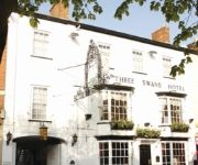
Three Swans Hotel
TRAVELODGE MARKET HARBOROUGH
Market Harborough
Videos from this area
These are videos related to the place based on their proximity to this place.
Naseby King of the Hill 2010 06
Sealed Knot Parliament training at Naseby. King of the Hill Pike push competition http://naseby2010.weebly.com.
Robocraft Christmas Present Unwrapped
Robocraft Presents!!! It's here. OMG It's beauitiful. Sweet devs, Thank You. It was worth the wait. Thank You for rewarding me as a player. One day premium code is: GIVEPREM-68161 Robocraft...
Nissan Pathfinder (2 Steves n a Jeep PT2 Sibbertoft Offroad)
'06 Nnissan pathfinder 2006 off road at sibbertoft. this nissan pathfinder goes completely offroad.
Made by Niki Lingerie, UK Fashion Export Award
www.madebyniki.co.uk is a finalist in 2008 UK Fashion Export Award, presented by Her Royal Highness The Princess Royal.
Thatching a round straw roof, iron age hut thatch style
Straw thatching, Combed wheat reed. Round thatch roofs are among the most ancient types. Thatched roofs of this type have been used for thousands of years http://www.thatch.org/diy.htm will...
Gotham Season 1 Episode 10 Review (Mid Season Finale!!)
I do not own Gotham, DC Comics, DC Universe, Warner Bros, 20th Century Fox, Batman or any of the characters involved in I do not own the pictures during the video this video. I do not own the...
101 landrover driven by youngest daughter
Jade getting the hang of driving the101 hence the big smile and no screams.
My flight in a glider :D
As a part of the Vulcan to the sky club pre season party, we were offered the chance to have a flight in a glider at The Gliding Centre at Husbands Bosworth Airfield in leicestershire. It...
www.soccervip.co.uk-Cheap Football Boots,Football Cleats,Shirts,Jerseys Sale
Cheap Football Boots,Football Cleats,Shirts,Jerseys Sale- www.soccervip.co.uk.
Videos provided by Youtube are under the copyright of their owners.
Attractions and noteworthy things
Distances are based on the centre of the city/town and sightseeing location. This list contains brief abstracts about monuments, holiday activities, national parcs, museums, organisations and more from the area as well as interesting facts about the region itself. Where available, you'll find the corresponding homepage. Otherwise the related wikipedia article.
Battle of Naseby
The Battle of Naseby was the key battle of the first English Civil War. On 14 June 1645, the main army of King Charles I was destroyed by the Parliamentarian New Model Army commanded by Sir Thomas Fairfax and Oliver Cromwell.
Naseby Field
Naseby Field is the location of the Battle of Naseby, a cardinal battle of the English Civil War which resulted in a disastrous royalist defeat. It is located roughly twenty miles north of Northampton or roughly seven miles southwest of the town of Market Harborough, and is just north of the A14 main road. A commemorative plaque and obelisk marks the site of the battle.
Hothorpe Hall
Hothorpe Hall, in Theddingworth, Leicestershire, is a Georgian manor house near Market Harborough. It was the birthplace of Simon Elwes. It is currently used as a conference centre.
Sulby Reservoir, Northamptonshire
Sulby Reservoir is in the English county of Northamptonshire. Sulby Reservoir is the higher of a pair of reservoirs owned by British Waterways - the other being Welford Reservoir - that provide water to the summit level of the Grand Union Canal by way of the navigable Welford Arm.
Thorpe Lubenham
Thorpe Lubenham is a deserted settlement and former civil parish in the English midland county of Northamptonshire. Thorpe Lubenham lies to the south of the Leicestershire village of Lubenham and south of the River Welland which forms the county boundary. The area is part of the civil parish of Marston Trussell and the district of Daventry.
Theddingworth
Theddingworth is a village and civil parish in Leicestershire, England. It lies at grid reference SP668855 about 8 kilometres west of Market Harborough on the road to Lutterworth. It is on the north bank of the River Welland and the Grand Union Canal passes within a mile. There is a church, Congregational Chapel and Theddingworth railway station was a former stop on the Rugby to Market Harborough line.
Theddingworth railway station
Theddingworth railway station was a railway station serving Theddingworth in the English county of Leicestershire. It was opened on the Rugby and Stamford Railway in 1850.
Lubenham railway station
Lubenham railway station was a railway station serving Lubenham in the English county of Leicestershire. It was opened on the Rugby and Stamford Railway in 1850.


