Safety Score: 3,0 of 5.0 based on data from 9 authorites. Meaning we advice caution when travelling to United Kingdom.
Travel warnings are updated daily. Source: Travel Warning United Kingdom. Last Update: 2024-08-13 08:21:03
Discover Lowick
Lowick in Northamptonshire (England) is a town in United Kingdom about 64 mi (or 103 km) north of London, the country's capital city.
Current time in Lowick is now 07:52 AM (Friday). The local timezone is named Europe / London with an UTC offset of zero hours. We know of 12 airports near Lowick, of which 5 are larger airports. The closest airport in United Kingdom is Sywell Aerodrome in a distance of 12 mi (or 20 km), South-West. Besides the airports, there are other travel options available (check left side).
There are several Unesco world heritage sites nearby. The closest heritage site in United Kingdom is Blenheim Palace in a distance of 39 mi (or 62 km), South. Also, if you like playing golf, there are a few options in driving distance. Looking for a place to stay? we compiled a list of available hotels close to the map centre further down the page.
When in this area, you might want to pay a visit to some of the following locations: Swineshead, Podington, Riseley, Sharnbrook and Pertenhall. To further explore this place, just scroll down and browse the available info.
Local weather forecast
Todays Local Weather Conditions & Forecast: 8°C / 47 °F
| Morning Temperature | 5°C / 40 °F |
| Evening Temperature | 6°C / 43 °F |
| Night Temperature | 5°C / 41 °F |
| Chance of rainfall | 0% |
| Air Humidity | 78% |
| Air Pressure | 1028 hPa |
| Wind Speed | Gentle Breeze with 6 km/h (4 mph) from North-East |
| Cloud Conditions | Overcast clouds, covering 95% of sky |
| General Conditions | Overcast clouds |
Saturday, 16th of November 2024
8°C (47 °F)
7°C (45 °F)
Light rain, gentle breeze, overcast clouds.
Sunday, 17th of November 2024
7°C (44 °F)
4°C (39 °F)
Light rain, moderate breeze, overcast clouds.
Monday, 18th of November 2024
5°C (42 °F)
0°C (32 °F)
Rain and snow, moderate breeze, broken clouds.
Hotels and Places to Stay
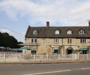
The Woolpack Inn
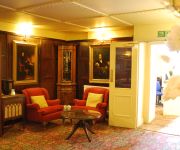
Bridge
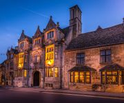
The Talbot
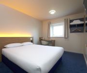
TRAVELODGE KETTERING THRAPSTON
Videos from this area
These are videos related to the place based on their proximity to this place.
Kayaks, Cows & Sunshine.
Donny & Matt take a paddle on the Nene from Wadenhoe to Thorpe Waterville. Lots of cows, cups of tea, good paddling!
Photo Booth Hire Northamptonshire - Celebrity Photo Booth - Jasmine's 13th Birthday
http://celebrityphotobooth.co.uk - Photo Booth Hire Northamptonshire Photo Booth hire from £365 for 3 hours, including: - Travel, delivery, setup and take down of the booth - 3 hours unlimited...
Hottest day of the Year 2013 Raunds Rainbow Nursery
In the garden at Raunds Rainbow Nursery School. July 2013.
Hubsan X4 H107C 2MP high altitude (well as high as I can see it) Raunds
Just thought I'd upload a video for anyone thinking of buying the Hubsan H107C 2MP and was wandering how high it can go and how well the camera copes. This Quad is amazing for the price, I...
Bicycle Service & Repairs Thrapston
http://www.crankworkscycleservice.co.uk/ Welcome to Crankworks Cycle Service - I am a City & Guilds qualified bicycle mechanic and I offer mobile cycle services in Thrapston and the surrounding...
Videos provided by Youtube are under the copyright of their owners.
Attractions and noteworthy things
Distances are based on the centre of the city/town and sightseeing location. This list contains brief abstracts about monuments, holiday activities, national parcs, museums, organisations and more from the area as well as interesting facts about the region itself. Where available, you'll find the corresponding homepage. Otherwise the related wikipedia article.
Thrapston Rural District
Thrapston was a rural district in England from 1894 to 1935. It was one of only a few rural districts to be split between administrative counties, with part in Northamptonshire and part in Huntingdonshire.
Harpers Brook
Harpers Brook is a tributary of the river Nene which runs through Northamptonshire. According to sources (ordnance survey sheet 141) it originates close to the Leicestershire town of Market Harborough and meanders through the north of the county of Northamptonshire, passing through the town of Corby and on until it joins the River Nene just North of Thrapston.
Thrapston Town F.C
Thrapston Town F.C. is an English football club based in Thrapston, Northamptonshire. The club are currently members of the United Counties League Division One and play at Chancery Lane.
Thrapston Bridge Street railway station
See also Thrapston Midland Road Thrapston Bridge Street railway station is a former railway station in Thrapston, Northamptonshire on the former Northampton and Peterborough Railway line which connected Peterborough and Northampton. In 1846 the line, along with the London and Birmingham, became part of the London and North Western Railway. At grouping in 1923 it became part of the London Midland and Scottish Railway.
Thrapston Midland Road railway station
See also Thrapston Bridge Street on the Northampton and Peterborough Railway station. Thrapston Midland Road railway station is a former railway station on a Midland Railway branch line from Kettering. The Station officially closed to Passengers on the 15th June 1959. However the actual last passengers left the Platform on the 8.30pm from Kettering on the evening of 13th June 1959. The train was hauled by steam locomotive and tender 46467 a 1946 Class Ivatt LMS Mogul 42 Class 2-6-0.
All Saints Church, Aldwincle
All Saints Church, Aldwincle, is a redundant Anglican church in the village of Aldwincle, Northamptonshire, England. It has been designated by English Heritage as a Grade I listed building, and is under the care of the Churches Conservation Trust.
St Peter's Church, Lowick
St. Peter's Church, Lowick, is a parish church in the Church of England in Lowick, Northamptonshire, England.
Drayton House
Drayton House is a country house 1 mile south-west of the village of Lowick, Northamptonshire, England.


