Safety Score: 3,0 of 5.0 based on data from 9 authorites. Meaning we advice caution when travelling to United Kingdom.
Travel warnings are updated daily. Source: Travel Warning United Kingdom. Last Update: 2024-08-13 08:21:03
Discover Cranford
Cranford in Northamptonshire (England) is a place in United Kingdom about 63 mi (or 102 km) north of London, the country's capital city.
Current time in Cranford is now 05:40 AM (Friday). The local timezone is named Europe / London with an UTC offset of zero hours. We know of 12 airports near Cranford, of which 5 are larger airports. The closest airport in United Kingdom is Sywell Aerodrome in a distance of 8 mi (or 13 km), South-West. Besides the airports, there are other travel options available (check left side).
There are several Unesco world heritage sites nearby. The closest heritage site in United Kingdom is Blenheim Palace in a distance of 36 mi (or 58 km), South. Also, if you like playing golf, there are a few options in driving distance. We encountered 1 points of interest in the vicinity of this place. If you need a hotel, we compiled a list of available hotels close to the map centre further down the page.
While being here, you might want to pay a visit to some of the following locations: Podington, Odell, Sharnbrook, Harrold and Warrington. To further explore this place, just scroll down and browse the available info.
Local weather forecast
Todays Local Weather Conditions & Forecast: 8°C / 47 °F
| Morning Temperature | 5°C / 40 °F |
| Evening Temperature | 6°C / 43 °F |
| Night Temperature | 5°C / 41 °F |
| Chance of rainfall | 0% |
| Air Humidity | 78% |
| Air Pressure | 1028 hPa |
| Wind Speed | Gentle Breeze with 6 km/h (4 mph) from North-East |
| Cloud Conditions | Overcast clouds, covering 95% of sky |
| General Conditions | Overcast clouds |
Saturday, 16th of November 2024
8°C (47 °F)
7°C (45 °F)
Light rain, gentle breeze, overcast clouds.
Sunday, 17th of November 2024
7°C (44 °F)
4°C (39 °F)
Light rain, moderate breeze, overcast clouds.
Monday, 18th of November 2024
5°C (42 °F)
0°C (32 °F)
Rain and snow, moderate breeze, broken clouds.
Hotels and Places to Stay
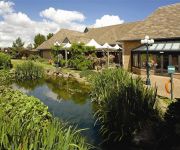
Kettering Park Hotel and Spa
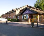
TRAVELODGE WELLINGBOROUGH RUSHDEN
Wellingborough
ibis Wellingborough
Videos from this area
These are videos related to the place based on their proximity to this place.
Stanwick Lakes in the Snow
A walk around a small part of Stanwick Lakes on Saturday 7 February 2009 after heavy snow in the previous two days.
Stanwick Lakes 24.06.2012
A few more shots of Stanwick Lakes in Northamptonshire from the evening of the 24th June 2012.
How My Advertising Pays Works
http://tidyurl.com/my-ads-pay click the link and create your free my advertising pays account.. My Advertising Pays LLC Company Name: My Advertising Pays LLC CEO: Mike Deese (retired...
Kettering Vintage Rally & Steam Fayre 2012
Photos of the event can be found here: http://rhobbs.co.uk/bju Kettering Vintage Rally & Steam Fayre 2012, held at Cranford.
The willy watt marina and the woodford mill,ringstead,east northamptonshire
This film was recorded in september 2012 and shows some of the recent enhancements and further developments that have taken place at the willy watt marina and woodford mill.It features an ...
Kettering Vintage Rally and Steam Fayre 2011
Photos of the event can be found here: http://rhobbs.co.uk/au2 Kettering Vintage Rally & Steam Fayre 2011, held at Cranford.
Kettering Vintage Rally & Steam Fayre 2010
Photos of the event can be found here: http://rhobbs.co.uk/a49 Kettering Vintage Rally & Steam Fayre 2010, held at Cranford.
Swirly Wind Turbine at Burton Wold Wind Farm 2014
This short video documents one of the ten original wind turbines built at the Burton Wold Wind Farm on the edge of Burton Latimer, filmed in May 2014. This particular one was named "Swirly"...
Rich ARAB spend $1million in one night club video! Crazy
Crazy rich arab guy spend one million dollar in one night club. videos compilation ultimate.
Videos provided by Youtube are under the copyright of their owners.
Attractions and noteworthy things
Distances are based on the centre of the city/town and sightseeing location. This list contains brief abstracts about monuments, holiday activities, national parcs, museums, organisations and more from the area as well as interesting facts about the region itself. Where available, you'll find the corresponding homepage. Otherwise the related wikipedia article.
Nene Park
Nene Park is a football stadium situated by Irthlingborough, Northamptonshire, England, along the bank of the River Nene, and holds 6,441, with 4,641 seated and 1,800 standing. The car park can hold 800 vehicles. From 1992 until 2011 it was the home ground of Rushden & Diamonds until their demise. It was then the home of Kettering Town for just 18 months, but they left in November 2012 to play at Corby due to the costs of running the ground.
Irthlingborough railway station
Irthlingborough railway station is a former railway station in Irthlingborough, Northamptonshire, on the former Northampton and Peterborough Railway line which connected Peterborough and Northampton. In 1846 the line, along with the London and Birmingham Railway, became part of the London and North Western Railway. At grouping in 1923 it became part of the London Midland and Scottish Railway.
Volta Tower
The Volta Tower was a folly in the town of Finedon, Northamptonshire, England. The tower was built in 1865 by William Mackworth-Dolben of Finedon Hall. William Harcourt Isham Mackworth (1806—1872), a younger son of Sir Digby Mackworth, the 3rd Baronet, took the additional surname Dolben after he married Frances, the heiress of Sir John English Dolben, the 4th Baronet.
Twywell Hills and Dales
Twywell Hills and Dales is a country park in East Northamptonshire, England. It is situated on the site of a former quarry in Rockingham Forest. Since quarrying ended in 1948, it has been managed by The Wildlife Trusts. Twywell Hills and Dales is a Site of Special Scientific Interest due to a number of uncommon insect and butterfly species.
St Andrew's Church, Cranford
St Andrew's Church, Cranford, is a redundant Anglican church in Cranford St Andrew, Northamptonshire, England. It has been designated by English Heritage as a Grade II* listed building, and is under the care of the Churches Conservation Trust. The church stands in the park of Cranford Hall, to the southwest of the house.


