Safety Score: 3,0 of 5.0 based on data from 9 authorites. Meaning we advice caution when travelling to United Kingdom.
Travel warnings are updated daily. Source: Travel Warning United Kingdom. Last Update: 2024-08-13 08:21:03
Delve into Chacombe
Chacombe in Northamptonshire (England) with it's 659 habitants is located in United Kingdom about 64 mi (or 103 km) north-west of London, the country's capital town.
Current time in Chacombe is now 06:02 AM (Friday). The local timezone is named Europe / London with an UTC offset of zero hours. We know of 9 airports close to Chacombe, of which 5 are larger airports. The closest airport in United Kingdom is Oxford (Kidlington) Airport in a distance of 18 mi (or 28 km), South. Besides the airports, there are other travel options available (check left side).
There are several Unesco world heritage sites nearby. The closest heritage site in United Kingdom is Blenheim Palace in a distance of 32 mi (or 52 km), South-East. Also, if you like playing golf, there are some options within driving distance. If you need a hotel, we compiled a list of available hotels close to the map centre further down the page.
While being here, you might want to pay a visit to some of the following locations: Hanwell, Oxford, Warwick, Coventry and Frilford. To further explore this place, just scroll down and browse the available info.
Local weather forecast
Todays Local Weather Conditions & Forecast: 8°C / 47 °F
| Morning Temperature | 5°C / 40 °F |
| Evening Temperature | 6°C / 43 °F |
| Night Temperature | 5°C / 41 °F |
| Chance of rainfall | 0% |
| Air Humidity | 79% |
| Air Pressure | 1028 hPa |
| Wind Speed | Light breeze with 5 km/h (3 mph) from North-East |
| Cloud Conditions | Overcast clouds, covering 100% of sky |
| General Conditions | Overcast clouds |
Saturday, 16th of November 2024
8°C (47 °F)
7°C (45 °F)
Light rain, gentle breeze, overcast clouds.
Sunday, 17th of November 2024
7°C (44 °F)
3°C (38 °F)
Light rain, moderate breeze, overcast clouds.
Monday, 18th of November 2024
5°C (41 °F)
1°C (34 °F)
Moderate rain, moderate breeze, overcast clouds.
Hotels and Places to Stay
Ashlea Guest House
JCT. 11 BANBURY M40 (former Holiday Inn Express)
Cromwell Lodge
Cromwell Lodge
Dashwood Apartments
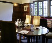
Mercure Banbury Whately Hall Hotel
Best Western Banbury House
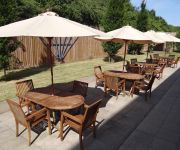
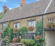
Red Lion
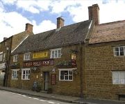
The Bell
J11) Banbury (M40
Videos from this area
These are videos related to the place based on their proximity to this place.
Trains near Banbury Including Virgin Trains Diversions 24/08/2014
A variety of services heading towards Birmingham and London in the United Kingdom. Trains include: CrossCountry 220/221 Voyagers, Chiltern Railways 168/172/165 & 67 + DVTs as well as diverted.
Narrow Canal Boats in Banbury
Vacation in the UK, 2007, narrow canal boats transiting through a lock in Banbury.
Virgin Trains Chiltern Diversions - Part 1 (Banbury).wmv
Virgin Trains diversions through Banbury on 6th May 2012, featuring Arriva 57315 top 'n' tail with Virgin 57308 on 'Pretendolino' stock, 10 car and 15 car Virgin Voyagers, plus a handful of...
Enduroland Chacombe 16 June 2013 Full lap on Husaberg TE 300
Full lap from sundays practice day at Chacombe 16 June 2013. Brilliant course with a healthy mixture of hills, open field, technical sections, man made features & natural farrows forming a...
Great Bourton, Oxon, in the snow
This was taken in the village of Great Bourton on the morning of Sunday, 19th December 2010, a day after snow had fallen on the village. The temperature was -8C and almost no vehicles attempted...
Chiltern route-learner 960014, Great Bourton 26/06/08
The Chiltern Railways class 121 "bubble car" 977873 (formerly W55022) heads towards Banbury. This presumably was a route-learning trip for Virgin Trains Voyager drivers in anticipation of re-routin...
60163 Tornado 'The William Shakespeare' 30.12.2011
To end 2011, LNER A1 Class Pacific, 60163 'Tornado' is seen on the last steam railtour of the year. 'Tornado' is seen hauling 'The William Shakespeare' tour heading past Little Bourton near...
ahab - Need You In My Arms Tonight - Cropredy 2010
Sorry for rubbish video - filmed on my phone at Cropredy 2010.
RIFT Airsoft Coms Site 3 9th March 2014 RiftSim Act 2 720P HD
WARNING: May contain profanity, If you are easily offended, this is not for you! ========================================================= RIFT Com's Site 3 - 9th March 2014 - RiftSim ...
Videos provided by Youtube are under the copyright of their owners.
Attractions and noteworthy things
Distances are based on the centre of the city/town and sightseeing location. This list contains brief abstracts about monuments, holiday activities, national parcs, museums, organisations and more from the area as well as interesting facts about the region itself. Where available, you'll find the corresponding homepage. Otherwise the related wikipedia article.
Battle of Edgecote Moor
The Battle of Edgecote Moor took place 6 miles northeast of Banbury, England on 26 July 1469 during the Wars of the Roses. The site of the battle was actually Danes Moor in Northamptonshire, at a crossing of a tributary of the River Cherwell. The battle pitted the forces of Richard Neville, 16th Earl of Warwick, against those of King Edward IV. The battle is considered to be an important turning point in the course of the war.
Battle of Cropredy Bridge
The Battle of Cropredy Bridge was a battle of the English Civil Wars, fought on 29 June 1644 between a Parliamentarian army under Sir William Waller and the Royalist army of King Charles. After a Parliamentarian attack on the Royalist rearguard was repulsed, Waller's army became demoralised and ineffective, allowing the King to retrieve the Royalists' fortunes after other defeats during the earlier part of the year.
Cropredy Bridge
Cropredy Bridge was first built in 1312 and carries a road into a village of the same name beside the upper reaches of the River Cherwell at Cropredy in Oxfordshire, England. A new bridge was erected in the 1930s.
Middleton Cheney Rural District
Middleton Cheney was a rural district in Northamptonshire, England from 1894 to 1935. It was formed under the Local Government Act 1894 from that part of the Banbury rural sanitary district which was in Northamptonshire (the main part in Oxfordshire becoming the Banbury Rural District). It was named after the village of Middleton Cheney. The district was abolished in 1935 under a County Review Order, and its area added to the existing Brackley Rural District.
Westminster Group
The Westminster Group plc is a worldwide security company that specialises in Fire, Safety, Security and Defence. The firms' headquarters are at Westminster House, Blacklocks Hill, Overthorpe, near Banbury, Oxfordshire, United Kingdom.
Chalcombe Road Halt railway station
Chalcombe Road Halt was a railway station on the link line between the Great Central Railway and the Great Western Railway's Birmingham - London line, leaving the Great Central at Culworth Junction to connect with Banbury Junction. The station, which served the nearby Northamptonshire village of Chacombe, opened in 1911 and closed in 1956.
Dogs for the Disabled
Dogs for the Disabled is a UK-based charity training and providing accredited assistance dogs to children and adults with impaired mobility due to physical disabilities.
Battle of Danes Moor
The Battle of Danes Moor (or 'Dunsmoor') occurred between the Danes and the Saxons in 914 on Danes Moor between Culworth and Edgecote, north-east of Banbury, Oxfordshire, at a crossing of a tributary of the River Cherwell. The battlefield was also the site of the 1469 Battle of Edgecote Moor.


