Safety Score: 3,0 of 5.0 based on data from 9 authorites. Meaning we advice caution when travelling to United Kingdom.
Travel warnings are updated daily. Source: Travel Warning United Kingdom. Last Update: 2024-08-13 08:21:03
Discover Staveley
Staveley in North Yorkshire (England) is a place in United Kingdom about 184 mi (or 296 km) north of London, the country's capital city.
Current time in Staveley is now 11:09 PM (Thursday). The local timezone is named Europe / London with an UTC offset of zero hours. We know of 9 airports near Staveley, of which 5 are larger airports. The closest airport in United Kingdom is RAF Linton-On-Ouse in a distance of 8 mi (or 13 km), East. Besides the airports, there are other travel options available (check left side).
There are several Unesco world heritage sites nearby. The closest heritage site in United Kingdom is Studley Royal Park including the Ruins of Fountains Abbey in a distance of 42 mi (or 67 km), East. Also, if you like playing golf, there are a few options in driving distance. If you need a hotel, we compiled a list of available hotels close to the map centre further down the page.
While being here, you might want to pay a visit to some of the following locations: Wetherby, Collingham, Walton, Scarcroft and Clifford. To further explore this place, just scroll down and browse the available info.
Local weather forecast
Todays Local Weather Conditions & Forecast: 3°C / 37 °F
| Morning Temperature | -2°C / 29 °F |
| Evening Temperature | 2°C / 36 °F |
| Night Temperature | 2°C / 35 °F |
| Chance of rainfall | 0% |
| Air Humidity | 62% |
| Air Pressure | 998 hPa |
| Wind Speed | Moderate breeze with 10 km/h (6 mph) from East |
| Cloud Conditions | Few clouds, covering 19% of sky |
| General Conditions | Few clouds |
Friday, 22nd of November 2024
5°C (40 °F)
1°C (34 °F)
Sky is clear, moderate breeze, clear sky.
Saturday, 23rd of November 2024
2°C (36 °F)
12°C (54 °F)
Rain and snow, fresh breeze, overcast clouds.
Sunday, 24th of November 2024
15°C (59 °F)
10°C (49 °F)
Light rain, fresh breeze, overcast clouds.
Hotels and Places to Stay
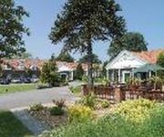
Bridge Hotel and Spa
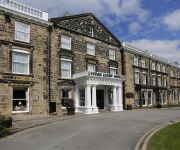
Ascend Cedar Court Hotel Harrogate
BW DOWER HOUSE HTL AND SPA
BEST WESTERN CROWN HOTEL
The Old Deanery
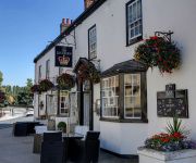
The Market Tavern
Harrogate South
Videos from this area
These are videos related to the place based on their proximity to this place.
Lenis Guess - Thank Goodness Gotta Good Woman - Peanut Country: 1002 DJ
a flawless PROMO copyAnother Frank Guida project for Norfolk' Rockmasters Inc: both sifdes wrote by Frank Guida & Lenis Guess. Guess, Lenis Peanut Country: 1002 DJ Artist Guess, Lenis Label...
Lenis Guess - Too Many Nights - Peanut Country: 1002 DJ
a flawless PROMO copyAnother Frank Guida project for Norfolk' Rockmasters Inc: both sifdes wrote by Frank Guida & Lenis Guess. Guess, Lenis Peanut Country: 1002 DJ Artist Guess, Lenis Label...
Village Choir - Along The Beach - S C M
Right on the money for today's "upfront" segment of this burgeoning Northern Soul scene. From the first horn blow, the signal is to DANCE! A sexy blend of jazz/soul/funk is whisked up into...
The Great Knaresborough Bed Race 2014
The Great Knaresborough Bed Race is something different: it is part fancy dress pageant and part gruelling time trial over a 2.4 mile course, ending with a swim through the icy waters of the...
Knaresborough Station, North Yorkshire, UK (throughout 2012)
Knaresborough railway station is a station serving the town of Knaresborough in North Yorkshire, England. It is located on the Harrogate Line 16.75 miles (27 km) west of York and is operated...
Knaresborough Yorkshire a winter walk with wildlife and dogs by geordieschords
We took my daughter"s dogs Pippin and Lola walking yesterday and this is what we saw. You can find more photos and videos of my local area of Yorkshire on Flickr geordieschords.
Knaresborough: Boxing Day Tug of War
Every Boxing Day pub tug o'war teams face each other from either side of the banks of the river Nidd at Low Bridge, Knaresborough. They attepmt to pull each other into the river!
Leah Dawson & Choker Campbell & Magic City Orchestra - My Mechanical Man - Magic City test press
A listing for those many of you who appreciate the historical, the unusual and conversation pieces that make the rich Northern Soul tapestry so very interesting. I was immediately attracted...
Knaresborough Sword Dance
Claro Sword dancing the Knaresborough Sword Dance in St. John's Church, Knaresborough on Plough Sunday 2010. Records indicate there was a traditional Yorkshire Longsword Dance from the market...
Village Choir - Sweet Hot Lips - N.Y.C. Street Sound
Could they have chosen a better label name, as the vehicle for these two sensational sides - both of which are soaked with the what the streets of New York have to offer. Salacious, sultry,...
Videos provided by Youtube are under the copyright of their owners.
Attractions and noteworthy things
Distances are based on the centre of the city/town and sightseeing location. This list contains brief abstracts about monuments, holiday activities, national parcs, museums, organisations and more from the area as well as interesting facts about the region itself. Where available, you'll find the corresponding homepage. Otherwise the related wikipedia article.
Knaresborough Castle
Knaresborough Castle is a ruined fortress overlooking the River Nidd in the town of Knaresborough, North Yorkshire, England.
Airedale
Airedale is a geographic area in Yorkshire, England, corresponding to the river valley of the River Aire (pronounced air). The valley stretches from the river's origin in Malham which is in the Yorkshire Dales, down past Keighley and Bingley, through Leeds and Castleford and on to join the River Ouse at Airmyn. This valley is the major cause of the Aire Gap, a pass of great topographic significance that provides a low-altitude pass through the Pennine chain.
Nidderdale Rural District
Nidderdale was a rural district in the West Riding of Yorkshire from 1938 to 1974. It was created from the combination of most of the disbanded rural districts of Great Ouseburn and Knaresborough. http://www. visionofbritain. org. uk/relationships. jsp?u_id=10108585 The district covered villages in the lower valley of the River Nidd between Hampsthwaite and York. Despite its name it included only a small part of Nidderdale, most of which was in Ripon and Pateley Bridge Rural District.
A6055 road
The A6055 is a twenty-five mile stretch of road in North Yorkshire. It runs in a NNE direction from the A59 at Bond End in Knaresborough where it is called Boroughbridge Road, through the Stockwells Estate. It exits Knaresborough just past Greengate Lane where it turns directly north, before once again resuming a northeasterly direction at a sharp bend on the junction with Farnham Lane.
Ferrensby
Ferrensby is a village and civil parish in the Harrogate district of North Yorkshire, England. It is about 3 miles north east of Knaresborough and near the A1(M) motorway. Nearby attractions include a balloon centre and a maze.
Nidd Gorge
Nidd Gorge makes up a section of the River Nidd in North Yorkshire, England, in which the river enters a deep ravine with sheer, tree covered valley sides. The river as a whole flows from its source near Great Whernside in Nidderdale (part of the Yorkshire Dales), to its confluence with the River Ouse near Nun Monkton.
St Mary's Church, Roecliffe
St Mary's Church, Roecliffe, is a redundant Anglican church in the village of Roecliffe, North Yorkshire, England. It has been designated by English Heritage as a Grade II* listed building, and is under the care of the Churches Conservation Trust.


