Safety Score: 3,0 of 5.0 based on data from 9 authorites. Meaning we advice caution when travelling to United Kingdom.
Travel warnings are updated daily. Source: Travel Warning United Kingdom. Last Update: 2024-08-13 08:21:03
Delve into Ingleby Greenhow
Ingleby Greenhow in North Yorkshire (England) with it's 14,608 habitants is a town located in United Kingdom about 207 mi (or 334 km) north of London, the country's capital town.
Time in Ingleby Greenhow is now 03:09 AM (Friday). The local timezone is named Europe / London with an UTC offset of zero hours. We know of 9 airports closer to Ingleby Greenhow, of which 4 are larger airports. The closest airport in United Kingdom is Durham Tees Valley Airport in a distance of 14 mi (or 22 km), West. Besides the airports, there are other travel options available (check left side).
There are several Unesco world heritage sites nearby. The closest heritage site in United Kingdom is Durham Castle and Cathedral in a distance of 35 mi (or 57 km), North-East. Also, if you like the game of golf, there is an option about 10 mi (or 16 km). away. We saw 1 points of interest near this location. In need of a room? We compiled a list of available hotels close to the map centre further down the page.
Since you are here already, you might want to pay a visit to some of the following locations: Guisborough, Nunthorpe, South Bank, Middlesbrough and Greatham. To further explore this place, just scroll down and browse the available info.
Local weather forecast
Todays Local Weather Conditions & Forecast: 3°C / 38 °F
| Morning Temperature | 2°C / 35 °F |
| Evening Temperature | 1°C / 33 °F |
| Night Temperature | 1°C / 34 °F |
| Chance of rainfall | 0% |
| Air Humidity | 63% |
| Air Pressure | 1004 hPa |
| Wind Speed | Moderate breeze with 12 km/h (8 mph) from South-East |
| Cloud Conditions | Clear sky, covering 8% of sky |
| General Conditions | Sky is clear |
Saturday, 23rd of November 2024
2°C (35 °F)
11°C (52 °F)
Rain and snow, strong breeze, overcast clouds.
Sunday, 24th of November 2024
15°C (58 °F)
9°C (49 °F)
Moderate rain, strong breeze, overcast clouds.
Monday, 25th of November 2024
8°C (47 °F)
8°C (46 °F)
Broken clouds, high wind, near gale.
Hotels and Places to Stay
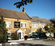
Chapters Hotel & Restaurant
Wainstones
Videos from this area
These are videos related to the place based on their proximity to this place.
Eddy, Tim, Guisborough and torrential rain
Soggy media fest in guisborough woods, taking in daz's, les's, snake bite, nomad and dh1.
Bransdale Moor, Cleveland Hills - 3 January 2011
A walk around the valley of Bransdale on the North York Moors. The route from Clay Bank follows the Cleveland Way towards Round Hill and on to Bloworth Crossing where we then headed South East.
Ingleby Incline, North York Moors - 23 September 2011
A 8 mile walk starting from Clay Bank, near Great Broughton. The walk goes through Greenhow Plantation before descending to the base of Ingleby Incline. Climbing up Ingleby Incline the walk...
Stokesley AC - Match at Ingleby Road Pond, Great Broughton
First match of the season at this small fishery a mile or so outside the village of Great Broughton in North Yorkshire. Despite temperatures never climbing higher than 9C all day catches were...
FM Bandscan - North Yorkshire, England (31-Dec-2011)
FM scan on top of the North Yorkshire moors with a great view of Teesside. This scan was done just before New Year 2012.
Fish-friendly Plastic Hydrodynamic Screw Turbine
Fish-friendly Plastic Hydrodynamic Screw Turbine. Archimedes Screw Turbines are utilised to generate electricity in low head Hydro schemes, all around Europe.Plastic Hydrodynamic Screw Turbine...
Stokesley SC v Whitehaven
Division Two 30th November 2013 FT Stokesley SC 2-2 Whitehaven Kelly (2) Tymon penalty Hunter.
My first DJI Phantom Flytrex flight
A video taken alongside the North Yorkshire Moors with a Gopro Hero 3 onboard My DJI Phantom carrying a Flytrex Core logger for the first time. Edited using Gopro Studio 2.
Videos provided by Youtube are under the copyright of their owners.
Attractions and noteworthy things
Distances are based on the centre of the city/town and sightseeing location. This list contains brief abstracts about monuments, holiday activities, national parcs, museums, organisations and more from the area as well as interesting facts about the region itself. Where available, you'll find the corresponding homepage. Otherwise the related wikipedia article.
Little Ayton
Little Ayton is a village and civil parish in Hambleton district of North Yorkshire, England. It lies immediately south of Great Ayton.
Great Ayton Friends' School
Great Ayton Friends' School (1841–1997) in Great Ayton, North Yorkshire, England, was an independent, co-educational, agricultural boarding school, run by the Religious Society of Friends (the Quakers). The school was situated on High Green on an estate of around 70 acres in a picturesque setting in the shadow of the Cleveland Hills. The River Leven, ran through the school grounds and was bridged in several places.
Easby Moor
Easby Moor is located in the North York Moors national park at 324 metres above sea level it lies within the Cleveland Hills, North Yorkshire, England. The moor is a part of the Cleveland Way and is best known for its 51 ft high monument to Captain James Cook, which overlooks the village of Great Ayton.
Hasty Bank
Hasty Bank is a hill in the Cleveland Hills range of the North York Moors, in north-east England. The Cleveland Way National Trail crosses Hasty Bank and is part of Wainwright's Coast to Coast Walk. The north face of Hasty Bank has heavily eroded, possessing a vertical rocky face sloping steeply down to Broughton Bank. Roseberry Topping can be clearly seen from the summit which offers great views of the Tees Valley.


