Safety Score: 3,0 of 5.0 based on data from 9 authorites. Meaning we advice caution when travelling to United Kingdom.
Travel warnings are updated daily. Source: Travel Warning United Kingdom. Last Update: 2024-08-13 08:21:03
Explore Bainbridge
Bainbridge in North Yorkshire (England) is a city in United Kingdom about 210 mi (or 338 km) north-west of London, the country's capital.
Local time in Bainbridge is now 09:14 AM (Monday). The local timezone is named Europe / London with an UTC offset of zero hours. We know of 10 airports in the vicinity of Bainbridge, of which 5 are larger airports. The closest airport in United Kingdom is Durham Tees Valley Airport in a distance of 30 mi (or 49 km), North-East. Besides the airports, there are other travel options available (check left side).
There are several Unesco world heritage sites nearby. The closest heritage site is Frontiers of the Roman Empire in Germany at a distance of 55 mi (or 89 km). The closest in United Kingdom is Studley Royal Park including the Ruins of Fountains Abbey in a distance of 69 mi (or 89 km), North-East. Also, if you like golfing, there are multiple options in driving distance. If you need a place to sleep, we compiled a list of available hotels close to the map centre further down the page.
Depending on your travel schedule, you might want to pay a visit to some of the following locations: Bowes, Lartington, Startforth, Brignall and Barningham. To further explore this place, just scroll down and browse the available info.
Local weather forecast
Todays Local Weather Conditions & Forecast: 7°C / 44 °F
| Morning Temperature | 7°C / 44 °F |
| Evening Temperature | 5°C / 42 °F |
| Night Temperature | 5°C / 41 °F |
| Chance of rainfall | 5% |
| Air Humidity | 74% |
| Air Pressure | 994 hPa |
| Wind Speed | Strong breeze with 20 km/h (12 mph) from North-East |
| Cloud Conditions | Overcast clouds, covering 98% of sky |
| General Conditions | Light rain |
Tuesday, 26th of November 2024
6°C (42 °F)
2°C (36 °F)
Light rain, fresh breeze, scattered clouds.
Wednesday, 27th of November 2024
6°C (42 °F)
2°C (35 °F)
Light rain, gentle breeze, overcast clouds.
Thursday, 28th of November 2024
4°C (40 °F)
3°C (38 °F)
Light rain, light breeze, broken clouds.
Hotels and Places to Stay
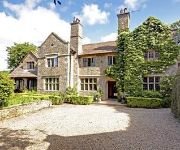
Stone House
Videos from this area
These are videos related to the place based on their proximity to this place.
Lake Semerwater, Nr. Marsett in the Yorkshire Dales, UK
Lake Semerwater near Marsett in Raydale at the very centre of the Yorkshire Dales.
MTB - Down the Roman Road/Cam High Road from above Hawes, North Yorkshire
Video taken above Hawes in the Yorkshire Dales on the Roman Road Bridleway /Cam High Road with a GoPro Hero3 mounted to the handle bars of my Mountain Bike. Video consists of the final climb.
Hoy 100 - Over the wall
On the Chris Hoy 100 sportive about 51 miles in I took too much speed on a descent which led to a blind corner and I just couldn't stop quick enough. Walked away with only muscle injuries....
Yorkshire Dales stunning views
A collection of some of the most beautiful scenery of the Yorkshire Dales National Park in England. As featured on a full-length DVD "Yorkshire Dales A Landscape of Longing" available from...
Swaledale Springtime
A slideshow of the meadows in upper Swaledale with lots of buttercups and field barns. Birdsong includes curlew, blackbird, lapwing, pheasant and oystercatcher. The attractive village of Muker...
PSPscene - ULTIMATE GHOSTS'N GOBLINS - SONY PSP
This video shows a psp slim running Ultimate Ghosts'n Goblins via a FS monitor. A Classic arcade game gets a full makeover. Now with lovely use of the psp color palette, the graphics and...
Videos provided by Youtube are under the copyright of their owners.
Attractions and noteworthy things
Distances are based on the centre of the city/town and sightseeing location. This list contains brief abstracts about monuments, holiday activities, national parcs, museums, organisations and more from the area as well as interesting facts about the region itself. Where available, you'll find the corresponding homepage. Otherwise the related wikipedia article.
Yorkshire Dales
The Yorkshire Dales (also known simply as The Dales) is an upland area of Northern England dissected by numerous valleys. The area lies within the county boundaries of historic Yorkshire, though it spans the ceremonial counties of North Yorkshire, West Yorkshire and Cumbria. Most of the area falls within the Yorkshire Dales National Park, created in 1954 and now one of the fifteen National parks of Britain, but the term also includes areas to the east of the National Park, notably Nidderdale.
Semerwater
Semerwater is the second largest natural lake in North Yorkshire, England after Malham Tarn. It is half a mile (800 m) long, covers 100 acres and lies in Raydale, opposite England's shortest river the River Bain. A private pay and display parking area is at the foot of the lake. Semerwater attracts canoers, windsurfers, yachtsmen and fishermen. There are three small settlements nearby: Stalling Busk Countersett Marsett
Newbiggin, Askrigg
Newbiggin is a tiny hamlet very close to Askrigg, North Yorkshire, England. Another Newbiggin is only about 7 miles away.
River Bain, North Yorkshire
The River Bain is a river in North Yorkshire, England. It is designated legally as a Main River, so at around two and a half miles long is reputed to be the shortest river in England. The Brennand River in Lancashire is half the distance, but as it is a tributary to other tributaries, it is not classified as a Main River. The river is home to the small scale hydroelectricity project River Bain Hydro located at Bainbridge.


