Safety Score: 3,0 of 5.0 based on data from 9 authorites. Meaning we advice caution when travelling to United Kingdom.
Travel warnings are updated daily. Source: Travel Warning United Kingdom. Last Update: 2024-08-13 08:21:03
Discover Winford
Winford in North Somerset (England) with it's 1,165 citizens is a place in United Kingdom about 110 mi (or 176 km) west of London, the country's capital city.
Current time in Winford is now 09:33 PM (Sunday). The local timezone is named Europe / London with an UTC offset of zero hours. We know of 10 airports near Winford, of which 5 are larger airports. The closest airport in United Kingdom is Bristol International Airport in a distance of 3 mi (or 4 km), West. Besides the airports, there are other travel options available (check left side).
There are several Unesco world heritage sites nearby. The closest heritage site in United Kingdom is Blaenavon Industrial Landscape in a distance of 29 mi (or 47 km), North. Also, if you like playing golf, there are a few options in driving distance. We encountered 1 points of interest in the vicinity of this place. If you need a hotel, we compiled a list of available hotels close to the map centre further down the page.
While being here, you might want to pay a visit to some of the following locations: Dundry, Butcombe, Chew Magna, Compton Martin and Stanton Drew. To further explore this place, just scroll down and browse the available info.
Local weather forecast
Todays Local Weather Conditions & Forecast: 10°C / 50 °F
| Morning Temperature | 8°C / 46 °F |
| Evening Temperature | 9°C / 49 °F |
| Night Temperature | 9°C / 49 °F |
| Chance of rainfall | 0% |
| Air Humidity | 79% |
| Air Pressure | 1017 hPa |
| Wind Speed | Moderate breeze with 10 km/h (7 mph) from East |
| Cloud Conditions | Overcast clouds, covering 97% of sky |
| General Conditions | Light rain |
Monday, 18th of November 2024
9°C (48 °F)
11°C (51 °F)
Moderate rain, fresh breeze, overcast clouds.
Tuesday, 19th of November 2024
3°C (38 °F)
3°C (38 °F)
Rain and snow, fresh breeze, overcast clouds.
Wednesday, 20th of November 2024
5°C (42 °F)
3°C (38 °F)
Moderate rain, gentle breeze, clear sky.
Hotels and Places to Stay
Mercure Bristol Holland House Hotel and Spa
Radisson Blu Bristol
The Bristol Hotel
Bristol Marriott Royal Hotel
Ring O Bells
The Town and Country Lodge
The Regency Bristol Hotel
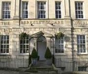
Berkeley Square Clifton Hotel
ibis Bristol Centre
The Channings Hotel
Videos from this area
These are videos related to the place based on their proximity to this place.
Chew Valley School Sixth Form Revue 2013 Part 4
You've Been Framed -Hammett Gets Electrocuted -Balloons In Arbuckles Office -Dunford Gets Tied to a tree - Staff Room Take Over - Morph Suit Mafia -Sweet Child of mine from Step Brothers ...
Bristol City v Bristol Rovers 4th September 2013 pt 3
Here is a short vid of the above game after City got their second goal.
SPENG BOND ALONGSIDE QUAKER CITY SOUND SYSTEM last tune pt 1
FEATURING YOUNGER QUAKER AT THE CONTROLL & MR BOND AKA SPENG.
Show Of Hands VRC0415 Cousin Jack
Show Of Hands (Steve Nightley & Phil Beer) at The Albert Hole Bristol 21st July 99.
LANDING AT BRISTOL INTERNATIONAL AIRPORT TCX725 THOMAS COOK AIRLINES FROM MONASTIR TUNISIA.MP4
Landing at Bristol International Airport on Thomas Cook Flight TCX725 on 5th May 2010 at 12.50pm from Monastir Airport Tunisia.(excuse the condensation on the plane window).
Jet Ranger cockpit view
Cocokpit view of a Jet Ranger take off from Bristol Airport 7th Feb 2009 Off to do Emergency Electricity patrols after the snow storm.
Bristol Airport, Britannia Boeing 757, Majorca Palma Airport & Footballers in Pueto Pollensa
Driving past the wicker man in Bridgewater, onwards to Bristol International Airport, and on the Britannia Boeing plane - we're sat right on the wing. There are some in-flight views, and then...
Videos provided by Youtube are under the copyright of their owners.
Attractions and noteworthy things
Distances are based on the centre of the city/town and sightseeing location. This list contains brief abstracts about monuments, holiday activities, national parcs, museums, organisations and more from the area as well as interesting facts about the region itself. Where available, you'll find the corresponding homepage. Otherwise the related wikipedia article.
Long Ashton Research Station
Long Ashton Research Station (LARS) was an agricultural and horticultural government research centre in the village of Long Ashton near Bristol, UK. It was created in 1903 to study and improve the West Country cider industry, expanded into fruit research, and was redirected in the 1980s to work on arable crops and aspects of botany. It closed in 2003.
Dundry Hill
Dundry Hill is immediately south of Bristol, England: it includes farmland, a small number of houses and a church. It stretches east-west for some two miles. The village of Dundry, with its prominent church, is near the summit. At the eastern end is Maes Knoll, near Norton Malreward, an Iron Age hillfort and the start of Wansdyke. To the South lies the Chew Valley. On the western side of the hill is a spring which becomes the Land Yeo
Fairy Toot
The Fairy Toot is an extensive oval barrow in the village of Nempnett Thrubwell, Somerset, England. It is an example of the Severn-Cotswold tomb type which consist of precisely-built, long trapezoid earth mounds covering a burial chamber. Because of this they are a type of chambered long barrow. Fairy Toot was formerly a chambered cairn which is a Scheduled Ancient Monument, on the national monument register as '198102'.
Barrow Gurney Reservoirs
Barrow Gurney Reservoirs (also known as Barrow Gurney Tanks or Barrow Tanks) are three artificial reservoirs for drinking water near the village of Barrow Gurney, which lies southwest of Bristol, England. They are known by their numbers rather than names. They are fed by several springs including one which becomes the Land Yeo. Some of the outfall is also used to feed the river which flows to the Bristol Channel.
Chew Magna Reservoir
Chew Magna Reservoir is a small reservoir on the western outskirts of the village of Chew Magna, Somerset, England. It lies just north of the B3130 Winford Road. This 5 acres reservoir was created in the 1930s, damming Winford brook, to supply water for villages in the Chew Valley. It is owned and managed by Bristol Water. Chew Magna reservoir provides fly fishing for stocked Brown Trout (Salmo trutta morpha fario) and Rainbow Trout (Oncorhynchus mykiss). Rainbows can be fished all year.
Bishopsworth
Bishopsworth is the name of both a council ward of the city of Bristol in the United Kingdom, and a suburb of the city which lies within that ward. As well as the suburb of Bishopsworth, the ward contains the areas of Bedminster Down, Highridge and Withywood.
Flax Bourton railway station
Flax Bourton railway station was a railway station on the Bristol to Exeter Line, 5 miles 49 chains from Bristol Temple Meads, serving the village of Flax Bourton in North Somerset. It opened in 1860, and was closed by the Beeching Axe in 1964.
Barrow Gurney Nunnery
Barrow Gurney Nunnery (also called Minchin Barrow) was established around 1200 in Barrow Gurney Somerset, England. The Benedictine nunnery was founded by one of the Fitz-Hardinges (or Fitzhardinge), and in 1212, was left 10 marks in the will of Hugh de Wells. The nunnery also received a pension on the church of Twerton by the time of the Taxatio in 1291. Several other donations of money and land had been received by the Valor of 1535 when the property was assessed as worth £29 6s. 8½d.


