Safety Score: 3,0 of 5.0 based on data from 9 authorites. Meaning we advice caution when travelling to United Kingdom.
Travel warnings are updated daily. Source: Travel Warning United Kingdom. Last Update: 2024-08-13 08:21:03
Explore Stalham
Stalham in Norfolk (England) with it's 3,971 inhabitants is located in United Kingdom about 112 mi (or 180 km) north-east of London, the country's capital.
Local time in Stalham is now 11:44 AM (Friday). The local timezone is named Europe / London with an UTC offset of zero hours. We know of 9 airports in the wider vicinity of Stalham, of which 3 are larger airports. The closest airport in United Kingdom is Norwich International Airport in a distance of 12 mi (or 19 km), South-West. Besides the airports, there are other travel options available (check left side).
There are several Unesco world heritage sites nearby. The closest heritage site in United Kingdom is Royal Botanic Gardens, Kew in a distance of 103 mi (or 166 km), South-West. Also, if you like golfing, there is an option about 4 mi (or 7 km). away. If you need a place to sleep, we compiled a list of available hotels close to the map centre further down the page.
Depending on your travel schedule, you might want to pay a visit to some of the following locations: East Ruston, Brundall, Surlingham, Rockland Saint Mary and Hellington. To further explore this place, just scroll down and browse the available info.
Local weather forecast
Todays Local Weather Conditions & Forecast: 9°C / 49 °F
| Morning Temperature | 9°C / 48 °F |
| Evening Temperature | 8°C / 47 °F |
| Night Temperature | 6°C / 43 °F |
| Chance of rainfall | 0% |
| Air Humidity | 76% |
| Air Pressure | 1027 hPa |
| Wind Speed | Gentle Breeze with 8 km/h (5 mph) from North-East |
| Cloud Conditions | Overcast clouds, covering 100% of sky |
| General Conditions | Overcast clouds |
Saturday, 16th of November 2024
10°C (50 °F)
7°C (45 °F)
Broken clouds, moderate breeze.
Sunday, 17th of November 2024
8°C (47 °F)
5°C (40 °F)
Light rain, moderate breeze, broken clouds.
Monday, 18th of November 2024
5°C (41 °F)
2°C (35 °F)
Snow, moderate breeze, scattered clouds.
Hotels and Places to Stay
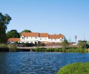
Wayford Bridge Hotel
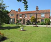
May Cottage B&B
Olde Hall
Videos from this area
These are videos related to the place based on their proximity to this place.
Let's play! The Dark Secret - Part13. The Hospital
Download: http://www.moddb.com/members/the-dark-secret-mods/downloads/the-dark-secret-part-one Tds 1 Time / Date: 2002 (Half Life 1 mod) Thank you for watching...
Naomi'e party pt3
Mediaocracy live at Naomi's party in her back garden in a quiet North Norfolk seaside village.
Flight in Happisburgh 4
Yet another FPV video from Happisburgh in North Norfolk. Next one will be 2014 so we can see the erosion that has happened from 2012.
Cromer Forest Bed Fossil Project
This short video shows some of the survey work being undertaken on the Cromer Forest Bed on the beach near Happisburgh. The Cromer Forest-bed Fossil Project is a partnership between Norfolk...
Scania P230 at Speed.
Scania P230 on country roads near the village of Ludham in Norfolk. the road got a bit bumpy at times but we got the job done.
Barton.wmv
UK-HBBR Rally at Barton Turf, Norfolk Broads, Late May Bank Holiday 2010. An esoteric collection of Homebuilt Boats enjoying a messabout. For more on this disorganisation of eccentrics visit...
312hp Mk1 Focus RS Acceleration
Sorry about the camera recorded along a very bumpy country road.. enjoy! Vrooom Tssshhh!
Sailing onto Barton Broad from the River Ant
Entering Barton Broad from the River Ant, way to Barton Turf behind to the left.
Videos provided by Youtube are under the copyright of their owners.
Attractions and noteworthy things
Distances are based on the centre of the city/town and sightseeing location. This list contains brief abstracts about monuments, holiday activities, national parcs, museums, organisations and more from the area as well as interesting facts about the region itself. Where available, you'll find the corresponding homepage. Otherwise the related wikipedia article.
Barton Broad
Barton Broad lies within The Broads in Norfolk, the United Kingdom. The broad is situated to the south and east of the village of Barton Turf, and is within the parish of Barton Turf. It is, after Hickling Broad, the second largest broad, and a nature reserve in the care of the Norfolk Wildlife Trust. It is reputed that Horatio Nelson learnt to sail here. Among other users are the Sailing Club of Gresham's School.
Ant Broads & Marshes NNR
Ant Broads & Marshes NNR is a National Nature Reserve in Norfolk, England established by English Nature. It is named after the River Ant. It is part of the "Ant Broads and Marshes" Site of Special Scientific Interest and is within The Broads National Park. The NNR includes: Barton Broad and Catfield Fen, owned and managed by Norfolk Wildlife Trust Catfield Fen Reserve, owned and managed by the British Butterfly Conservation Society.
East Ruston Old Vicarage
East Ruston Old Vicarage Gardens is a notable privately owned garden in the county of Norfolk at East Ruston in Eastern England. The gardens were established in 1973 by Alan Gray and Graham Robeson, who have created a 32-acre design which incorporates exuberant and innovative planting alongside a more traditional formal design.
Stalham railway station
Stalham railway station was a station in North Norfolk serving the settlement of Stalham. It was on the line between Melton Constable and Great Yarmouth. It is now closed, having been shut in 1959 when the line was closed. The station lay derelict and unused for many years after closure. However the station buildings were dismantled and rebuilt at the new Holt station on the North Norfolk Railway.
Catfield railway station
Catfield railway station was a station in Catfield, Norfolk. It closed in 1959. Former Services Preceding station Disused railways Following station Sutton Staithe Halt Midland and Great Northern Potter Heigham
Sutton Staithe Halt railway station
Sutton Staithe Halt was a railway station on the Midland and Great Northern Joint Railway which was opened in 1933 to serve the holidaymakers visiting the Norfolk Broads in the vicinity of the village of Sutton.
St Mary's Church, East Ruston
St Mary's Church, East Ruston, is a redundant Anglican church in the village of East Ruston, Norfolk, England. It has been designated by English Heritage as a Grade II* listed building, and is under the care of the Churches Conservation Trust. The church stands in an isolated position on the east side of the B1159 road, some 2 miles north of Stalham. It is noted for its 15th-century painted and carved chancel screen.
Catfield Fen Reserve
Catfield Fen is a nature reserve near Ludham in the county of Norfolk, England. Butterfly Conservation owns and manages this reserve. Part of the Ant Broads & Marshes National Nature Reserve, it comprises 59 acres .


