Safety Score: 3,0 of 5.0 based on data from 9 authorites. Meaning we advice caution when travelling to United Kingdom.
Travel warnings are updated daily. Source: Travel Warning United Kingdom. Last Update: 2024-08-13 08:21:03
Touring Little Plumstead
Little Plumstead in Norfolk (England) with it's 656 residents is a town located in United Kingdom about 103 mi (or 166 km) north-east of London, the country's capital place.
Time in Little Plumstead is now 11:47 AM (Friday). The local timezone is named Europe / London with an UTC offset of zero hours. We know of 9 airports nearby Little Plumstead, of which 3 are larger airports. The closest airport in United Kingdom is Norwich International Airport in a distance of 6 mi (or 9 km), West. Besides the airports, there are other travel options available (check left side).
There are several Unesco world heritage sites nearby. The closest heritage site in United Kingdom is Royal Botanic Gardens, Kew in a distance of 94 mi (or 152 km), South-West. Also, if you like the game of golf, there is an option about 7 mi (or 11 km). away. Need some hints on where to stay? We compiled a list of available hotels close to the map centre further down the page.
Being here already, you might want to pay a visit to some of the following locations: Brundall, Surlingham, Rockland Saint Mary, Hellington and Norwich. To further explore this place, just scroll down and browse the available info.
Local weather forecast
Todays Local Weather Conditions & Forecast: 9°C / 49 °F
| Morning Temperature | 7°C / 44 °F |
| Evening Temperature | 7°C / 45 °F |
| Night Temperature | 5°C / 42 °F |
| Chance of rainfall | 0% |
| Air Humidity | 75% |
| Air Pressure | 1027 hPa |
| Wind Speed | Gentle Breeze with 7 km/h (4 mph) from North-East |
| Cloud Conditions | Overcast clouds, covering 100% of sky |
| General Conditions | Overcast clouds |
Saturday, 16th of November 2024
10°C (49 °F)
7°C (44 °F)
Broken clouds, gentle breeze.
Sunday, 17th of November 2024
8°C (46 °F)
3°C (37 °F)
Light rain, moderate breeze, broken clouds.
Monday, 18th of November 2024
5°C (41 °F)
0°C (33 °F)
Snow, moderate breeze, scattered clouds.
Hotels and Places to Stay
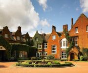
Sprowston Manor Marriott Hotel & Country Club
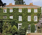
The Old Rectory
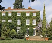
The Old Rectory Norwich
Norfolk Mead
Colts Lodge B&B
OAKLANDS HOTEL AND COURT
Premier Inn Norwich East (Broadlands/A47)
Videos from this area
These are videos related to the place based on their proximity to this place.
sledge build
The sledge is made of half inch oak boards steamed round the former and fastened by oak cleats. Designed for a family, we have had both parents and two little girls on it but unsure whether...
Ring-necked Duck - Wroxham Broad
The Ring-Necked Duck at Wroxham, 24/11/09 http://www.freewebs.com/garybirder/
Norfolk Broads Places to visit near Salhouse Broad Winter 2012/13
Norfolk Broads (Web sites and QR codes are on the clips and you will need annotations switched to use the menus) Salhouse Broad on the Norfolk broads is a good starting location, for visiting...
Norfolk Broads: Salhouse Broad Raft Race 2012
You can't get more English Country Living than messing about on the water with some good company! On 26th August that's what happened on Salhouse Broad in Norfolk. Thanks to Bex for sending...
Norfolk Broads - Pubs near Salhouse Broad Winter 2012/13
Norfolk Broads (Web sites and QR codes are on the clips and you will need annotations switched to use the menus) At Salhouse Broad we often get asked about Pubs and places to eat near Salhouse...
37518 + 70000 + 45407 convoy - Salhouse - 07/03/2013
Ian Riley's Intercity livery 37518 "Fort William" with 70000 "Britannia" & Black 5 45407 "The Lancashire Fusillier" in tow, slips quietly through Salhouse station on 5Z54 Castleton East Lancs...
Winsome at Salhouse 2007
The head of the Norfolk Broads Authority tries the WInsome pedal launch at the Norfolk Braods Green Boat Show, Salhouse Braod, September 2007.
Norvic challenge 2012
A race using a bike a canoe and by foot over 7 miles from the Norvic clinic (staff) in Thorpe to Salhouse broad then to the nearest Pub Woodbastwicks Fur 'n' feature for a drink all raising...
Videos provided by Youtube are under the copyright of their owners.
Attractions and noteworthy things
Distances are based on the centre of the city/town and sightseeing location. This list contains brief abstracts about monuments, holiday activities, national parcs, museums, organisations and more from the area as well as interesting facts about the region itself. Where available, you'll find the corresponding homepage. Otherwise the related wikipedia article.
Hoveton Great Broad
Hoveton Great Broad lies within The Broads in Norfolk, England, between Wroxham Broad and Salhouse Broad. The broad is connected to the River Bure, but not open to boat traffic. A nature trail was laid out in 1968 - the first in the region. It is accessible only by boat. Mooring is allowed on the north bank of the Bure, opposite Salhouse Broad. Natural England has established a Nature trail. From the boardwalk, one can see the broad with its adjoining fens and alder carr.
Wroxham Broad
Wroxham Broad is on the River Bure near the village of Wroxham in Norfolk, England within The Broads National Park. The broad has an area of 34.4 hectares and a mean depth of 1.3 metres. It lies to the west of the Bure, with two navigable openings between river and broad. The village and broad lie in an area of fairly intensive agriculture, with areas of wet woodland adjoining the broad and river. The broad is home to the Norfolk Broads Yacht Club.
Salhouse Broad
Salhouse Broad, one of the Norfolk Broads, is situated on the River Bure in The Broads in Norfolk, England. The broad is situated just off the river and attracts little through traffic. It lies south of Hoveton Great Broad and about half a mile north of the village of Salhouse. The Broad is accessible from the landward side and moorings are also permitted to fee-paying boat visitors. The Broad is privately owned and managed in conjunction with the community of Salhouse.
Salhouse railway station
Salhouse is a railway station serving the village of Salhouse in the English county of Norfolk. The station is served by local services operated by Greater Anglia on the Bittern Line,Bad rounding here{{#invoke:Math|precision_format| 10*1,000/1,609.344 | 1-0 }} miles (10 km) north east of Norwich towards Cromer and Sheringham.
Brundall Gardens railway station
Brundall Gardens railway station is a railway station serving the western end of the village of Brundall in the English county of Norfolk. The station is located on the Wherry Lines linking Norwich with Great Yarmouth and Lowestoft. The station is served by Greater Anglia, who operate services between Norwich, Great Yarmouth and Lowestoft.
Norwich United F.C
Norwich United F.C. is an English football club based in Blofield, Norfolk. The club are currently members of the Eastern Counties League Premier Division and play at Plantation Park. The club is affiliated to the Norfolk County FA.
RAF Rackheath
Royal Air Force Station Rackheath or more simply RAF Rackheath is a former Royal Air Force station located 5 miles north east of Norwich, Norfolk, England.
Little Plumstead
Little Plumstead is a small village and parish in the county of Norfolk, England, about six miles east of Norwich. It is the home of Little Plumstead Hospital. Its church, St Protase and St Gervase, is one of 124 existing round-tower churches in Norfolk.


