Safety Score: 3,0 of 5.0 based on data from 9 authorites. Meaning we advice caution when travelling to United Kingdom.
Travel warnings are updated daily. Source: Travel Warning United Kingdom. Last Update: 2024-08-13 08:21:03
Touring Horsford
Horsford in Norfolk (England) with it's 4,163 residents is a town located in United Kingdom about 101 mi (or 162 km) north-east of London, the country's capital place.
Time in Horsford is now 11:38 AM (Friday). The local timezone is named Europe / London with an UTC offset of zero hours. We know of 10 airports nearby Horsford, of which 4 are larger airports. The closest airport in United Kingdom is Norwich International Airport in a distance of 3 mi (or 4 km), South-East. Besides the airports, there are other travel options available (check left side).
There are several Unesco world heritage sites nearby. The closest heritage site in United Kingdom is Royal Botanic Gardens, Kew in a distance of 93 mi (or 150 km), South-West. Also, if you like the game of golf, there is an option about 13 mi (or 21 km). away. Need some hints on where to stay? We compiled a list of available hotels close to the map centre further down the page.
Being here already, you might want to pay a visit to some of the following locations: Norwich, Surlingham, Rockland Saint Mary, Brundall and Hellington. To further explore this place, just scroll down and browse the available info.
Local weather forecast
Todays Local Weather Conditions & Forecast: 9°C / 49 °F
| Morning Temperature | 7°C / 44 °F |
| Evening Temperature | 7°C / 45 °F |
| Night Temperature | 5°C / 42 °F |
| Chance of rainfall | 0% |
| Air Humidity | 75% |
| Air Pressure | 1027 hPa |
| Wind Speed | Gentle Breeze with 7 km/h (4 mph) from North-East |
| Cloud Conditions | Overcast clouds, covering 100% of sky |
| General Conditions | Overcast clouds |
Saturday, 16th of November 2024
10°C (49 °F)
7°C (44 °F)
Broken clouds, gentle breeze.
Sunday, 17th of November 2024
7°C (45 °F)
3°C (37 °F)
Light rain, moderate breeze, broken clouds.
Monday, 18th of November 2024
5°C (41 °F)
0°C (32 °F)
Snow, moderate breeze, scattered clouds.
Hotels and Places to Stay
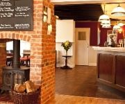
The Marsham Arms Inn
Holiday Inn NORWICH CITY
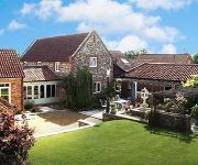
Woodman's Farm
Mercure Norwich
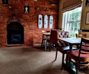
The Plough Inn
Holiday Inn NORWICH - NORTH
Hardwick House MAX Serviced Apartments Norwich
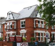
Stracey Hotel
The William IV
Riverside Hotel Bed and Breakfast
Videos from this area
These are videos related to the place based on their proximity to this place.
Norwich to Thetford (Norwich to Stansted part 1 of 3)
SEE MY MOTORHOME GROUP ON FACEBOOK : https://www.facebook.com/motorhomefulltime The first part of a journey to Norwich to Stansted on 3 March 2011 takes me to Thetford. I am travelling to.
Walk along the River Wensum in Norwich part two of four
SEE MY SITE ON FACEBOOK : https://www.facebook.com/historysite Starting at the former location of Norwich City Station, I continue with my walk along the River Wensum in Norwich. The river...
cycle ride near Norwich.wmv
A bike ride Norwich UK. It's easy to escape to the country as Norwich is surrounded by farmland and ex-railway lines. Norwich is a metropolis in Norfolk and when we're not eating cabbages...
Football Competition 2011.mpg
Highlights from the 2011 5-a-side football competition with teams from the School of Technology. Held at the Football Development Centre, Bowthorpe, Norwich.
On Board First Norfolk Plaxton President
Ex London (Epping) in Norwich on route 28 from Thorpe Marriott to Norwich City Center.
Working the Land: Farm Life in East Anglia Farmworker Interviews DVD clip
Working the Land: Full DVD available online at http://www.timereel.co.uk/products/working-the-land-farm-life-in-east-anglia/ East Anglia, 1920s: the farm is a major employer. The horse ploughs...
Tractor pulling at the Starting Handle Club summer show, Marsham.
The Peak Vale tractor pulling demonstration at the 2013 Starting Handle Club summer show in Marsham, Norfolk. This was the first tractor pulling event in the county for 27 years.
First Norwich Volvo B7TL Plaxton President 32202 LT52 WTG
Boarded a groany President from Drayton on the route 28 after we had got off the lovely Streetlite to go back into city so sorry for lack of movement in this video but I thought I'd share the...
My New Running Trainers!
Follow me: www.thetlady.wordpress.com facebook.com/TheTLady1 twitter.com/The_TLady instagram: thetlady So guys, I have been very practical this year and asked for new Running Trainers as a...
Videos provided by Youtube are under the copyright of their owners.
Attractions and noteworthy things
Distances are based on the centre of the city/town and sightseeing location. This list contains brief abstracts about monuments, holiday activities, national parcs, museums, organisations and more from the area as well as interesting facts about the region itself. Where available, you'll find the corresponding homepage. Otherwise the related wikipedia article.
Norwich International Airport
Norwich International Airport, also known as Norwich Airport, is an airport in the City of Norwich within Norfolk, England 2.8 NM north of the city centre and on the edge of the city's suburbs at Hellesdon. As of 2012 Norwich airport is 30th busiest airport in the UK. Along with a long history of flights to Amsterdam Airport Schiphol via KLM Cityhopper, it offers flights to various destinations in the United Kingdom and Europe.
City of Norwich Aviation Museum
The City of Norwich Aviation Museum is a volunteer run museum and charitable trust dedicated to the preservation of the aviation history of the county of Norfolk, England. The museum is located on the northern edge of Norwich International Airport and is reached by road through the village of Horsham St. Faith. The museum is open daily except Mondays during the summer months and on Wednesdays, some Fridays, Saturdays and Sundays through the winter. A small charge is made for admission.
RAF Horsham St Faith
RAF Horsham St Faith was a Royal Air Force station near Norwich, Norfolk, England from 1939 to 1963. It was then developed as Norwich International Airport.
Drayton railway station
Drayton railway station is a former station in Norfolk, England. Constructed by the Midland and Great Northern Joint Railway in the 1880s, on the line between Melton Constable and Norwich, it was closed to passengers in 1959. It served the settlement of Drayton now on the outskirts of Norwich. The site is now home to an industrial site, Many of the buildings follow the old footings of the platform and other buildings. Many of the railway bridges in this area have been filled in or removed.
Manor Park, Horsford
Manor Park is a cricket ground in Horsford, Norfolk. The ground is the main home ground of Norfolk County Cricket Club. The first recorded match on the ground was in 1986, when Norfolk played their first MCCA Knockout Trophy match on the ground against Suffolk. The same season they played another MCCA Knockout Trophy match against Oxfordshire at the ground.


