Safety Score: 3,0 of 5.0 based on data from 9 authorites. Meaning we advice caution when travelling to United Kingdom.
Travel warnings are updated daily. Source: Travel Warning United Kingdom. Last Update: 2024-08-13 08:21:03
Delve into Frettenham
Frettenham in Norfolk (England) is a town located in United Kingdom about 103 mi (or 166 km) north-east of London, the country's capital town.
Time in Frettenham is now 11:51 AM (Friday). The local timezone is named Europe / London with an UTC offset of zero hours. We know of 10 airports closer to Frettenham, of which 4 are larger airports. The closest airport in United Kingdom is Norwich International Airport in a distance of 3 mi (or 5 km), South-West. Besides the airports, there are other travel options available (check left side).
There are several Unesco world heritage sites nearby. The closest heritage site in United Kingdom is Royal Botanic Gardens, Kew in a distance of 95 mi (or 153 km), South-West. Also, if you like the game of golf, there is an option about 9 mi (or 15 km). away. In need of a room? We compiled a list of available hotels close to the map centre further down the page.
Since you are here already, you might want to pay a visit to some of the following locations: Norwich, Brundall, Surlingham, Rockland Saint Mary and Hellington. To further explore this place, just scroll down and browse the available info.
Local weather forecast
Todays Local Weather Conditions & Forecast: 9°C / 49 °F
| Morning Temperature | 7°C / 44 °F |
| Evening Temperature | 7°C / 45 °F |
| Night Temperature | 5°C / 42 °F |
| Chance of rainfall | 0% |
| Air Humidity | 75% |
| Air Pressure | 1027 hPa |
| Wind Speed | Gentle Breeze with 7 km/h (4 mph) from North-East |
| Cloud Conditions | Overcast clouds, covering 100% of sky |
| General Conditions | Overcast clouds |
Saturday, 16th of November 2024
10°C (49 °F)
7°C (44 °F)
Broken clouds, gentle breeze.
Sunday, 17th of November 2024
8°C (46 °F)
3°C (37 °F)
Light rain, moderate breeze, broken clouds.
Monday, 18th of November 2024
5°C (41 °F)
0°C (33 °F)
Snow, moderate breeze, scattered clouds.
Hotels and Places to Stay
Norfolk Mead
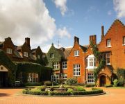
Sprowston Manor Marriott Hotel & Country Club
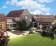
Woodman's Farm
The Plough Inn
Holiday Inn NORWICH - NORTH
Mercure Norwich
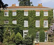
The Old Rectory
The Old Rectory Norwich
TRAVELODGE NORWICH CENTRAL
OAKLANDS HOTEL AND COURT
Videos from this area
These are videos related to the place based on their proximity to this place.
Coltishall April 1988
Ruth Church - Christopher Chris Church - Jill Larkman Church - Sinead Taylor - Suzanne Allsopp - Diane Freezer - Marie Shingfield - Jessica Chaney.
From Norwich to Coltishall
SEE MY TRAVEL PAGE ON FACEBOOK : https://www.facebook.com/motorhomefulltime Coltishall is a village located just to the north of Norwich and this is the route to get to it. Coltishall, located...
Norfolk Wedding in Coltishall at the Norfolk Mead
A Video showing some of the Stills from a Wedding I shot at the Norfolk Mead hotel near Coltishall. See more of my work at http://photographybystephenthorpe.com/
Wroxham Bridge West to East 2009
Starting the return journey from Wroxham on my second tour out. First was through Great Yarmouth to Norwich, second to Horning and Wroxham.
Norfolk Journeys (Spring 09)
Filmed during Spring 09 in various locations, primarily Ranworth and the area between Newton St Faith and Horstead.
Horstead mill jackass kayaking
Alex Maine, Martin Klinge and Jez Strachan paddle at horstead mill in the summer of 2012!
Winter Wonderland at Hillside
A short film showing some of our rescued animals being cared for on a snowy day at Hillside. To help Hillside or for more info, please see: http://www.hillside.org.uk/HillsideDD.htm Filmed...
Horstead playboating practice
The usual wednesday night practice with an uncommon face making an appearance!
GoPro HD Hero mounted on, in and under a car.
Part of a test of the GoPro HD hero camera and camcorder, it was attached to various points of my car to film its journey. The resulting video is made up of several clips edited together,...
GoPro HD Hero on ride to work
Part of a test of the GoPro HD hero camera and camcorder, it was attached to various points of my bike to film the journey to work. The resulting video is made up of several clips edited together,...
Videos provided by Youtube are under the copyright of their owners.
Attractions and noteworthy things
Distances are based on the centre of the city/town and sightseeing location. This list contains brief abstracts about monuments, holiday activities, national parcs, museums, organisations and more from the area as well as interesting facts about the region itself. Where available, you'll find the corresponding homepage. Otherwise the related wikipedia article.
Coltishall railway station
Coltishall railway station serves the town of Coltishall in Norfolk and is served by the
RAF Horsham St Faith
RAF Horsham St Faith was a Royal Air Force station near Norwich, Norfolk, England from 1939 to 1963. It was then developed as Norwich International Airport.
Horstead Hall
Horstead Hall was a country house in Norfolk that was demolished in the 1950s. The village of Horstead in the county of Norfolk is not short of country houses. Towards Norwich lie Horstead House and Heggatt Hall, while towards Buxton lies the Horstead Hall estate. The house lay in the middle of a substantial park. A seventeenth-century house stood here until 1835, when it was rebuilt in the Tudor style by Edward Harbord, 3rd Baron Suffield.
Little Hautbois
Little Hautbois is a small hamlet in Broadland, England, part of the parish of Lamas. The name is pronounced 'Hobbis', and can be seen thus spelled on a memorial on the outside of nearby Lamas Church. In the Middle Ages, the settlement of Great Hautbois was the head of the navigation on the river Bure, and it is thought Little Hautbois developed from that. The name is taken from that of the de Alto Bosco, or de Haut Bois family, who acquired these lands at the Norman Conquest.
Horstead with Stanninghall
Horstead with Stanninghall is a civil parish in the English county of Norfolk, consisting of the former parishes of Horstead and Stanninghall. It covers an area of 11.54 km and had a population of 1007 in 435 households as of the 2001 census. For the purposes of local government, it falls within the district of Broadland. There is a history of the parish, written by Percy Millican, bearing the descriptive title 'The History of Horstead and Stanninghall'.
Norwich Northern Distributor Road
The Norwich Northern Distributor Road (also known as the Norwich Northern bypass, the Norwich Northern Distributor Route and the NDR) is a proposed 8.7 mile dual-carriageway linking the A47 to the south east of the city to the proposed Rackheath Eco-town and to Norwich International Airport to the north of Norwich. It was given 'Programme Entry' status by the Department for Transport in December 2009 with estimated completion in 2015 at a cost of £90.7m.
Frettenham Windmill
Frettenham Mill is a Grade II listed tower mill at Frettenham, Norfolk, England which has been converted to residential accommodation.


