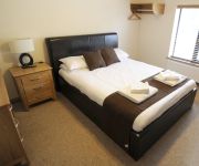
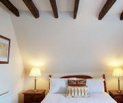
Safety Score: 3,0 of 5.0 based on data from 9 authorites. Meaning we advice caution when travelling to United Kingdom.
Travel warnings are updated daily. Source: Travel Warning United Kingdom. Last Update: 2024-08-13 08:21:03
Delve into Emneth
Emneth in Norfolk (England) with it's 2,257 habitants is a city located in United Kingdom about 80 mi (or 128 km) north of London, the country's capital town.
Current time in Emneth is now 09:35 AM (Friday). The local timezone is named Europe / London with an UTC offset of zero hours. We know of 11 airports closer to Emneth, of which 5 are larger airports. The closest airport in United Kingdom is RAF Marham in a distance of 14 mi (or 23 km), East. Besides the airports, there are other travel options available (check left side).
There are several Unesco world heritage sites nearby. The closest heritage site in United Kingdom is Derwent Valley Mills in a distance of 40 mi (or 65 km), North-West. Also, if you like playing golf, there are some options within driving distance. In need of a room? We compiled a list of available hotels close to the map centre further down the page.
Since you are here already, you might want to pay a visit to some of the following locations: Thorney, Eye, Newborough, Cambridge and Fulbourn. To further explore this place, just scroll down and browse the available info.
Local weather forecast
Todays Local Weather Conditions & Forecast: 9°C / 48 °F
| Morning Temperature | 5°C / 41 °F |
| Evening Temperature | 7°C / 45 °F |
| Night Temperature | 5°C / 42 °F |
| Chance of rainfall | 0% |
| Air Humidity | 75% |
| Air Pressure | 1027 hPa |
| Wind Speed | Gentle Breeze with 7 km/h (4 mph) from North-East |
| Cloud Conditions | Overcast clouds, covering 94% of sky |
| General Conditions | Overcast clouds |
Saturday, 16th of November 2024
9°C (49 °F)
7°C (44 °F)
Overcast clouds, gentle breeze.
Sunday, 17th of November 2024
8°C (47 °F)
4°C (38 °F)
Light rain, moderate breeze, overcast clouds.
Monday, 18th of November 2024
6°C (42 °F)
0°C (32 °F)
Snow, moderate breeze, broken clouds.
Hotels and Places to Stay
The Elm Tree Inn
The Rose & Crown
Videos from this area
These are videos related to the place based on their proximity to this place.
Wisbech and Fenland Museum
David Wright, curator of Wisbech and Fenland Museum talks about the museum and the important role played by Fenland District Council in maintaining its collections and exhibits. Visit Wisbech...
Test Advert for Wisbech Museum
This advert was created by Pacific Presences team members and colleagues from the Imperial War Museum Duxford and Stevenage Museum on a Share Museum's film production training day.
Wisbech Rainbow Savers
ShapeYourPlace Community Reporter interviews Terry, a volunteer with the Wisbech Rainbow Savers.
Royley U13s Rugby Team at Wisbech
Royston and Ely (aka "Royley") Combined U13s team at Wisbech 1st March 2009.
the little ranch.wisbech.cambs.quality carp
kids now in compition on how many caught.having great time. highly recommend the little ranch lake for small to large carp. a real eye opener.
Videos provided by Youtube are under the copyright of their owners.
Attractions and noteworthy things
Distances are based on the centre of the city/town and sightseeing location. This list contains brief abstracts about monuments, holiday activities, national parcs, museums, organisations and more from the area as well as interesting facts about the region itself. Where available, you'll find the corresponding homepage. Otherwise the related wikipedia article.
Wisbech Town F.C
Wisbech Town F.C. is an English football club currently based in Wisbech, Cambridgeshire. The club are currently members of the Eastern Counties League Premier Division and play at the Fenland Stadium.
Beaupré Hall
Beaupré Hall was a large 16th century house mainly of brick, which was built by the Beaupres in Outwell, Norfolk, England and enlarged by their successors the Bells. Like many of Britains's country houses it was demolished in the mid-20th century.
Wisbech and Upwell Tramway
The Wisbech and Upwell Tramway was a rural standard gauge tramway in East Anglia. It was built by the Great Eastern Railway between Wisbech, Cambridgeshire and Upwell, Norfolk to carry agricultural produce. Although called a tram, in many ways it more closely resembled a conventional railway line.
Elmbridge railway station (Upwell Tramway)
Elmbridge railway station was a stop on the Wisbech and Upwell Tramway. It was located on the outskirts of Wisbech, Cambridgeshire, though actually in the county of Norfolk being just across the border from Wisbech. It was opened in 1883 to serve nearby settlements and closed to passengers in 1927. The entire tramway line closed to goods in 1966 as part of the Beeching Axe. Former Services Preceding station Disused railways Following station Wisbech Upwell Tramway Boyces Bridge
Boyces Bridge railway station (Upwell Tramway)
Boyces Bridge railway station was a station in Norfolk on the Wisbech and Upwell Tramway commonly known as the Upwell Tramway. It was located north of Outwell. It was opened in the 1880s along with the rest of the line, and closed to passengers in 1927 and goods in 1966. Former Services Preceding station Disused railways Following station Elmbridge Upwell Tramway Outwell Basin
Outwell Village railway station (Upwell Tramway)
Outwell Village railway station was a station in Outwell, Norfolk on the Wisbech and Upwell Tramway. It opened in 1883 and closed to passengers in 1927. Goods services ran on a while longer, before finishing in 1966. The line provided inspiration for Toby the Tram Engine. Former Services
Outwell Basin railway station (Upwell Tramway)
Outwell Basin railway station was a stop on the Wisbech and Upwell Tramway in Outwell, Norfolk. It opened in the 19th century, carrying passenger and goods traffic from nearby farms. It was closed to passengers in 1927, and fully to goods in 1966. The line it once stood on is now a grassy track. Former Services Preceding station Disused railways Following station Boyces Bridge Upwell Tramway Outwell Village
Collett's Bridge
Collett's Bridge is a village in Cambridgeshire, England.


