Safety Score: 3,0 of 5.0 based on data from 9 authorites. Meaning we advice caution when travelling to United Kingdom.
Travel warnings are updated daily. Source: Travel Warning United Kingdom. Last Update: 2024-08-13 08:21:03
Explore Dickleburgh
Dickleburgh in Norfolk (England) with it's 1,096 inhabitants is a city in United Kingdom about 83 mi (or 133 km) north-east of London, the country's capital.
Local time in Dickleburgh is now 11:44 AM (Friday). The local timezone is named Europe / London with an UTC offset of zero hours. We know of 10 airports in the vicinity of Dickleburgh, of which 4 are larger airports. The closest airport in United Kingdom is RAF Honington in a distance of 18 mi (or 29 km), West. Besides the airports, there are other travel options available (check left side).
There are several Unesco world heritage sites nearby. The closest heritage site in United Kingdom is Royal Botanic Gardens, Kew in a distance of 74 mi (or 119 km), South-West. Also, if you like golfing, there are multiple options in driving distance. If you need a place to sleep, we compiled a list of available hotels close to the map centre further down the page.
Depending on your travel schedule, you might want to pay a visit to some of the following locations: Norwich, Snetterton, Shropham, Hellington and Rockland Saint Mary. To further explore this place, just scroll down and browse the available info.
Local weather forecast
Todays Local Weather Conditions & Forecast: 9°C / 48 °F
| Morning Temperature | 7°C / 44 °F |
| Evening Temperature | 8°C / 46 °F |
| Night Temperature | 6°C / 42 °F |
| Chance of rainfall | 0% |
| Air Humidity | 77% |
| Air Pressure | 1027 hPa |
| Wind Speed | Gentle Breeze with 6 km/h (4 mph) from North-East |
| Cloud Conditions | Overcast clouds, covering 100% of sky |
| General Conditions | Overcast clouds |
Saturday, 16th of November 2024
8°C (46 °F)
7°C (45 °F)
Broken clouds, gentle breeze.
Sunday, 17th of November 2024
7°C (45 °F)
4°C (39 °F)
Light rain, moderate breeze, overcast clouds.
Monday, 18th of November 2024
5°C (41 °F)
0°C (32 °F)
Snow, moderate breeze, broken clouds.
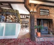
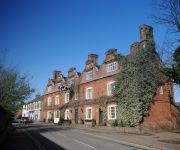
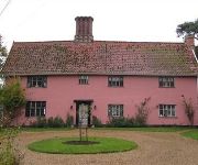
Hotels and Places to Stay
Red House Farm
Dickleburgh Crown
The Scole Inn
Best Western Brome Grange
Abbey Farm
Videos from this area
These are videos related to the place based on their proximity to this place.
Class 90005 Arriving at Diss Station at 20:33 on 5th May 2014 (ALL ABELLIO COACHES)
ALL COACHES HAD NEW LIVERY ABELLIO.
50050 at Diss 19th September 1999
On 19th September Anglia Railways hired 50050 Fearles to Work From Norwich to Liverpool Street and back on one of it's service trains. It is seen on the return run at Diss. As it leaves, an...
Don' Diss diss Diss!
En route to Great Yarmouth, we stop at the quintessentially Anglian town of Diss.
Holli Atkins and Lea Buttler- where ever you will go Diss High Leavers Day 2012 :)
sorry its a bit blury but i think aslond as you can hear it, it dont matter to much :L.
Diss ACF Drill
I got bored on night at detachment and decided to lead a few of my cadets in some fancy drill moves. this isnt the best recording we have but this one is the only one that uploads XD.
Dorset Police
Dorset Police DUE TO THE RECENT UNAUTHORIZED TAMPERING AND REMOVAL OF OUR SITE, WHICH WE HAVE NOW REGAINED CONTROL. OUR WEB SITE IS FUNDED ON BEHALF OF THE ...
Videos provided by Youtube are under the copyright of their owners.
Attractions and noteworthy things
Distances are based on the centre of the city/town and sightseeing location. This list contains brief abstracts about monuments, holiday activities, national parcs, museums, organisations and more from the area as well as interesting facts about the region itself. Where available, you'll find the corresponding homepage. Otherwise the related wikipedia article.
River Dove, Suffolk
The River Dove is a river in the county of Suffolk. It is a tributary of the River Waveney starting near Horham going through Eye to the Waveney.
Burston railway station
Burston railway station was on the Diss to Norwich line and served the village of Burston. Only the station building remains; very little evidence of the platforms exist. The railway line still passes through it on a level crossing. The original signal box is no longer there. A cottage between the railway line and the station master's house also no longer exists. There are no longer any sidings on the site .
Pulham Market railway station
Pelham Market was a railway station on the Waveney Valley Line in Norfolk, England. It was closed as part of the Beeching Axe which saw many rural services heavily curtailed. Former Services Preceding station Disused railways Following station Tivetshall Great Eastern RailwayWaveney Valley Line Pulham St Mary
St George's Church, Shimpling
St George's Church, Shimpling, is a redundant Anglican church in the village of Shimpling, Norfolk, England. It has been designated by English Heritage as a Grade I listed building, and is under the care of the Churches Conservation Trust. It stands at the end of a short lane to the south of the village.


