Safety Score: 3,0 of 5.0 based on data from 9 authorites. Meaning we advice caution when travelling to United Kingdom.
Travel warnings are updated daily. Source: Travel Warning United Kingdom. Last Update: 2024-08-13 08:21:03
Discover Caistor Saint Edmunds
Caistor Saint Edmunds in Norfolk (England) is a city in United Kingdom about 96 mi (or 155 km) north-east of London, the country's capital city.
Local time in Caistor Saint Edmunds is now 11:53 AM (Friday). The local timezone is named Europe / London with an UTC offset of zero hours. We know of 10 airports in the vicinity of Caistor Saint Edmunds, of which 4 are larger airports. The closest airport in United Kingdom is Norwich International Airport in a distance of 6 mi (or 10 km), North. Besides the airports, there are other travel options available (check left side).
There are several Unesco world heritage sites nearby. The closest heritage site in United Kingdom is Royal Botanic Gardens, Kew in a distance of 88 mi (or 141 km), South-West. Also, if you like golfing, there are a few options in driving distance. Looking for a place to stay? we compiled a list of available hotels close to the map centre further down the page.
When in this area, you might want to pay a visit to some of the following locations: Norwich, Rockland Saint Mary, Hellington, Surlingham and Brundall. To further explore this place, just scroll down and browse the available info.
Local weather forecast
Todays Local Weather Conditions & Forecast: 9°C / 49 °F
| Morning Temperature | 7°C / 44 °F |
| Evening Temperature | 7°C / 45 °F |
| Night Temperature | 5°C / 42 °F |
| Chance of rainfall | 0% |
| Air Humidity | 75% |
| Air Pressure | 1027 hPa |
| Wind Speed | Gentle Breeze with 7 km/h (4 mph) from North-East |
| Cloud Conditions | Overcast clouds, covering 100% of sky |
| General Conditions | Overcast clouds |
Saturday, 16th of November 2024
10°C (49 °F)
7°C (44 °F)
Broken clouds, gentle breeze.
Sunday, 17th of November 2024
8°C (46 °F)
3°C (37 °F)
Light rain, moderate breeze, broken clouds.
Monday, 18th of November 2024
5°C (41 °F)
0°C (33 °F)
Snow, moderate breeze, scattered clouds.
Hotels and Places to Stay
DUNSTON HALL - QHOTELS
Holiday Inn NORWICH CITY
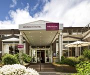
Mercure Norwich
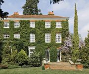
The Old Rectory Norwich
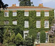
The Old Rectory
Holiday Inn NORWICH
Holiday Inn Express NORWICH
OAKLANDS HOTEL AND COURT
The William IV
Riverside Hotel Bed and Breakfast
Videos from this area
These are videos related to the place based on their proximity to this place.
NORWICH BUSES JULY 2010
a trailer for www.pmpfilms.com see website for shopping, links and list, the world's largest range of transport hobby film.
Norwich City FC - Under 18s FA Youth Cup Semi Final 2nd Leg - Penalties
FA Youth Cup semi-final, second leg: Norwich City U18s 0, Nottingham Forest U18s 1 (1-1 on agg, City win 5-4 on penalties) from behind the goal in the Barclay. (apologies for the sound)
HUET and EBS Training. Norwich, England. February 2009
HUET and EBS Training. Norwich, England. February 2009. Training was done over 3 days. HUET and EBS Training, fire fighting, first aid, sea survival.
1985 Milk Cup Semi-Final Norwich 2:0 Ipswich
6th March 1985 - the night Norwich City beat Ipswich Town to qualify for the Milk Cup Final. In the first leg at Portman Road, Norwich had been battered but come away with a 1-0 defeat. There...
1984 FA Cup 3rd Round Replay Norwich City v Aston Villa - Part 1
After a 1-1 draw at Villa Park, Aston Villa traveled to Carrow Road for the Wednesday night replay.
Norwich City 1 Manchester City 6 Teams Coming Out at Carrow Road HD
Teams coming out at Carrow Road then Man City running over to the away fans side.
Feb '83 FA Cup 4th Rnd Replay Norwich City vs Coventry City - Part 1
This is an FA Cup 4th Round Replay between Norwich City and Coventry City at Carrow Road. Having beaten Swansea City 2-1 an home in the 3rd Round, Norwich were drawn against one of their ...
Mustard Chicken Recipe + VIP Tickets Norwich City Football Club
Please visit my website, www.healthylifestyle.recipes for a full list of ingredients. Let me know what you think, and please comment below. Don't forget to subscribe! Like and Share this video...
FA Cup 3rd Round Norwich City 1-0 Birmingham - Jan 1985
The third and final replay between Norwich City and Birmingham saw Norwich go through with a 1-0 win to earn an away tie with West Ham.
Videos provided by Youtube are under the copyright of their owners.
Attractions and noteworthy things
Distances are based on the centre of the city/town and sightseeing location. This list contains brief abstracts about monuments, holiday activities, national parcs, museums, organisations and more from the area as well as interesting facts about the region itself. Where available, you'll find the corresponding homepage. Otherwise the related wikipedia article.
River Tas
The River Tas is a river which flows northwards through South Norfolk in England - towards Norwich. The area is named the Tas Valley after the river. The origin of the name of the river is uncertain - it may have taken it from the village of Tasburgh or vice versa. Tributaries which have their sources at Hempnall and Carleton Rode converge at Tasburgh. The river then flows on through Newton Flotman and Smockmill Common.
City College Norwich
City College Norwich (CCN) is a college of further and higher education which is located on Ipswich Road, in Norwich, Norfolk, England. The college has a second site at St Andrews House in Norwich city centre, which is also home to the National Skills Academy for Financial Services. Founded in 1891, City College Norwich has been situated in its current location since 1953. It is one of the largest colleges in the country.
Venta Icenorum
Venta Icenorum, probably meaning "Market Town of the Iceni", located at modern-day Caistor St Edmund in the English county of Norfolk, was the civitas or capital of the Iceni tribe, who inhabited the flatlands and marshes of that county and who revolted against Roman rule under their queen Boudica (or Boadicea) in the winter of 61 CE. The town, which is mentioned in the Ravenna Cosmography, and the Antonine Itinerary, was a settlement near the village of Caistor St.
Caistor St. Edmund Chalk Pit
Caistor St. Edmund Chalk Pit is a 23.8 hectare geological Site of Special Scientific Interest in Norfolk, England, notified in 1968.
Virgin Money
Virgin Money plc is a UK-based bank and financial services company owned by the Virgin Group and founded by Sir Richard Branson in March 1995. It was originally known as Virgin Direct, and pioneered index tracking by launching a value Personal Equity Plan into the market. In the 2000s Virgin Money expanded its operations around the world. In 2010, the company received a banking licence through the purchase of the Church House Trust, and announced plans to expand further into the sector.
County Ground, Lakenham
The County Ground in Lakenham, Norwich, Norfolk was a cricket ground for over two hundred years, hosting both first-class and List A cricket. Five first-class games, all involving touring international sides, were played here between 1912 and 1986, and 13 List A matches were staged between 1969 and 1998. The County Ground's most regular users, however, were Norfolk County Cricket Club, who played over 400 Minor Counties Championship games at the venue.
Trowse railway station
Trowse was a station on the Great Eastern Main Line just south of Norwich. It was opened around the same time as Norwich Thorpe, and was intended to provide a short commute from the outer suburbs of Norwich. It was closed during the Second World War as a cost-cutting measure. It was re-opened for a brief spell in 1986 when Norwich was closed for electrification works and it served as the line's northern terminus. When the main station re-opened, Trowse shut again.
Carrow Abbey
Carrow Abbey is a former Benedictine priory in Bracondale, northeast Norwich, England. The village on the site was previously called Carrow (there are many alternate spellings) and gives its name to Carrow Road, the football ground of Norwich F.C. , located just metres to the north. Granted by charter of King Stephen, it was founded ca. 1146, and became a Grade I listed building in 1954.


