Safety Score: 3,0 of 5.0 based on data from 9 authorites. Meaning we advice caution when travelling to United Kingdom.
Travel warnings are updated daily. Source: Travel Warning United Kingdom. Last Update: 2024-08-13 08:21:03
Touring Childwall
Childwall in Liverpool (England) is a town located in United Kingdom about 175 mi (or 282 km) north-west of London, the country's capital place.
Time in Childwall is now 02:07 PM (Thursday). The local timezone is named Europe / London with an UTC offset of zero hours. We know of 8 airports nearby Childwall, of which 4 are larger airports. The closest airport in United Kingdom is Liverpool John Lennon Airport in a distance of 5 mi (or 8 km), South-East. Besides the airports, there are other travel options available (check left side).
There are several Unesco world heritage sites nearby. The closest heritage site in United Kingdom is Pontcysyllte Aqueduct and Canal in a distance of 30 mi (or 47 km), South. Also, if you like the game of golf, there are several options within driving distance. Need some hints on where to stay? We compiled a list of available hotels close to the map centre further down the page.
Being here already, you might want to pay a visit to some of the following locations: Knowsley, Liverpool, Melling, Prescot and Whiston. To further explore this place, just scroll down and browse the available info.
Local weather forecast
Todays Local Weather Conditions & Forecast: 4°C / 39 °F
| Morning Temperature | 2°C / 35 °F |
| Evening Temperature | 4°C / 40 °F |
| Night Temperature | 5°C / 41 °F |
| Chance of rainfall | 6% |
| Air Humidity | 60% |
| Air Pressure | 1000 hPa |
| Wind Speed | Fresh Breeze with 13 km/h (8 mph) from South-East |
| Cloud Conditions | Overcast clouds, covering 95% of sky |
| General Conditions | Rain and snow |
Friday, 22nd of November 2024
6°C (43 °F)
4°C (39 °F)
Moderate rain, fresh breeze, overcast clouds.
Saturday, 23rd of November 2024
5°C (42 °F)
13°C (56 °F)
Moderate rain, strong breeze, overcast clouds.
Sunday, 24th of November 2024
12°C (54 °F)
11°C (52 °F)
Moderate rain, moderate breeze, overcast clouds.
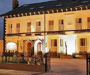
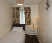
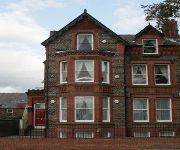
Hotels and Places to Stay
Crowne Plaza LIVERPOOL JOHN LENNON AIRPORT
Beech Mount
Suites Knowsley
Hampton by Hilton Liverpool-John Lennon Airport
JCT.4 Holiday Inn Express LIVERPOOL - KNOWSLEY M57
Travelodge Liverpool John Lennon Airport
Arinza Apartment Kingsley Court
Sheil Suites
Castle Lodge Guest House
Grove Suites
Videos from this area
These are videos related to the place based on their proximity to this place.
Building the National Wildflower Centre
A very brief video showing some of the work involved when the 'Visitor Centre' buildings of the National Wildflower Centre were built in 1999. Part of the ce...
Visit to 'Strawberry Field(s) Forever' - Liverpool
A memory of our trip to Liverpool. Here's our own videoversion of the greatest Beatlessong. Don't miss the end of it...
21st Anniversery Trans Pennine Trail
21st Anniversary of the Trans Pennine Trail At 12.30 on Sunday 13th June 2010 Court Hey Park, Roby. To celebrate this important milestone a Baton will be carried across the whole length of...
Woodpecker Sculpture
Andy Burgess was engaged by the Friends to create a Woodpecker Sculpture feature for our park. We think he did a wonderful job as you will see. Local schoolchildren from St Gabriel's School...
The National Wildflower Centre: Award winning venue for conferences and visitors.
Set in a tranquil Victorian park and only minutes from the M62 motorway, the National Wildflower Centre is a beautiful visitor attraction with a difference. ...
Cardio Walk in Court Hey Park 1
Court Hey Park is situated in Roby, on the border between Liverpool and Knowsley. The Cardiac Rehab Walking club was established in September 2005. The walk was set up by Broad Green Hospital ...
Cricket match at Court Hey Park 1997
Whitefield Cricket Club playing a match on a sunny Sunday afternoon in Court Hey Park. The video was filmed in 1997.
Step Out with the Stroke Association
The Stroke Association Step Out Charity walk around Court Hey Park in Knowsley on Monday 21st May was a great success. The group joined members of the regular walking for health group and ...
Richard Scott talks about Creative Conservation
Wondered what Creative Conservation means? Richard Scott, Senior project officer at Landlife at the National Wildflower Centre explains how people can make a difference by giving nature a helping...
Videos provided by Youtube are under the copyright of their owners.
Attractions and noteworthy things
Distances are based on the centre of the city/town and sightseeing location. This list contains brief abstracts about monuments, holiday activities, national parcs, museums, organisations and more from the area as well as interesting facts about the region itself. Where available, you'll find the corresponding homepage. Otherwise the related wikipedia article.
Strawberry Field
Strawberry Field was a Salvation Army children's home in Woolton, a suburb of Liverpool, England. The earliest reference to 'Strawberry Field' dates from 1870. In 1912 it was transferred to a wealthy merchant whose widow sold the estate to the Salvation Army in 1934. It opened on 7 July 1936. The original house was later demolished and replaced with a smaller purpose-built home for children which opened in the early 1970s. This home provided three family units, each accommodating 12 children.
Calderstones Park
Calderstones Park is a public park in Liverpool, Merseyside, United Kingdom. The 94 acres park is mainly a family park. Within it there are a variety of different attractions including a playground, a botanical garden and places of historical interest. Calderstones botanical garden contains almost 4000 species of plants brought from all over the world by merchants and other travellers.
Church of All Hallows, Allerton
The Church of All Hallows, Allerton is in Allerton, Liverpool, Merseyside, England. It has been designated by English Heritage as a Grade I listed building, and an active Anglican parish church in the diocese of Liverpool, the archdeaconry of Liverpool and the deanery of Liverpool South - Childwall.
All Saints' Church, Childwall
All Saints' Church, Childwall is in Childwall, Liverpool, Merseyside, England. It is designated by English Heritage as a Grade I listed building, and is the only medieval church remaining in the Metropolitan borough of Liverpool. It is an active Anglican parish church in the diocese of Liverpool, the archdeaconry of Liverpool and the deanery of Liverpool South - Childwall.
Thingwall Hall
Thingwall Hall is a former stately home situated in the Knotty Ash district of Liverpool, England. The grade II listed building was built early in the 19th century and was originally set in 60 acres of grounds. It can upon occasion be mistaken for the nearby Thingwall House.
Calderstones House
Calderstones House, Calderstones Park, Liverpool was built in 1828 for Joseph Need Walker, a lead shot manufacturer. In 1875 the house and estate were acquired by Charles McIver, founder of Cunard Line, for £52,000. It is a Grade II Listed building. The House and Stables now house the Recreation and Open Spaces Departments of the Liverpool City Council. However in January 2012 the council placed the house on the market.
Broadgreen Hospital
Broadgreen Hospital is a teaching hospital located in the suburb of Broadgreen; in the city of Liverpool, England. Alongside the Royal Liverpool University Hospital and Liverpool University Dental Hospital in the city centre; the hospital belongs to and operates on behalf of the Royal Liverpool and Broadgreen University Hospitals NHS Trust. The hospital shares its buildings with and adjoins other NHS hospital trusts on the same site.
Calderstones School
Calderstones School is an English comprehensive school and specialist science college, located opposite Calderstones Park on Harthill Road in the Liverpool suburb of Allerton. The school was founded in 1921 as Quarry Bank High School and its first intake of 225 pupils was on 11 January 1922. The first headmaster of the school was R.F. Bailey (an old Etonian). He formed the school on the principles of public school houses. Subsequently, the first year boys' house was named Bailey.
Broad Green railway station
Broad Green railway station is situated in the Broadgreen district of Liverpool, England. Along with some other stations on the same line, it is the joint oldest used railway station site in the world being a part of the original 1830 Liverpool and Manchester passenger railway. However, the current station buildings date from the 1970s. The station is located very close to junction 4 of the M62 motorway but is not a "parkway" or "interchange" station.
Liverpool Mossley Hill (UK Parliament constituency)
Liverpool Mossley Hill was a parliamentary constituency centred on the Mossley Hill suburb of Liverpool. It returned one Member of Parliament (MP) to the House of Commons of the Parliament of the United Kingdom, elected by the first-past-the-post voting system.
Wavertree Windmill
First recorded in 1452, the Wavertree windmill was one of only four 'King's Mills' in Liverpool, England. For nearly 200 years it was the property of the crown, until in 1639 Charles I granted it to Lord Strange, a son of Lord Derby. By the 18th century the ownership of the mill had passed to Bamber Gascoyne, tenant of Childwall Hall. It then passed to the Marquess of Salisbury and finally was leased by Colonel James Bourne of Heathfield. The mill was wrecked in a storm in 1898.
Jet of Iada
Jet of Iada aka Jet (21 July 1942–18 October 1949) was an Alsatian, who assisted in the rescue of 150 people trapped under blitzed buildings. He was a pedigree dog born in Liverpool, and served with the Civil Defence Services of London. He was awarded both the Dickin Medal and the RSPCA's Medallion of Valor for his rescue efforts.


