Safety Score: 3,0 of 5.0 based on data from 9 authorites. Meaning we advice caution when travelling to United Kingdom.
Travel warnings are updated daily. Source: Travel Warning United Kingdom. Last Update: 2024-08-13 08:21:03
Discover Woolsthorpe by Colsterworth
Woolsthorpe by Colsterworth in Lincolnshire (England) is a town in United Kingdom about 92 mi (or 149 km) north of London, the country's capital city.
Current time in Woolsthorpe by Colsterworth is now 12:54 PM (Friday). The local timezone is named Europe / London with an UTC offset of zero hours. We know of 12 airports near Woolsthorpe by Colsterworth, of which 5 are larger airports. The closest airport in United Kingdom is RAF Cottesmore in a distance of 5 mi (or 8 km), South. Besides the airports, there are other travel options available (check left side).
There are several Unesco world heritage sites nearby. The closest heritage site in United Kingdom is Derwent Valley Mills in a distance of 16 mi (or 26 km), North. Also, if you like playing golf, there are a few options in driving distance. Looking for a place to stay? we compiled a list of available hotels close to the map centre further down the page.
When in this area, you might want to pay a visit to some of the following locations: Greetham, Market Overton, Clipsham, Cottesmore and Exton. To further explore this place, just scroll down and browse the available info.
Local weather forecast
Todays Local Weather Conditions & Forecast: 9°C / 47 °F
| Morning Temperature | 5°C / 41 °F |
| Evening Temperature | 6°C / 44 °F |
| Night Temperature | 6°C / 42 °F |
| Chance of rainfall | 0% |
| Air Humidity | 77% |
| Air Pressure | 1027 hPa |
| Wind Speed | Gentle Breeze with 7 km/h (4 mph) from North-East |
| Cloud Conditions | Overcast clouds, covering 100% of sky |
| General Conditions | Overcast clouds |
Saturday, 16th of November 2024
10°C (50 °F)
6°C (44 °F)
Overcast clouds, gentle breeze.
Sunday, 17th of November 2024
6°C (44 °F)
4°C (38 °F)
Light rain, moderate breeze, overcast clouds.
Monday, 18th of November 2024
5°C (41 °F)
-0°C (32 °F)
Rain and snow, moderate breeze, overcast clouds.
Hotels and Places to Stay
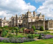
Stoke Rochford Hall
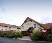
TRAVELODGE GRANTHAM COLSTERWORTH
TRAVELODGE GRANTHAM SOUTH WITHAM
Grantham
Videos from this area
These are videos related to the place based on their proximity to this place.
Video Postcard. CLIPSHAM. Meadow and Field - pc33.
Clipsham, Rutland, U.K. A field of blue flowers with a meadow edge of wild grass, Rosebay Willowherb and Buddleia. July 16th. 2007. The village of Clipsham is to the north of Rutland about...
Clipsham Yew Avenue
Clipsham is a small village in the county of Rutland in the East Midlands of England. It is in the northeast of Rutland, close to the county boundary with Lincolnshire. The topiary Yew Tree...
Watch out for black ice, while cycling!!
Lucky I noticed this black ice, while out cycling or I would have been off my bike. Vlog filmed under the ECML on Burton Lane, near Burton Coggles, Lincolnshire.
Witham SV Military Vehicle Auction / Tender Jan 2014
Witham SV Military Vehicle Auction / Tender Jan 2014 Usual selection of vehicle ... Good and Bad ! The Seaking Helicopters are still there. Unusual CVRT Sturgeons 6 Off £7500 no gearboxes...
Foden 6x6 Heavy Recovery Ex Military at UK Auction
Foden 6x6 Heavy Recovery Ex Military at UK Auction Seen at Witham Specialist Vehicles January 2014 Tender - Guide Price £15000.
The Onoband
The Onoband performing at Harlaxton in 2007. The function was a Rotary fund raiser for for Hampton Village is Sri Lanka. A new village for Tsunami victims. The band was formed by three Rotarians...
Videos provided by Youtube are under the copyright of their owners.
Attractions and noteworthy things
Distances are based on the centre of the city/town and sightseeing location. This list contains brief abstracts about monuments, holiday activities, national parcs, museums, organisations and more from the area as well as interesting facts about the region itself. Where available, you'll find the corresponding homepage. Otherwise the related wikipedia article.
Woolsthorpe Manor
Woolsthorpe Manor in Woolsthorpe-by-Colsterworth, near Grantham, Lincolnshire, England, was the birthplace of Sir Isaac Newton on 25 December 1642. At that time it was a yeoman's farmstead, principally rearing sheep (hence the wool reference in the name — thorpe comes from a Viking word meaning farmstead). Newton returned here when Cambridge University closed due to the plague, and here he performed many of his most famous experiments, most notably his work on light and optics.
A151 road
The A151 road is relatively minor part of the British road system. It lies entirely in the county of Lincolnshire, England. Its western end lies at coordinates {{#invoke:Coordinates|coord}}{{#coordinates:52|48.1892|N|0|36.5179|W|region:GB|| | |name=A151 road, western end }} otherwise, grid reference SK938238. This article attempts to deal with its several aspects by treating some separately, before integrating them with the others into an overall picture, sequentially from its western end.
RAF North Witham
RAF North Witham is a former World War II airfield in Lincolnshire, England. The airfield is located in Twyford Wood, approximately 19 miles east-southeast of Cotgrave; about 104 miles north-northwest of London Opened in 1943, it was used by both the Royal Air Force and United States Army Air Forces. During the war it was used primarily as a transport airfield. After the war it was closed in late 1945.
Grantham Rural District
Grantham was a rural district in Lincolnshire, Parts of Kesteven from 1894 to 1931. It was created by the Local Government Act 1894 based on the Grantham rural sanitary district, the Leicestershire part of which went to form the Belvoir Rural District. In 1931, under a County Review Order, it was abolished, with nealy all of its area going to the West Kesteven Rural District, except the parish of Haceby, which became part of the East Kesteven Rural District.
Stainby railway station
Stainby railway station was a station in Stainby, Lincolnshire. It was on a small, single-stop branch from Great Ponton which connected it to the Main Line and trains from the nearby town of Grantham.


