Safety Score: 3,0 of 5.0 based on data from 9 authorites. Meaning we advice caution when travelling to United Kingdom.
Travel warnings are updated daily. Source: Travel Warning United Kingdom. Last Update: 2024-08-13 08:21:03
Delve into Frithville
Frithville in Lincolnshire (England) with it's 288 habitants is a town located in United Kingdom about 106 mi (or 170 km) north of London, the country's capital town.
Time in Frithville is now 08:25 AM (Friday). The local timezone is named Europe / London with an UTC offset of zero hours. We know of 12 airports closer to Frithville, of which 5 are larger airports. The closest airport in United Kingdom is RAF Coningsby in a distance of 7 mi (or 11 km), North-West. Besides the airports, there are other travel options available (check left side).
There are several Unesco world heritage sites nearby. The closest heritage site in United Kingdom is Derwent Valley Mills in a distance of 20 mi (or 32 km), West. Also, if you like the game of golf, there is an option about 5 mi (or 9 km). away. In need of a room? We compiled a list of available hotels close to the map centre further down the page.
Since you are here already, you might want to pay a visit to some of the following locations: Thimbleby, Thorney, Wold Newton, Newborough and Eye. To further explore this place, just scroll down and browse the available info.
Local weather forecast
Todays Local Weather Conditions & Forecast: 9°C / 48 °F
| Morning Temperature | 5°C / 41 °F |
| Evening Temperature | 7°C / 44 °F |
| Night Temperature | 6°C / 43 °F |
| Chance of rainfall | 0% |
| Air Humidity | 75% |
| Air Pressure | 1027 hPa |
| Wind Speed | Gentle Breeze with 7 km/h (4 mph) from North-East |
| Cloud Conditions | Overcast clouds, covering 96% of sky |
| General Conditions | Overcast clouds |
Saturday, 16th of November 2024
10°C (51 °F)
7°C (44 °F)
Light rain, gentle breeze, overcast clouds.
Sunday, 17th of November 2024
7°C (45 °F)
2°C (36 °F)
Light rain, moderate breeze, overcast clouds.
Monday, 18th of November 2024
5°C (41 °F)
1°C (34 °F)
Snow, moderate breeze, broken clouds.
Hotels and Places to Stay
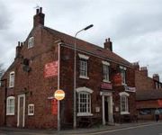
The Kings Arms
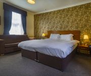
Best Western White Hart
Boston
Videos from this area
These are videos related to the place based on their proximity to this place.
A WARTIME VISIT TO BOSTON 1945
A WARTIME VISIT TO BOSTON Boston & District, Lincolnshire, UK. 1945 A wide range of events and pleasing, colourful scenes in the town, including most notably the railway station, the May Fair,...
Boston Pedestrian Zone
Book Study Tour: http://hembrow.eu/studytour http://hembrow.blogspot.com/2011/12/bostons-strange-pedestrian-zone.html Boston in Lincolnshire, the town which the US city is named after, is...
Boston Stump - St Botolph's Church Boston Lincs
St Botolph's Church also known as the Boston Stump, it has 365 steps to the top, the public are now only allowed to go up the first 209 but it's still worth the effort for the great views of...
Selfie home tour at Riverside, Boston
Let Hannah take you on a tour of the Montacue four-bedroom townhouse at Chestnut Homes' Riverside development in Boston, Lincolnshire.
Lincolnshire - Boston ALP (C06A1) - WN63OUS
20140413104838 Seen here been brought out to be photographed, quite an impressive appliance.
BOSTON JUBILEE PARADE 1977
BOSTON JUBILEE PARADE Boston, Lincolnshire, UK. 1977 Parade of decorated floats, seen from two different viewpoints, one at a street corner, the other in the Market Place. Accession no. 390...
junior GB Rowing trials at Boston Rowing Club 3
GB junior trials at Boston Rowing Club 21st 22nd February 2009.
Body Max - Fitness Classes in Boston, Lincolnshire
Pilates, Aerotone, Aerobics, Legs Bums & Tums and now Bokwa - www.bodymaxboston.co.uk Safe methods of exercise that benefits everyone, regardless of age, physical condition or level of fitness!...
Boston May Fair 2012 - the fun house :)
Boston May fair - me, courtney, melanie, vicky and samwel going round the fun house :P.
Videos provided by Youtube are under the copyright of their owners.
Attractions and noteworthy things
Distances are based on the centre of the city/town and sightseeing location. This list contains brief abstracts about monuments, holiday activities, national parcs, museums, organisations and more from the area as well as interesting facts about the region itself. Where available, you'll find the corresponding homepage. Otherwise the related wikipedia article.
Hilldyke, Lincolnshire
Hilldyke is a hamlet in East Lindsey, Lincolnshire. The population has dwindled to a small number over the last 30 years and Hilldyke is now home to about a dozen individuals. The village is mainly farmland with a few small businesses. Locally, the village is best known as the former home of the "Pied Bull" public house. Although the pub ceased to exist in the 1960s, "Pied Bull Corner" is still given as a landmark when asking for directions, which can be confusing to newcomers.
Sibsey Rural District
Sibsey was a rural district in Lincolnshire, Parts of Lindsey from 1894 to 1936. It was formed in 1894 from that part of the Boston rural sanitary district which in Lindsey. It included the parishes of Sibsey, Carrington, Frithville, Langriville, Seven Acres, Thornton le Fen, and Westville. The district was abolished in 1936 under a County Review Order. The bulk became part of Spilsby Rural District with part of a couple of parishes going to Boston Rural District.
Sibsey Trader Mill
Trader Mill is located in the village of Sibsey, Lincolnshire. It one of two windmills which were grinding flour for the local community. Rhodes Mill (the second of the two) has been converted into a house. Built in 1877 by Saunderson of Louth in the typical Lincolnshire style, since then it has been restored and is now owned by English Heritage and managed by an independent party. It is a six storey windmill with complete gear, six sails and fantail which still works today.


