Safety Score: 3,0 of 5.0 based on data from 9 authorites. Meaning we advice caution when travelling to United Kingdom.
Travel warnings are updated daily. Source: Travel Warning United Kingdom. Last Update: 2024-08-13 08:21:03
Discover Swinford
Swinford in Leicestershire (England) with it's 586 citizens is a city in United Kingdom about 76 mi (or 123 km) north-west of London, the country's capital city.
Local time in Swinford is now 08:35 AM (Friday). The local timezone is named Europe / London with an UTC offset of zero hours. We know of 10 airports in the vicinity of Swinford, of which 5 are larger airports. The closest airport in United Kingdom is Coventry Airport in a distance of 14 mi (or 22 km), West. Besides the airports, there are other travel options available (check left side).
There are several Unesco world heritage sites nearby. The closest heritage site in United Kingdom is Blenheim Palace in a distance of 45 mi (or 73 km), South-East. Also, if you like golfing, there are a few options in driving distance. Looking for a place to stay? we compiled a list of available hotels close to the map centre further down the page.
When in this area, you might want to pay a visit to some of the following locations: Leicester, Glenfield, Northampton, Coventry and Keresley. To further explore this place, just scroll down and browse the available info.
Local weather forecast
Todays Local Weather Conditions & Forecast: 8°C / 46 °F
| Morning Temperature | 5°C / 40 °F |
| Evening Temperature | 6°C / 43 °F |
| Night Temperature | 5°C / 41 °F |
| Chance of rainfall | 0% |
| Air Humidity | 79% |
| Air Pressure | 1027 hPa |
| Wind Speed | Light breeze with 5 km/h (3 mph) from North-East |
| Cloud Conditions | Overcast clouds, covering 100% of sky |
| General Conditions | Overcast clouds |
Saturday, 16th of November 2024
8°C (47 °F)
6°C (43 °F)
Light rain, gentle breeze, overcast clouds.
Sunday, 17th of November 2024
7°C (45 °F)
4°C (38 °F)
Light rain, moderate breeze, overcast clouds.
Monday, 18th of November 2024
5°C (41 °F)
0°C (32 °F)
Snow, moderate breeze, broken clouds.
Hotels and Places to Stay
Little Lodge
The Shambles
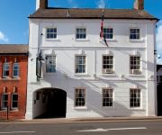
The Greyhound Coaching Inn
JCT.18 Holiday Inn RUGBY-NORTHAMPTON M1
TRAVELODGE LUTTERWORTH
ibis Rugby East
Videos from this area
These are videos related to the place based on their proximity to this place.
Summer Wolf Run Stanford Hall 15-06-2014 - Garmin Virb Elite & Data Overlay
My first obstacle course run at Stanford Hall recorded with the Garmin Virb Elite. This video shows all of the obstacles you will encounter on the Summer Wolf its an awesome run and shows...
Škoda Owners Club Meeting - Stanford Hall - 26th May 2013
Video of some of the vehicles attending the Škoda owners club meeting held at Stanford Hall on 26th May 2013. As well as the Octavia Combi, Rapid, Estelle, Favorit, Š100 and Š110R, a Wartburg...
East European Cars at Stanford Hall 2007 - Skoda S100
Brief clip of a white Skoda S100 idling at Stanford Hall on 13th May 2007.
East European Cars at Stanford Hall 2007 Skoda 1000MB
Brief clip of blue Skoda 1000MB departing in heavy rain from Stanford Hall on 13th May 2007.
Founders Day 2007
Taverners section of the Vintage Motorcycle Club held their event at Stanford Hall in September after the summer event was rained off.
The Greyhound Coaching Inn and Hotel
A tour of this unique 18th century coaching inn by 'Britain's Best Breaks' showing some of the individual character and charm of this Grade II listed coaching inn - the only surviving coaching...
Goose Meadow - Jonny and Polly
Resident rider Jonny and all round nutcase Polly on Quad hit the Tabletop at Goose Meadow Off Road, see you at the weekends ;)
WMCCL U12s 23 Oct 2011 Misterton Hall
The Waldrons West Midlands Cyclo Cross League (WMCCL) Under 12s (U12) Cyclo Cross (CX) Race at Misterton Hall, Welland Valley, UK on 23 October 2011. A few cyclo cross crashes. HACC ...
WMCCL Seniors & Vets (40+) Misterton 28 Oct 2012
Seniors and Vets race at Misterton in WMCCL Round 6 with Welland Valley Cycling. Matt Barratt won Seniors (30+), Tom Payton won Seniors (U23), Paul Cox Seniors, and Darren Atkins won Vets ...
Videos provided by Youtube are under the copyright of their owners.
Attractions and noteworthy things
Distances are based on the centre of the city/town and sightseeing location. This list contains brief abstracts about monuments, holiday activities, national parcs, museums, organisations and more from the area as well as interesting facts about the region itself. Where available, you'll find the corresponding homepage. Otherwise the related wikipedia article.
Stanford Hall, Leicestershire
Stanford Hall is a stately home in Leicestershire, England, near the village of Stanford on Avon (which is in Northamptonshire) and the town of Lutterworth, Leicestershire.
Stanford, Northamptonshire
Stanford is a civil parish in the English county of Northamptonshire. The village of Stanford is now deserted; the only settlement in the parish is the hamlet of Stanford-on-Avon.
Shawell
Shawell is a small village in the Harborough district of Leicestershire, England. Its population at the 2001 UK census was 126. It lies less than a mile from the M1 and M6 motorways. The site of the Roman town of Tripontium is on the A5, west of the village. Near to the church are the earthwork remains of a motte and bailey castle.
Catthorpe
Catthorpe is a village and civil parish in the Harborough district of Leicestershire, England. It is close to the A5 road which forms the border with Warwickshire- the nearest town is Rugby, about four miles (6 km) south-west. The parish had a population of 179 according to the 2001 census. The parish church is St Thomas. The local pub is the Cherry Tree on Main Street.
Swinford, Leicestershire
Swinford is a nucleated village and civil parish in the Harborough district of the English county of Leicestershire. It used to be on the former A427, which led under the M1, to Catthorpe. The parish church is All Saints, a 12th Century Norman rebuilding of an earlier Saxon church with a 14th century square bell tower. The local pub is The Chequers on the High Street, formerly known as Chequer Inn.
Greenhaven Woodland Burial Ground
Greenhaven Woodland Burial Ground is a natural burial ground located in the village of Lilbourne, 5 miles from the town of Rugby, England. It opened in 1994 and was the first privately owned natural burial ground in the country. Greenhaven is situated on 14 acres of former agricultural land and originally catered for approximately 7000 plots, but as of December 8, 2008, roughly 5000 of these remain.
Yelvertoft and Stanford Park railway station
Yelvertoft and Stanford Park railway station was a railway station serving Yelvertoft in the English county of Northamptonshire. It was opened as Stanford Hall on the Rugby and Stamford Railway in 1850. Parliamentary approval was gained in 1846 by the directors of the London and Birmingham Railway for a branch from Rugby to the Syston and Peterborough Railway near Stamford. In the same year the company became part of the London and North Western Railway.
Catthorpe Interchange
The Catthorpe Interchange is a major intersection at the southern end of the M6, the western end of the A14 and Junction 19 of the M1 near the village of Catthorpe in Leicestershire, England. It was developed in 1994 when a link to the A14 was added to the pre-existing M1/M6 junction by joining the M1, M6 and A14 to the country lane between Catthorpe and Swinford. The interchange currently handles 100,000 vehicles per day, is overloaded and has a poor safety record.


