Safety Score: 3,0 of 5.0 based on data from 9 authorites. Meaning we advice caution when travelling to United Kingdom.
Travel warnings are updated daily. Source: Travel Warning United Kingdom. Last Update: 2024-08-13 08:21:03
Delve into Earl Shilton
Earl Shilton in Leicestershire (England) with it's 19,578 habitants is a city located in United Kingdom about 89 mi (or 144 km) north-west of London, the country's capital town.
Current time in Earl Shilton is now 11:30 AM (Friday). The local timezone is named Europe / London with an UTC offset of zero hours. We know of 10 airports closer to Earl Shilton, of which 5 are larger airports. The closest airport in United Kingdom is Coventry Airport in a distance of 16 mi (or 26 km), South-West. Besides the airports, there are other travel options available (check left side).
There are several Unesco world heritage sites nearby. The closest heritage site in United Kingdom is Derwent Valley Mills in a distance of 46 mi (or 74 km), North-East. Also, if you like playing golf, there are some options within driving distance. In need of a room? We compiled a list of available hotels close to the map centre further down the page.
Since you are here already, you might want to pay a visit to some of the following locations: Glenfield, Leicester, Keresley, Coventry and Netherseal. To further explore this place, just scroll down and browse the available info.
Local weather forecast
Todays Local Weather Conditions & Forecast: 8°C / 47 °F
| Morning Temperature | 5°C / 40 °F |
| Evening Temperature | 6°C / 43 °F |
| Night Temperature | 5°C / 41 °F |
| Chance of rainfall | 0% |
| Air Humidity | 77% |
| Air Pressure | 1027 hPa |
| Wind Speed | Light breeze with 5 km/h (3 mph) from North-East |
| Cloud Conditions | Overcast clouds, covering 100% of sky |
| General Conditions | Overcast clouds |
Saturday, 16th of November 2024
9°C (47 °F)
6°C (43 °F)
Light rain, gentle breeze, overcast clouds.
Sunday, 17th of November 2024
7°C (45 °F)
4°C (39 °F)
Light rain, moderate breeze, overcast clouds.
Monday, 18th of November 2024
5°C (41 °F)
-0°C (32 °F)
Snow, moderate breeze, overcast clouds.
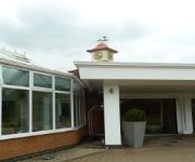
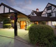
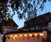
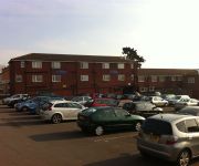
Hotels and Places to Stay
Jurys Inn Hickley Island
Sketchley Grange Hotel and Spa
BW PLUS ULLESTHORPE COURT HTL
Travellers Inn
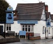
The Blue Bell Inn
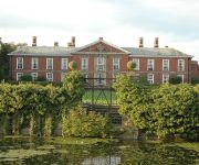
Bosworth Hall
Hinckley
Videos from this area
These are videos related to the place based on their proximity to this place.
Hinckley United v Worcester City
Blue Square North - Saturday 3rd November 2012 Hinckley United 0 Worcester City 5.
Birmingham to Peterborough Line Near Hinckley 12.02.2011
On the 12th February 2011, DMU's are seen near Hinckley on the Birmingham to Peterborough Line. Diesal Class 170 'Turbostar's' are seen in the livery of Cross Country trains.
BSAC Advanced Diver Training at Stoney Cove
Trip to Stoney Cove on 29th March 2013. A lovely day for doing rescue and advanced training... 3 degrees in the water and 3 degrees in the sunshine... Many Thanks to Chris Howells from Richmond...
Stoney Cove
Stoney Cove, 13th December 2008. 5 Degrees Centigrade. Testing out our Cold Water Gear in preparation for our Norway Trip! Northern Diver Dry Gloves and Fourth Element SubZero make all the...
Beth not looking forward to a cold scuba dive at Stoney Cove
Beth entering the water at Stoney Cove Water was a cold 2c!
35 Meter dive down to the Hydrobox at Stoney Cove + the Stanegarth
Chilly December dive down to 35 meters onto the deep Hydrobox at Stoney Cove then a look around the Stanegarth with dive buddy Cameron Cromwell.. 8 degree water, 1 degree air temperature.
Air Ambulance @ Stoney Cove
This helicopter landed on 15.06.08 for an incident at Stoney Cove and took off without a patient. Hopefully all was well.
Stoney Cove - March 2013. (Workflow Practice)
Very quick edit to test workflow with GoPro Hero Black. As you can see there are problems with the colour flickering - I didnt edit with the .avi files. I used the .mp4 exported files. ...
Videos provided by Youtube are under the copyright of their owners.
Attractions and noteworthy things
Distances are based on the centre of the city/town and sightseeing location. This list contains brief abstracts about monuments, holiday activities, national parcs, museums, organisations and more from the area as well as interesting facts about the region itself. Where available, you'll find the corresponding homepage. Otherwise the related wikipedia article.
Kirkby Mallory
Kirkby Mallory is a hamlet in Leicestershire, England that is part of the civil parish of Peckleton. It is known mainly for its Race Circuit, Mallory Park, a one mile (1.6 km) track where car and motorbike races take place. Its church is All Saints and is located near the entrance. Numerous lakes and farms are situated in and around the village and the lakes are popular fishing areas.
Hinckley Rural District
The rural district of Hinckley was set up in 1894, covering the rural area around Hinckley, Leicestershire, England. It was named for Hinckley, but did not include it. It was created by the Local Government Act 1894 based on the Hinckley Rural Sanitary District. The district was split up in 1935, under the review caused by the Local Government Act 1929, with part going to Hinckley urban district, and most of the rest going to Blaby Rural District and Market Bosworth Rural District.
Elmesthorpe
Elmesthorpe is a village and civil parish in the Blaby district of Leicestershire, England. It is situated to the south-east of Earl Shilton, near to Hinckley on the A47 road. In 2004, the parish had an estimated population of 520. The parish of Elmesthorpe has strong connections with King Richard III and the Battle of Bosworth. It is said that the now partially ruined 13th century church provided shelter for the officers of Richard's army on their march from Leicester to the Battle.
Mallory Park
Mallory Park is a motor racing circuit situated in the village of Kirkby Mallory, just off the A47, between Leicester and Hinckley. With the full car circuit measuring only 1.35 miles (2.173 km) it is amongst the shortest permanent race circuits in the UK. However, chicanes introduced to reduce speeds in motorcycle events mean that the Superbike Circuit is slightly longer, at 1.41 miles (2.269 km).
Leicester Road
The Leicester Road Ground is a cricket stadium based in the town of Hinckley, Leicestershire. It has, in the past, been used by Leicestershire as an outground and has held 11 first class games in total. The first game took place in 1981 against Nottinghamshire and the last in 1991 against Gloucestershire.
De Montfort Park
De Montfort Park is the home of Hinckley United, an English football club from Hinckley, Leicestershire. The club currently plays in the Conference North. The stadium complex covers 22 acres and includes three full size pitches, two three-quarter size pitches, three half size pitches and a full size, all-weather floodlit 3G rubber crumb surface pitch. It is named in honour of Simon de Montfort, 6th Earl of Leicester.
Ancient and Medieval Earl Shilton
Earl Shilton is a village in Leicestershire, England.
Kirkby Road
Kirkby Road is a cricket ground in Barwell, Leicestershire. It was used by the County team for three first class matches, two in 1946 and one in 1947. Les Berry scored 89 for the home side against Warwickshire in July 1946. This is the highest first class score on the ground. The ground is still used by the village club.


