Safety Score: 3,0 of 5.0 based on data from 9 authorites. Meaning we advice caution when travelling to United Kingdom.
Travel warnings are updated daily. Source: Travel Warning United Kingdom. Last Update: 2024-08-13 08:21:03
Touring Desford
Desford in Leicestershire (England) with it's 3,179 residents is a town located in United Kingdom about 92 mi (or 148 km) north-west of London, the country's capital place.
Time in Desford is now 01:43 PM (Friday). The local timezone is named Europe / London with an UTC offset of zero hours. We know of 10 airports nearby Desford, of which 5 are larger airports. The closest airport in United Kingdom is East Midlands Airport in a distance of 14 mi (or 23 km), North. Besides the airports, there are other travel options available (check left side).
There are several Unesco world heritage sites nearby. The closest heritage site in United Kingdom is Derwent Valley Mills in a distance of 43 mi (or 69 km), North-East. Also, if you like the game of golf, there are several options within driving distance. Need some hints on where to stay? We compiled a list of available hotels close to the map centre further down the page.
Being here already, you might want to pay a visit to some of the following locations: Glenfield, Leicester, Keresley, Netherseal and Coventry. To further explore this place, just scroll down and browse the available info.
Local weather forecast
Todays Local Weather Conditions & Forecast: 8°C / 47 °F
| Morning Temperature | 5°C / 41 °F |
| Evening Temperature | 6°C / 43 °F |
| Night Temperature | 5°C / 42 °F |
| Chance of rainfall | 0% |
| Air Humidity | 77% |
| Air Pressure | 1027 hPa |
| Wind Speed | Gentle Breeze with 6 km/h (3 mph) from North-East |
| Cloud Conditions | Overcast clouds, covering 100% of sky |
| General Conditions | Overcast clouds |
Saturday, 16th of November 2024
9°C (48 °F)
6°C (43 °F)
Light rain, gentle breeze, overcast clouds.
Sunday, 17th of November 2024
7°C (44 °F)
4°C (39 °F)
Moderate rain, moderate breeze, overcast clouds.
Monday, 18th of November 2024
5°C (41 °F)
-0°C (32 °F)
Snow, moderate breeze, overcast clouds.
Hotels and Places to Stay
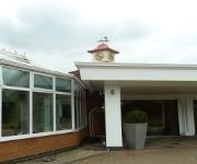
Jurys Inn Hickley Island
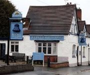
The Blue Bell Inn
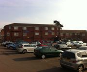
Travellers Inn
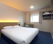
TRAVELODGE LEICESTER MARKFIELD
TRAVELODGE LEICESTER HINCKLEY ROAD
Leicester (Forest East)
Days Inn Leicester Forest East Welcome Break Service Area
Videos from this area
These are videos related to the place based on their proximity to this place.
Thornton - a biker's eye view (Kawasaki z750)
I thought I'd take you on a nice ride up to Thornton Reservoir on my Kawasaki z750 (2009 ABS). This isn't a video to show you how fast the bike can go or how much of a tw*t i can be, it's just...
Thornton Reservoir
A first test of my new Canon Legria HF R506 camcorder. A stroll around Thornton Reservoir in Leicestershire.
My daily journey to work
Everyday on my way to work in my TT I see 6 or 7 other tts. In this clip you can see 3 other tts in quick succession. Audio removed due to copyright issue.
Building the M1 1965
See the Leicestershire section of the M1 Motorway under construction and and scenes of the brand new motorway in use. See also busy roads filled with brand new "Classic" vehicles and London...
Naruto Ninja Council - Sasuke - Sunset Bridge - Part 2
Enjoy Boss Ino Yamanaka Next up Mountain trail.
My Grow Hydroponics Shop - Leicester
Website: www.mygrowhydroponics.co.uk Address: 35 Hill Lane, Markfield, Leics, LE67 9PY (@ M1 Jct 22) Tel: 01530 249537.
Tropical Birdland 25/5/2012
Some of the free parrots at Tropical Birdland! With most of my favourites including Rio, Harry, Rosie and Tallulah. This is my favourite place.
Videos provided by Youtube are under the copyright of their owners.
Attractions and noteworthy things
Distances are based on the centre of the city/town and sightseeing location. This list contains brief abstracts about monuments, holiday activities, national parcs, museums, organisations and more from the area as well as interesting facts about the region itself. Where available, you'll find the corresponding homepage. Otherwise the related wikipedia article.
Kirkby Mallory
Kirkby Mallory is a hamlet in Leicestershire, England that is part of the civil parish of Peckleton. It is known mainly for its Race Circuit, Mallory Park, a one mile (1.6 km) track where car and motorbike races take place. Its church is All Saints and is located near the entrance. Numerous lakes and farms are situated in and around the village and the lakes are popular fishing areas.
Leicester Forest West
Leicester Forest West is a hamlet and civil parish in the Blaby district of Leicestershire, England. It has a population of about 30, making it much smaller than its neighbour, Leicester Forest East. The village takes its name from the ancient Leicester Forest.
Tropical Birdland, Leicestershire
Tropical Birdland in the north of the village of Desford, Leicestershire, England, is a visitor attraction that has many bird species including parrots, toucans, hornbills and owls on display. Some of the birds are allowed to fly out-of-doors during visiting hours.
Thornton Reservoir
Thornton Reservoir is a small reservoir situated in the National Forest near the village of Thornton in Leicestershire. It has a surface area of 75 acres and a perimeter of 2.45 miles . It was originally built in 1854 when it had its own treatment works which were situated to the south of the current dam. It is now owned by Severn Trent and the water is treated a few miles away at Cropston Reservoir to which it runs via Rothley Brook.
Bagworth Heath Woods
Bagworth Heath Woods is a 75-hectare site on the location of the former Desford Colliery, in Leicestershire, England. There are a wide range of walks and great views across Thornton and Bagworth. The site is linked to Thornton and Bagworth by the 100-mile circular walk around Leicestershire called the Leicestershire Round.
Desford Community Primary School
Desford Community Primary School (DCPS or DPS) is a primary school for all students living in Desford and nearby districts for ages 4 to 11. The number of students attending the school in 2006 was 329. As of 2009, there are 237 students. The school mascot is the reindeer.
Merry Lees
Merry Lees is a small settlement and industrial park located in the Hinckley and Bosworth district of Leicestershire, England. It forms as part of the Bagworth and Thornton civil parish. According to the 2001 census, the parish had a population of 1,836. Merry Lees is best known for its industrial estate. There are very few housing estates, however, various farms are situated in and around the area. Notable nearby places include Thornton, Desford, Botcheston, and Newbold Verdon.
RAF Desford
Royal Air Force Station Desford or RAF Desford is a former Royal Air Force station located 1.0 mile south of Desford, Leicestershire and 6.7 miles south west of Leicester, Leicestershire, England.


