Safety Score: 3,0 of 5.0 based on data from 9 authorites. Meaning we advice caution when travelling to United Kingdom.
Travel warnings are updated daily. Source: Travel Warning United Kingdom. Last Update: 2024-08-13 08:21:03
Explore Samlesbury
Samlesbury in Lancashire (England) is located in United Kingdom about 188 mi (or 302 km) north-west of London, the country's capital.
Local time in Samlesbury is now 03:49 PM (Thursday). The local timezone is named Europe / London with an UTC offset of zero hours. We know of 9 airports in the wider vicinity of Samlesbury, of which 4 are larger airports. The closest airport in United Kingdom is Blackpool International Airport in a distance of 17 mi (or 27 km), West. Besides the airports, there are other travel options available (check left side).
There are several Unesco world heritage sites nearby. The closest heritage site in United Kingdom is Pontcysyllte Aqueduct and Canal in a distance of 56 mi (or 91 km), South. Also, if you like golfing, there are multiple options in driving distance. If you need a place to sleep, we compiled a list of available hotels close to the map centre further down the page.
Depending on your travel schedule, you might want to pay a visit to some of the following locations: Preston, Chorley, Blackburn, Haigh and Wigan. To further explore this place, just scroll down and browse the available info.
Local weather forecast
Todays Local Weather Conditions & Forecast: 1°C / 35 °F
| Morning Temperature | -1°C / 30 °F |
| Evening Temperature | 2°C / 35 °F |
| Night Temperature | 2°C / 35 °F |
| Chance of rainfall | 0% |
| Air Humidity | 84% |
| Air Pressure | 1000 hPa |
| Wind Speed | Fresh Breeze with 14 km/h (9 mph) from East |
| Cloud Conditions | Overcast clouds, covering 100% of sky |
| General Conditions | Rain and snow |
Friday, 22nd of November 2024
4°C (39 °F)
1°C (33 °F)
Rain and snow, fresh breeze, clear sky.
Saturday, 23rd of November 2024
3°C (38 °F)
12°C (54 °F)
Rain and snow, strong breeze, overcast clouds.
Sunday, 24th of November 2024
9°C (48 °F)
9°C (49 °F)
Moderate rain, moderate breeze, overcast clouds.
Hotels and Places to Stay
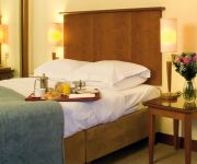
Best Western Plus Samlesbury
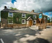
Macdonald Tickled Trout
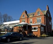
Derby Arms
Holiday Inn Express PRESTON - SOUTH
Pines Hotel
TRAVELODGE PRESTON CENTRAL
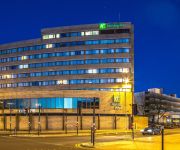
Holiday Inn PRESTON
Farington Lodge
Days Inn Corley - NEC M6 J3/4 Northbound
Preston East
Videos from this area
These are videos related to the place based on their proximity to this place.
44871 and 45407 at Bamber Bridge Foot Crossing on the 'Highlands and Islands Explorer'. 9th May 2014
After a long dragging day at school I made my way down to the train station to catch a short distance journey on a Class 142 Pacer! We then went from the station down to the foot crossing....
Bamber Bridge Spinning & Weaving Company Mill, Wesley Street, Bamber Bridge, Preston
Such a beautiful building laid to waste for so many years and this is what it looks like today..... FEB 2015 This building has now been demolished totally.
Scartop Bamber Bridge views of the store
www.scartop.com - Our store at Bamber Bridge with all the fabulous furniture in store.
Choonz Another Brick in the Wall
Choonz perform "Another brick in the wall " at Bamber Bridge Catholic Club.
LNER Class K4 No. 61994 'The Great Marquess' on The Fellsman 14/8/13
Here we see 61994 The Great Marquess hauling The Fellsman through Bamber Bridge on a wet day. She gives a nice whistle on approach to the station. Enjoy! Please like, share and subscribe.
Hoghton Tower 1940's Wartime Weekend
Lancashire One joined in when living history came to Hoghton Tower with the sights and sounds of the 1940's. The Grade 1 Listed building and historic home to the 14th Baronet, Sir Bernard...
Hoghton Tower sprint on-board footage
On-board bike footage with Mark Berry's air-cooled Yamaha RD250, fastest in the Modern 250cc and Modern 400cc classes at the Hoghton Tower Sprint 2/5/10 . Taken on a GoPro Hero HD camera ...
Videos provided by Youtube are under the copyright of their owners.
Attractions and noteworthy things
Distances are based on the centre of the city/town and sightseeing location. This list contains brief abstracts about monuments, holiday activities, national parcs, museums, organisations and more from the area as well as interesting facts about the region itself. Where available, you'll find the corresponding homepage. Otherwise the related wikipedia article.
Cuerdale Hoard
The Cuerdale Hoard is a hoard of more than 8,600 items, including silver coins, English and Carolingian jewellery, hacksilver and ingots. It was discovered on 15 May 1840 on the southern bank of a bend of the River Ribble, in an area called Cuerdale in South Ribble near to the city of Preston, Lancashire, England.
Flixton, Greater Manchester
Flixton is a village and electoral ward within the Urmston area of the Metropolitan Borough of Trafford in Greater Manchester, England. It lies about six miles (9.7 km) to the southwest of Manchester city centre, within the historic county boundaries of Lancashire. Neolithic and Bronze Age artefacts have been found locally and the area may therefore have been inhabited during those periods.
Preston Rural East
Preston Rural East is an electoral ward in the City of Preston, Lancashire, England. The ward is in the eastern and northeastern part of the city near the M55 motorway moving out towards Sherwood and Grimsargh.
Church of St Leonard the Less, Samlesbury
The Church of St Leonard the Less is an Anglican church in the village of Samlesbury, Lancashire, England, situated close to the banks of the River Ribble. It is an active parish church in the Diocese of Blackburn. It dates predominantly from 1558, with a tower added 1899–1900, and has been designated a Grade I listed building by English Heritage.
All Saints Church, Higher Walton
All Saints Church, Higher Walton, is located in Blackburn Road in the village of Higher Walton, Lancashire, England. It is an active Anglican parish church in the deanery of Leyland, the archdeaconry of Blackburn, and the diocese of Blackburn. The church is designated by English Heritage as a Grade II listed building.
St Michael's Church, Grimsargh
St Michael's Church is in the village of Grimsargh, Lancashire, England. It is an active Anglican parish church in the deanery of Grimsargh, the archdeaconry of Preston, and the diocese of Blackburn. The church is designated by English Heritage as a Grade II listed building.
St Mary Magdalene's Church, Ribbleton
St Mary Magdalene's Church is located in Ribbleton Avenue, Ribbleton, Preston, Lancashire, England. It is an active Anglican parish church in the deanery of Preston, the archdeaconry of Lancaster, and the diocese of Blackburn. Its benefice is united with that of The Church of the Ascension, Ribbleton.
Brockholes (nature reserve)
Brockholes is a nature reserve near Preston, Lancashire, England, just off Junction 31 of the M6 motorway. It is owned by the Wildlife Trust for Lancashire, Manchester and North Merseyside, and has the UK's first floating visitor village. The land was bought by the Trust in January 2007, and the reserve opened to the public at Easter 2011. It was previously a major quarry extraction site.


