Safety Score: 3,0 of 5.0 based on data from 9 authorites. Meaning we advice caution when travelling to United Kingdom.
Travel warnings are updated daily. Source: Travel Warning United Kingdom. Last Update: 2024-08-13 08:21:03
Explore Melling
Melling in Lancashire (England) is a city in United Kingdom about 209 mi (or 336 km) north-west of London, the country's capital.
Local time in Melling is now 03:45 PM (Thursday). The local timezone is named Europe / London with an UTC offset of zero hours. We know of 9 airports in the vicinity of Melling, of which 4 are larger airports. The closest airport in United Kingdom is Barrow Walney Island Airport in a distance of 26 mi (or 42 km), West. Besides the airports, there are other travel options available (check left side).
There are several Unesco world heritage sites nearby. The closest heritage site is Frontiers of the Roman Empire in Germany at a distance of 77 mi (or 123 km). The closest in United Kingdom is Pontcysyllte Aqueduct and Canal in a distance of 81 mi (or 123 km), North-East. Also, if you like golfing, there are multiple options in driving distance. If you need a place to sleep, we compiled a list of available hotels close to the map centre further down the page.
Depending on your travel schedule, you might want to pay a visit to some of the following locations: Preston, Blackburn, Freckleton, Warton and Chorley. To further explore this place, just scroll down and browse the available info.
Local weather forecast
Todays Local Weather Conditions & Forecast: 2°C / 35 °F
| Morning Temperature | -0°C / 32 °F |
| Evening Temperature | 2°C / 36 °F |
| Night Temperature | 2°C / 36 °F |
| Chance of rainfall | 0% |
| Air Humidity | 69% |
| Air Pressure | 1001 hPa |
| Wind Speed | Fresh Breeze with 14 km/h (9 mph) from East |
| Cloud Conditions | Overcast clouds, covering 95% of sky |
| General Conditions | Rain and snow |
Friday, 22nd of November 2024
4°C (40 °F)
3°C (37 °F)
Rain and snow, moderate breeze, clear sky.
Saturday, 23rd of November 2024
4°C (39 °F)
13°C (55 °F)
Rain and snow, high wind, near gale, overcast clouds.
Sunday, 24th of November 2024
9°C (49 °F)
9°C (49 °F)
Moderate rain, moderate breeze, overcast clouds.
Hotels and Places to Stay
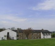
Whoop Hall Hotel and Leisure
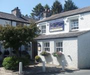
Pheasant Inn
Videos from this area
These are videos related to the place based on their proximity to this place.
Cumbria Country Walk Devils Bridge Kirkby Lonsdale Whittington River Lune round
Our video is a guided walk through the Lune Valley from Devil's Bridge at Kirkby Lonsdale in Cumbria. We cross over the border into Lancashire to the village of Whittington and return via the...
Kirkby Lonsdale Christmas Fair & Parade. 01/12/12
Kirkby Lonsdale Christmas Fair and town Parade. Filmed on 1st December 2012.
Night dive at Devils Bridge ,Kirkby Lonsdale, January 2003
A night dive at Devil Bridge.You can see the Salmon at night as they don't swim away . Its worth letting the police know you intend to dive to avoid any confusion, they will sometimes let...
What has Statistics got to do with fighting disease in Africa?
Talk by Prof. Peter Diggle of the School of Health and Medicine at Lancaster University and the Epidemiology and Population Health at the University of Liverpool, given on 13th March 2013 at...
Dare2Dive - Diving in Capernwray and Devil's Bridge
Krótki filmik z nurkowego weekendu z przyjaciółmi. Nurkowanie w Capernwray (UK) pierwszego dnia, camping na Red Bank Farm i nurkowanie w Kirkby Lonsdale pod Devil's Bridge drugiego dnia.
Kickflip Axel, 270 out
kickflip to axel stall, 270 revert out, from last year. Lame hands Sorrt about the horrible sound, my first ramped slo mo :)
Wray Scarecrow Festival
The little village of Wray in Lancashire celebrates each year with a Scarecrow Festival. Thousands of visitors come to the village to admire the skill and humour of the local residents.
Wray Scarecrow festival - Lancashire
A rural village called Wray celebrates its annual scarecrow festival where neighbours build scarecrows based on themes such as the Olympics, The Avengers, James Bond, Titanic 100th anniversary,...
46115 Scots Guardsman, with 'The Lune Rivers Trust Special' - 8th September 2012
LMS Royal Scot Class 7P, 46115 Scots Guardsman is seen at Wennington station with The Lune Rivers Trust Special on Saturday 8th September 2012. Sadly she was to fail a short time later at...
Videos provided by Youtube are under the copyright of their owners.
Attractions and noteworthy things
Distances are based on the centre of the city/town and sightseeing location. This list contains brief abstracts about monuments, holiday activities, national parcs, museums, organisations and more from the area as well as interesting facts about the region itself. Where available, you'll find the corresponding homepage. Otherwise the related wikipedia article.
St Margaret's Church, Hornby
St Margaret's Church, Hornby, is located in Main Street, Hornby, Lancashire, England. The church is designated by English Heritage as a Grade I listed building. It is an active Anglican parish church in the diocese of Blackburn, the archdeaconry of Lancaster and the deanery of Tunstall. Its benefice is combined with those of St Michael, Whittington, St John, Arkholme, and St John, Gressingham.
St Wilfrid's Church, Melling
St Wilfrid's Church, Melling, is located in Main Street, Melling, Lancashire, England. It is designated by English Heritage as a Grade I listed building, and is an active Anglican church in the united benefice of East Lonsdale, the deanery of Tunstall, the archdeaconry of Lancaster and the diocese of Blackburn. Its benefice is combined with those of St Peter, Leck, St John the Baptist, Tunstall, St James the Less, Tatham, the Good Shepherd, Lowgill, and Holy Trinity, Wray.
Tunstall, Lancashire
Tunstall is a village in north Lancashire, England. It is 11.1 miles northeast of Lancaster on the A683 road between Lancaster and Kirkby Lonsdale. In the 2001 census the civil parish of Tunstall had a population of 105. To the north east of the village is the Grade I listed Church of St John the Baptist. Several houses, a restaurant, a village hall, and a tennis court make up most of the village of Tunstall.
Arkholme for Kirkby Lonsdale railway station
Arkholme for Kirkby Lonsdale railway station served the village of Arkholme in Lancashire, England. It is situated on what is now the Leeds to Morecambe Line between the current Wennington and Carnforth stations.
Wennington Junction rail crash
Just west of Wennington railway station lies Wennington junction where the Furness and Midland Joint Railway leaves the Leeds to Morecambe section of the Midland Railway. On 11 August 1880 the 12:15 Leeds to Lancaster train completely derailed at the junction points then continued for 166 yards before striking the abutment of a bridge.
Hornby Priory
Hornby Priory was an English Premonstratensian monastic house in Hornby, Lancashire. Dedicated to St Wilfrid, the priory was a dependent cell of Croxton Abbey in Leicestershire. It was probably founded by Roger de Montbegon of Hornby, otherwise his father Adam or grandfather Roger. In 1544 Thomas Stanley, 2nd Baron Monteagle and Henry Croft bought the site of Hornby Priory.
Church of St James the Less, Tatham
The Church of St James the Less, Tatham, is located in the village of Tatham, Lancashire, England. It is an active Anglican parish church in the deanery of Tunstall, the archdeaconry of Lancaster and the diocese of Blackburn. Its benefice is united with those of St Wilfrid, Melling, St John the Baptist, Tunstall, St Peter, Leck, the Good Shepherd, Lowgill, and Holy Trinity, Wray, to form the benefice of East Lonsdale. The church is designated by English Heritage as a Grade II* listed building.
St John the Baptist's Church, Arkholme
St John the Baptist's Church, Arkholme, is located in the village of Arkholme, Lancashire, England. It is an active Anglican parish church in the deanery of Tunstall, the archdeaconry of Lancaster, and the diocese of Blackburn. Its benefice is united with those of St Margaret, Hornby, St John the Evangelist, Gressingham, and St Michael the Archangel, Whittington-in-Lonsdale. The church has been designated by English Heritage as a Grade II* listed building.


