Safety Score: 3,0 of 5.0 based on data from 9 authorites. Meaning we advice caution when travelling to United Kingdom.
Travel warnings are updated daily. Source: Travel Warning United Kingdom. Last Update: 2024-08-13 08:21:03
Delve into Longridge
Longridge in Lancashire (England) with it's 7,526 habitants is located in United Kingdom about 191 mi (or 307 km) north-west of London, the country's capital town.
Current time in Longridge is now 03:49 PM (Thursday). The local timezone is named Europe / London with an UTC offset of zero hours. We know of 10 airports close to Longridge, of which 5 are larger airports. The closest airport in United Kingdom is Blackpool International Airport in a distance of 18 mi (or 29 km), West. Besides the airports, there are other travel options available (check left side).
There are several Unesco world heritage sites nearby. The closest heritage site in United Kingdom is Pontcysyllte Aqueduct and Canal in a distance of 61 mi (or 98 km), South. Also, if you like playing golf, there are some options within driving distance. If you need a hotel, we compiled a list of available hotels close to the map centre further down the page.
While being here, you might want to pay a visit to some of the following locations: Preston, Blackburn, Chorley, Haigh and Freckleton. To further explore this place, just scroll down and browse the available info.
Local weather forecast
Todays Local Weather Conditions & Forecast: 1°C / 35 °F
| Morning Temperature | -1°C / 30 °F |
| Evening Temperature | 2°C / 35 °F |
| Night Temperature | 2°C / 35 °F |
| Chance of rainfall | 0% |
| Air Humidity | 84% |
| Air Pressure | 1000 hPa |
| Wind Speed | Fresh Breeze with 14 km/h (9 mph) from East |
| Cloud Conditions | Overcast clouds, covering 100% of sky |
| General Conditions | Rain and snow |
Friday, 22nd of November 2024
4°C (39 °F)
1°C (33 °F)
Rain and snow, fresh breeze, clear sky.
Saturday, 23rd of November 2024
3°C (38 °F)
12°C (54 °F)
Rain and snow, strong breeze, overcast clouds.
Sunday, 24th of November 2024
9°C (48 °F)
9°C (49 °F)
Moderate rain, moderate breeze, overcast clouds.
Hotels and Places to Stay
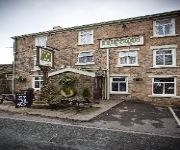
Millstone
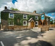
Derby Arms
Best Western Plus Samlesbury
Macdonald Tickled Trout
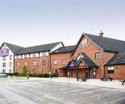
TRAVELODGE PRESTON CENTRAL
Preston East
Days Inn Corley - NEC M6 J3/4 Northbound
Ferrari's Country House
Videos from this area
These are videos related to the place based on their proximity to this place.
Wreckless - 'Storm In The River' Wreckless original in the White Bull Longridge 28/09/12
Wreckless - 'Storm In The River' Wreckless original in the White Bull Longridge 28/09/12.
Jordan Naylor - Longridge Chils..
Just a few clips i put together to try get myself on the Fresh Scooters Team! Thanks for watching please comment, rate and subscribe!
Innova Long Arm Quilting Machine w/ Emma Galbraith at Quilters Quarters
A brief video of Emma Galbraith quilting a commission for Nicky Woodhouse, using the Innova Long Arm Quilting machine. Emma is manually working the machine in a vermicelli pattern.
Wreckless - Dakota (Stereophinics Cover)
Wreckless, Dakota (Stereophinics Cover) in the White Bull Longridge 28/09/12.
North West England 2007 & 2008
A selection of photographs from North West England - taken 2007 & 2008 and within about an hour's drive (at most) of my home in Longridge. There are pictures of Lancashire and also a few...
David & Jane: Wedding Videography at Ferraris Counrty House
Teaser trailer for David & Janes wedding film. Filmed at Ferraris, lancashire.
Justine Forrests Showreel
Showreel for TV chef Justine Forrest, as seen on Michael Winners Dining Stars, Jonathan Ross and TV Burp........
Team OBAS
Team OBAS motivational preparation for the 2012 Charity Boat Race. OBAS and the Chamber of commerce join forces to raise as much money as possible for the Rosmere Cancer Fund! OBAS will ...
Videos provided by Youtube are under the copyright of their owners.
Attractions and noteworthy things
Distances are based on the centre of the city/town and sightseeing location. This list contains brief abstracts about monuments, holiday activities, national parcs, museums, organisations and more from the area as well as interesting facts about the region itself. Where available, you'll find the corresponding homepage. Otherwise the related wikipedia article.
Lancashire
Lancashire is a non-metropolitan county of historic origin in the North West of England. It takes its name from the city of Lancaster, and is sometimes known as the County of Lancaster. Although Lancaster is still considered to be the county town, Lancashire County Council is based in Preston. Lancashire is sometimes referred to by the abbreviation Lancs, as originally used by the Royal Mail. The population of the ceremonial county is 1,449,300. People from the county are known as Lancastrians.
Whittingham Hospital Railway
The Whittingham Hospital Railway (W.H.R. ) was a private light railway operated by Lancashire County Council to serve Whittingham lunatic asylum. Opened in 1889, it carried goods and passengers between Grimsargh on the Preston and Longridge Railway and the hospital grounds. It closed to all traffic in 1957.
Alston Hall
Alston Hall is a 19th century Victorian gothic style country mansion located in Longridge in Lancashire, England.
Preston Rural East
Preston Rural East is an electoral ward in the City of Preston, Lancashire, England. The ward is in the eastern and northeastern part of the city near the M55 motorway moving out towards Sherwood and Grimsargh.
Longridge circuit
Longridge Circuit was a motor racing circuit built in the former Tootle Heights quarry close to Longridge, Lancashire, England. This circuit may be unique in the world in being the only motor racing track situated in a quarry. The roads used for the extremely short circuit were already in place when racing started in 1973, although sprint events were held prior to this.
Hothersall
Hothersall is a civil parish in the Ribble Valley district, in Lancashire, England. The parish, which is on the north bank of the River Ribble, is rural and contains no major villages, and in the 2001 census had a population of 136. It is approximately 8 miles north-east of Preston, and has boundaries with Longridge to the north and west, and Ribchester to the east.
97.4 Rock FM
97.4 Rock FM is an Independent Local Radio station broadcasting to Lancashire, North West England and some parts of North Wales. Its output is mainly contemporary pop and current chart hits. The station is owned & operated by Bauer Radio and forms part of Bauer's Place Network of stations. The total survey area of the station for RAJAR is broadly defined as western, southern and central Lancashire including parts of Greater Manchester and Merseyside.
St Michael's Church, Grimsargh
St Michael's Church is in the village of Grimsargh, Lancashire, England. It is an active Anglican parish church in the deanery of Grimsargh, the archdeaconry of Preston, and the diocese of Blackburn. The church is designated by English Heritage as a Grade II listed building.


