Safety Score: 3,0 of 5.0 based on data from 9 authorites. Meaning we advice caution when travelling to United Kingdom.
Travel warnings are updated daily. Source: Travel Warning United Kingdom. Last Update: 2024-08-13 08:21:03
Discover Gisburn
Gisburn in Lancashire (England) with it's 521 citizens is a town in United Kingdom about 190 mi (or 306 km) north-west of London, the country's capital city.
Current time in Gisburn is now 02:46 PM (Thursday). The local timezone is named Europe / London with an UTC offset of zero hours. We know of 10 airports near Gisburn, of which 5 are larger airports. The closest airport in United Kingdom is Leeds Bradford Airport in a distance of 25 mi (or 40 km), East. Besides the airports, there are other travel options available (check left side).
There are several Unesco world heritage sites nearby. The closest heritage site in United Kingdom is Liverpool – Maritime Mercantile City in a distance of 63 mi (or 102 km), South-East. Also, if you like playing golf, there are a few options in driving distance. Looking for a place to stay? we compiled a list of available hotels close to the map centre further down the page.
When in this area, you might want to pay a visit to some of the following locations: Burnley, Blackburn, Oxenhope, Rochdale and Bury. To further explore this place, just scroll down and browse the available info.
Local weather forecast
Todays Local Weather Conditions & Forecast: 1°C / 34 °F
| Morning Temperature | -2°C / 28 °F |
| Evening Temperature | 1°C / 33 °F |
| Night Temperature | 1°C / 33 °F |
| Chance of rainfall | 0% |
| Air Humidity | 79% |
| Air Pressure | 1000 hPa |
| Wind Speed | Moderate breeze with 12 km/h (7 mph) from East |
| Cloud Conditions | Overcast clouds, covering 100% of sky |
| General Conditions | Rain and snow |
Friday, 22nd of November 2024
3°C (38 °F)
0°C (32 °F)
Sky is clear, moderate breeze, clear sky.
Saturday, 23rd of November 2024
3°C (37 °F)
11°C (52 °F)
Rain and snow, strong breeze, overcast clouds.
Sunday, 24th of November 2024
10°C (51 °F)
10°C (50 °F)
Moderate rain, fresh breeze, overcast clouds.
Hotels and Places to Stay
The Barley Mow
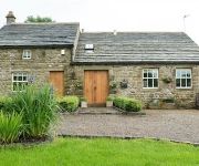
Dam Head Barn
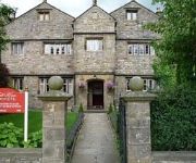
Stirk House Hotel Gisburn
The Pendle Inn
Plough Inn
Videos from this area
These are videos related to the place based on their proximity to this place.
Visit Barnoldswick Website Launch
The new Visit Barnoldswick website was launched in style at a 'Love Barnoldswick' event held on Valentine's Day. Hundreds of people visited a bake off - where Barnoldswick's bakers vied with...
Leon K Dewhurst - Award winning third generation specialist jeweller
Leon K Dewhurst is a multi-award winning third generation jeweller with over 12 years of experience in the trade. Our cameras followed the creation of a piece of jewellery he was producing...
pendle hill bad weather blast
danny and me decided a ride from nelson to the top of pendle was a great idea, which was true until we hit the top for the down hill to ogden res. howling winds and mist made it abit hairy...
Flying around Victoria Park Warrington with a QAV400 FPV / Gopro3
Quad didnt feel tuned well at all, picture was poor and although you cant really tell from the video there was a decent breeze crossing through the fields. Looking forward to going back once...
QAV400 Flying around my field before it becomes a building site :(
Getting used to the new QAV400 frame now, first time using simonk escs too, just waiting on a cc3d but flying it with a kk2 at the moment.
Victoria Park FPV with QAV400 Quadcopter and Mobius 1080p 30fps 0.47fw
First flights with new mobius camera.
Videos provided by Youtube are under the copyright of their owners.
Attractions and noteworthy things
Distances are based on the centre of the city/town and sightseeing location. This list contains brief abstracts about monuments, holiday activities, national parcs, museums, organisations and more from the area as well as interesting facts about the region itself. Where available, you'll find the corresponding homepage. Otherwise the related wikipedia article.
Stock Beck
Stock Beck is a minor river in the West Craven area of Pendle, Lancashire. Stock Beck drains the area around the town of Barnoldswick.
Rimington railway station
Rimington railway station was a railway station that served the small village of Rimington in Lancashire. It was built by the Lancashire and Yorkshire Railway. It was closed in July 1958, some four years prior to the withdrawal of passenger trains over the route.
Newsholme railway station
Newsholme railway station was a railway station that served the small village of Newsholme in Lancashire. It was built by the Lancashire and Yorkshire Railway. It was closed in 1957.
Horton, Lancashire
Horton is a village and a civil parish in the Ribble Valley District, in the English county of Lancashire (historically in the West Riding of Yorkshire). It is near the town of Barnoldswick. Horton has a place of worship. For transport there is the A59 road nearby.


