Safety Score: 3,0 of 5.0 based on data from 9 authorites. Meaning we advice caution when travelling to United Kingdom.
Travel warnings are updated daily. Source: Travel Warning United Kingdom. Last Update: 2024-08-13 08:21:03
Touring Coppull
Coppull in Lancashire (England) with it's 9,014 residents is a town located in United Kingdom about 181 mi (or 291 km) north-west of London, the country's capital place.
Time in Coppull is now 06:48 AM (Tuesday). The local timezone is named Europe / London with an UTC offset of zero hours. We know of 9 airports nearby Coppull, of which 4 are larger airports. The closest airport in United Kingdom is Blackpool International Airport in a distance of 18 mi (or 29 km), North-West. Besides the airports, there are other travel options available (check left side).
There are several Unesco world heritage sites nearby. The closest heritage site in United Kingdom is Pontcysyllte Aqueduct and Canal in a distance of 46 mi (or 75 km), South. Also, if you like the game of golf, there are several options within driving distance. Need some hints on where to stay? We compiled a list of available hotels close to the map centre further down the page.
Being here already, you might want to pay a visit to some of the following locations: Chorley, Haigh, Wigan, Preston and St Helens. To further explore this place, just scroll down and browse the available info.
Local weather forecast
Todays Local Weather Conditions & Forecast: 12°C / 53 °F
| Morning Temperature | 8°C / 47 °F |
| Evening Temperature | 11°C / 52 °F |
| Night Temperature | 10°C / 50 °F |
| Chance of rainfall | 0% |
| Air Humidity | 76% |
| Air Pressure | 1022 hPa |
| Wind Speed | Light breeze with 5 km/h (3 mph) from North-West |
| Cloud Conditions | Overcast clouds, covering 94% of sky |
| General Conditions | Overcast clouds |
Wednesday, 6th of November 2024
14°C (57 °F)
12°C (53 °F)
Overcast clouds, light breeze.
Thursday, 7th of November 2024
14°C (57 °F)
11°C (52 °F)
Few clouds, gentle breeze.
Friday, 8th of November 2024
13°C (55 °F)
9°C (48 °F)
Broken clouds, light breeze.
Hotels and Places to Stay
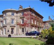
Macdonald Kilhey Court & Spa
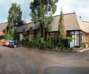
Best Western Park Hall Village
Best Western Park Hall Preston
Shaw Hill Golf & Country Club
Britannia Wigan
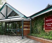
Mercure Wigan Oak Hotel
Farington Lodge
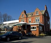
Pines Hotel
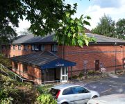
TRAVELODGE PRESTON CHORLEY
Wigan (M6 Jct 27)
Videos from this area
These are videos related to the place based on their proximity to this place.
Steam Train through Standish
On Saturday 10th March 2012 at around 6.15pm a steam train passed through Standish on the West Coast Main Line heading south. I don't know it's name but maybe someone out there does.
Brad and David at a windy Coppull BMX track 14 07 12
Brad and David on a Windy day at Coppull BMX track near Wigan in July 2012.
Property Tour Coppull Moor Lane, PR7 5JH (68037)
Semi Rural Location Adjacent To Open Fields Deceptive Well Proportioned Accommodation, Requires Some Updating Three Bedroom Garden Fronted Terraced House ...
Tatoo Infection Gone In 3 Days | Free Tatoo Infection Ebook No Purchase Required
CLICK HERE FOR YOUR FREE BOOK http://tattooaftercare1.com/ I am often asked, 'Is having an itchy tattoo is a sign of having a tattoo infection?' It works like this. Once your skin has been...
Tattoo Doctor Tattoo Infection Remedy | Tattoo Infection Treatment
CLICK HERE NOW http://tattooaftercare1.com/ Tattoo Doctor Tattoo Infection Remedy | tattoo infection treatment If you are worried about Signs of Tattoo Infection or Tattoo Infection Signs...
Chorley 3 Worcester City 3 Vanarama Conference North
Vanarama Conference North Chorley 3 Worcester City 3 Saturday 28th February 2015.
Same day flower delivery - Marshall's Florist, Chorley, UK
Having your flowers delivered is simple whether it is same day, Saturday, Sunday or an advance order, we can give you an estimate of costs and options. We deliver locally ourselves. If you...
Coppull to Work by Bicycle
Daily commute to Chorley Hospital. If this is too much trouble or your not fit enough then travel by bus! http://youtu.be/L8cJeeaIoVQ.
Property Tour Lichen Close, PR7 5RY (75739)
Two Bedroom Detached True Bungalow Ever Popular Semi Rural Village Location Fitted Dining Kitchen, Gas Central Heating, UPVC Double Glazing ...
Videos provided by Youtube are under the copyright of their owners.
Attractions and noteworthy things
Distances are based on the centre of the city/town and sightseeing location. This list contains brief abstracts about monuments, holiday activities, national parcs, museums, organisations and more from the area as well as interesting facts about the region itself. Where available, you'll find the corresponding homepage. Otherwise the related wikipedia article.
Yarrow Valley Park
Yarrow Valley Park is a country park in Lancashire, England. It follows the River Yarrow for about 6 miles. It contains much woodland and includes nature reserves, best known being Birkacre and Duxbury Woods. Parts of the park are reclaimed collieries and other old industrial sites. A visitor's centre is on site, with regular conservation events. Angling is permitted on the two lodges. The park provides recreation for the nearby town of Chorley and its surrounding villages.
Wigan Rural District
Wigan was a rural district in Lancashire, England from 1894 to 1974. It comprised an area to the north, but did not include the town Wigan. The district was created by the Local Government Act 1894 as the successor to the Wigan Rural Sanitary District. It consisted of six civil parishes: Dalton, Haigh, Parbold, Shevington, Worthington and Wrightington. The parish of Haigh was an exclave, separated from the rest of the district by Standish with Langtree Urban District.
River Chor
The River Chor is a largely culverted stream in the Lancashire town of Chorley. Its name was back-formed from "Chorley". The source of the river is in the hills near Heapey. Subsequently, the young stream flows through Chorley North Industrial Estate, past B&Q and then underground to Astley Park. The river exits at the Southport Road end of the park, flowing behind Chorley Nissan and through Big Wood at the foot of Stansted Road, before connecting into Gillibrand Reservoir.
Holy Cross Catholic High School (Chorley)
Holy Cross Catholic High School is a Roman Catholic Voluntary aided comprehensive school in Chorley, Lancashire, England. The school has dual specialist Sports College and Science College status. The school provides co-educational education for approximately 830 pupils in the 11-16 age range, most of whom reside in Chorley itself, or the surrounding villages of Chorley Borough, part of the Roman Catholic Archdiocese of Liverpool. The headmistress, Mrs.
Chisnall Hall Colliery
Chisnall Hall Colliery a colliery in Coppull in Lancashire, England. It was the largest coal mine on the Lancashire Coalfield north of Wigan. The colliery on Coppull Moor was owned by Pearson and Knowles Coal and Iron Company in 1896 when it employed 135 underground and 48 surface workers. It appeared on maps in 1908 as a coal mine with two shafts and railway sidings connecting its 1.5 mile mineral railway to the London and North Western Railway's Wigan–Preston main line.
Coppull Mill
Coppull Mill, Chorley is a former cotton spinning mill in Coppull, Chorley, Lancashire. It was opened in 1906, and its sister mill, Mavis Mill in 1908. Together they employed 700 workers. The mill was taken over by the Lancashire Cotton Corporation in the 1930s and passed to Courtaulds in 1964. The building is now used as an enterprise centre.
Mavis Mill
Mavis Mill, Coppull is a cotton spinning mill in Coppull, Chorley, Lancashire. Mavis was built in 1908 alongside the Coppull Ring Mill, which still survives under a change of use: Mavis is a car park. It was driven by a 2000 hp triple-expansion four-cylinder engine by J & E Wood, 1909. It had a 26 ft flywheel, 36 ropes. It was taken over by the Lancashire Cotton Corporation in the 1930s.
Lancashire College
Lancashire College is an adult education college located in Chorley, Lancashire, England. The college is the main site and headquarters of Lancashire Adult Learning, an adult education service operated by Lancashire County Council, which includes The Adult College and Alston Hall. Courses offered by the college are aimed primarily at adult learners rather than recent school leavers, and include short courses, weekly courses, ESOL programmes and short-term residential courses.


