Safety Score: 3,0 of 5.0 based on data from 9 authorites. Meaning we advice caution when travelling to United Kingdom.
Travel warnings are updated daily. Source: Travel Warning United Kingdom. Last Update: 2024-08-13 08:21:03
Explore Brinscall
Brinscall in Lancashire (England) with it's 2,286 inhabitants is a city in United Kingdom about 182 mi (or 293 km) north-west of London, the country's capital.
Local time in Brinscall is now 06:38 AM (Tuesday). The local timezone is named Europe / London with an UTC offset of zero hours. We know of 10 airports in the vicinity of Brinscall, of which 5 are larger airports. The closest airport in United Kingdom is Blackpool International Airport in a distance of 20 mi (or 31 km), West. Besides the airports, there are other travel options available (check left side).
There are several Unesco world heritage sites nearby. The closest heritage site in United Kingdom is Pontcysyllte Aqueduct and Canal in a distance of 52 mi (or 83 km), South. Also, if you like golfing, there are multiple options in driving distance. If you need a place to sleep, we compiled a list of available hotels close to the map centre further down the page.
Depending on your travel schedule, you might want to pay a visit to some of the following locations: Chorley, Haigh, Blackburn, Preston and Wigan. To further explore this place, just scroll down and browse the available info.
Local weather forecast
Todays Local Weather Conditions & Forecast: 11°C / 53 °F
| Morning Temperature | 8°C / 46 °F |
| Evening Temperature | 11°C / 52 °F |
| Night Temperature | 10°C / 49 °F |
| Chance of rainfall | 0% |
| Air Humidity | 75% |
| Air Pressure | 1022 hPa |
| Wind Speed | Light breeze with 4 km/h (3 mph) from North-West |
| Cloud Conditions | Overcast clouds, covering 97% of sky |
| General Conditions | Overcast clouds |
Wednesday, 6th of November 2024
14°C (57 °F)
11°C (52 °F)
Overcast clouds, light breeze.
Thursday, 7th of November 2024
14°C (57 °F)
11°C (52 °F)
Few clouds, gentle breeze.
Friday, 8th of November 2024
13°C (55 °F)
9°C (48 °F)
Broken clouds, light breeze.
Hotels and Places to Stay
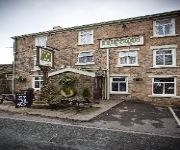
Millstone
Best Western Plus Samlesbury
Macdonald Tickled Trout
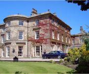
Shaw Hill Golf & Country Club
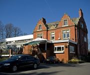
Pines Hotel
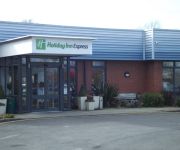
Holiday Inn Express PRESTON - SOUTH
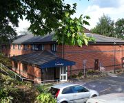
TRAVELODGE PRESTON CHORLEY
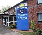
Days Inn Corley - NEC M6 J3/4 Northbound
Chorley North
Chorley South
Videos from this area
These are videos related to the place based on their proximity to this place.
The Beauty of Rivington & Anglezarke
Lancshire's scenic gems, these areas attract thousands of visitors to enjoy the delights of stunning views and amazing wildlife. Everthing from Deer, foxes and squirrels to a huge variety of...
Property Tour Chapel Street, PR6 8QD (79898)
Three Bedroom Semi Detached Family House Corner Plot With Parking & Garage, Sought After Village Location Two Reception Rooms, Modern Tiled Shower Room, Gas CH ...
Driving In Flash Floods nr Blackburn
Heavy rain turns roads into rivers and the build up of flood water at the start of the A675 catches one unlucky motorist out. I was driving a Suzuki Jimny with a snorkel fitted so was having...
Braunton test run 16th July
34046, Braunton on her first loaded main line test run passes Pleasington on 16th July 2013.
Libbey first play out since October 2013050714
This was Libbey's first play out since October 2013. .. and she had half a syringe of Domosedan in her, which seemed to have little effect.
Videos provided by Youtube are under the copyright of their owners.
Attractions and noteworthy things
Distances are based on the centre of the city/town and sightseeing location. This list contains brief abstracts about monuments, holiday activities, national parcs, museums, organisations and more from the area as well as interesting facts about the region itself. Where available, you'll find the corresponding homepage. Otherwise the related wikipedia article.
Abbey Village Reservoir
The reservoir north of Abbey Village on the River Roddlesworth - name unknown - is the latest addition to the reservoirs around this small Lancashire village, designed to increase water storage capacity in wet years.
The Goit
The Goit (sometimes written The Goyt) is a canal used for transporting drinking water along the Rivington chain in Lancashire, England. The section in Brinscall is currently covered, and a local campaign is ongoing to attempt to uncover the water. The Goit is now uncovered from Brinscall down to Aglezarke, passing through White Coppice, a path follows its course the whole way on either side and makes a delightful walk.
Hurst Hill
Hurst Hill is a location on Anglezarke Moor, within the West Pennine Moors of Lancashire, England. Despite a modest height of 317 metres (1040 feet), the summit provides excellent views towards the Irish Sea. Of more note, however, is its location between Round Loaf and Pikestones, both of which are Neolithic remnants. It is probable that Hurst Hill were vantage points for the ancient communities. No excavation work has taken place.
Grain Pole Hill
Grain Pole Hill is a location on Anglezarke Moor, within the West Pennine Moors of Lancashire, England. Despite a modest height of 285 metres (935 ft), the summit provides excellent views towards the Irish Sea. Of more note, however, is its location between Round Loaf and Pikestones, both of which are Neolithic remnants. Hurst Hill is less than half a mile away. It is uncertain as to when the hill gained its name.
Rake Brook Reservoir
Rake Brook Reservoir is a reservoir fed by two streams, including the eponymous Rake Brook, a tributary of the River Roddlesworth in Lancashire. The reservoir is adjacent to the two Roddlesworth Reservoirs.
Withnell railway station
Withnell railway station was a railway station that served Abbey Village and Withnell, in Lancashire, England.
Brinscall railway station
Brinscall railway station was a railway station that served the village of Brinscall, Lancashire, England.
Heapey railway station
Heapey railway station was a railway station that served the village of Heapey, in Lancashire, England.


