Safety Score: 3,0 of 5.0 based on data from 9 authorites. Meaning we advice caution when travelling to United Kingdom.
Travel warnings are updated daily. Source: Travel Warning United Kingdom. Last Update: 2024-08-13 08:21:03
Delve into Brierfield
Brierfield in Lancashire (England) with it's 10,271 habitants is located in United Kingdom about 183 mi (or 294 km) north-west of London, the country's capital town.
Current time in Brierfield is now 03:39 PM (Thursday). The local timezone is named Europe / London with an UTC offset of zero hours. We know of 10 airports close to Brierfield, of which 5 are larger airports. The closest airport in United Kingdom is Leeds Bradford Airport in a distance of 24 mi (or 38 km), East. Besides the airports, there are other travel options available (check left side).
There are several Unesco world heritage sites nearby. The closest heritage site in United Kingdom is Liverpool – Maritime Mercantile City in a distance of 58 mi (or 93 km), South-East. Also, if you like playing golf, there are some options within driving distance. If you need a hotel, we compiled a list of available hotels close to the map centre further down the page.
While being here, you might want to pay a visit to some of the following locations: Burnley, Rochdale, Bury, Blackburn and Oxenhope. To further explore this place, just scroll down and browse the available info.
Local weather forecast
Todays Local Weather Conditions & Forecast: 2°C / 35 °F
| Morning Temperature | -2°C / 29 °F |
| Evening Temperature | 1°C / 34 °F |
| Night Temperature | 1°C / 34 °F |
| Chance of rainfall | 0% |
| Air Humidity | 79% |
| Air Pressure | 1000 hPa |
| Wind Speed | Moderate breeze with 12 km/h (7 mph) from East |
| Cloud Conditions | Overcast clouds, covering 100% of sky |
| General Conditions | Rain and snow |
Friday, 22nd of November 2024
3°C (38 °F)
1°C (33 °F)
Light snow, moderate breeze, clear sky.
Saturday, 23rd of November 2024
3°C (38 °F)
12°C (53 °F)
Rain and snow, strong breeze, overcast clouds.
Sunday, 24th of November 2024
11°C (53 °F)
10°C (51 °F)
Moderate rain, fresh breeze, overcast clouds.
Hotels and Places to Stay
The Barley Mow
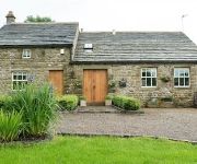
Dam Head Barn
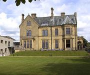
Best Western Oaks Hotel & Leisure Club
JCT.10 Holiday Inn Express BURNLEY M65
The Pendle Inn
Burnley
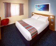
TRAVELODGE BURNLEY
Videos from this area
These are videos related to the place based on their proximity to this place.
Habits That Cause Driver Distraction by Clearwater Solicitors personal injury solicitors Burnley
source: http://www.clearwatersolicitors.co.uk/blog/accident-claims/top-5-habits-that-cause-driver-distraction/ 1- Use Of Mobile phones 2- Messing with the radio or other onboard electronics...
Offices in Burnley - Elm Street, Burnley BB10 Office Space
Welcome to this flexible leased office space video tour of Elm Street, Burnley from officebroker.com http://www.officebroker.com/burnley_lancashire/Elm+Stree...
Accident at Colne Road Burnley !!!
its happen about 11:20 PM on 16th of December 2010, due to speeding ,
Zikr of ALLAH swt - Nelson Ghausia Masjid
Nelson Ghausia Masjid - Remembrance of Allah swt - Circles of Zikr - SubhanAllah "Verily! Only in the Zikr of Allah will your heart find peace." Quran (Surah 13: Verse 8) Zikr, pronounced...
Art Car Parade in Nelson Town Centre
Video of the art car parade through the reopened high street in Nelson on Saturday, 20 August 2011, with description of the vehicles provided by Pendle Council's Vaughan Jones.
Estate Agents and Solicitors, Colne, Nelson, Lancashire - Clifford, Smith and Buchanan.
Estate agency The practice opened the first Solicitors Estate Agency in the area in 1988 and opened offices in Nelson and Colne in 1990 and 1992 respectively. Conveyancing and Estate Agency...
Wedding photography at Towneley Hall, Nelson, Lancashire
Wedding photography at Towneley Hall, Nelson, Lancashire. Wedding photographers from Northwest Photography - http://www.northwestphotography.co.uk.
Polandball: Remembrance Day
(Join The Facebook Page) https://www.facebook.com/PolandballAnimation No matter where you was born. England, Scotland or Australia. Remembrance Day is when we remember the brave men and ...
Videos provided by Youtube are under the copyright of their owners.
Attractions and noteworthy things
Distances are based on the centre of the city/town and sightseeing location. This list contains brief abstracts about monuments, holiday activities, national parcs, museums, organisations and more from the area as well as interesting facts about the region itself. Where available, you'll find the corresponding homepage. Otherwise the related wikipedia article.
Nelson F.C
Nelson F.C. are an English football club, based in Nelson, Lancashire. They are currently members of the North West Counties Football League Division One, who played their home matches at Victoria Park, Lomeshaye Way. They are full members of the Lancashire County Football Association.
Nelson railway station
Nelson railway station serves the town of Nelson in Lancashire, and is situated on the East Lancashire Line 2 miles (3 km) away from the terminus at Colne. The station is managed by Northern Rail, which also provides its passenger service. The station was opened in 1849 by the East Lancashire Railway (which later became part of the Lancashire & Yorkshire Railway) and was formerly on a through route to Skipton and the Aire Valley, but this was closed beyond Colne in 1970.
Seedhill Cricket Ground
The Seedhill Cricket Ground is a small cricket stadium in the English town of Nelson, Lancashire. It is the home of Lancashire League cricket team Nelson Cricket Club. It is situated near to Seedhill Football Ground, the former home of North West Counties League Division One side Nelson F.C. and its home during its period in the Football League from 1921 to 1931, during which time it won the Third Division North title in 1922-23 and played in the then Second Division the following season.
Seedhill Football Ground
The Seedhill Football Ground was a football stadium in Nelson, Lancashire. It was the home of current North West Counties League Division One side Nelson F.C. from 1905 until 1968. Nelson later moved to Victoria Park, before the ground was demolished in 1980 to make way for the M65 motorway.
Marsden Heights Community College
Marsden Heights Community College is a mixed 11-16 comprehensive school in Brierfield, Lancashire, England.
Thomas Whitham Sixth Form
Thomas Whitham Sixth Form is a mixed 16-20 sixth form centre in Burnley, Lancashire.
Edge End High School
Edge End High School was a secondary school for 11 - 16 year olds, in Nelson, Lancashire. The school closed its doors for the last time in June 2006 as part of the UK Government's Building Schools for the Future project. Mansfield High School in neighbouring Brierfield also closed its doors at the same time, the enrolled students from these two schools were merged into one and the new Marsden Heights Community College is now the secondary school serving this area.
St Andrew's Church, Burnley
St Andrew's Church, Burnley, is located in Colne Road, Burnley, Lancashire, England. It is an active Anglican parish church in the deanery of Burnley, the archdeaconry of Blackburn, and the diocese of Blackburn. Its benefice is united with those of St Margaret, Burnley, and St James, Burnley. The church has been designated by English Heritage as a Grade II listed building.


