Safety Score: 3,0 of 5.0 based on data from 9 authorites. Meaning we advice caution when travelling to United Kingdom.
Travel warnings are updated daily. Source: Travel Warning United Kingdom. Last Update: 2024-08-13 08:21:03
Delve into Balderstone
Balderstone in Lancashire (England) is located in United Kingdom about 188 mi (or 302 km) north-west of London, the country's capital town.
Current time in Balderstone is now 12:14 PM (Thursday). The local timezone is named Europe / London with an UTC offset of zero hours. We know of 10 airports close to Balderstone, of which 5 are larger airports. The closest airport in United Kingdom is Blackpool International Airport in a distance of 19 mi (or 30 km), West. Besides the airports, there are other travel options available (check left side).
There are several Unesco world heritage sites nearby. The closest heritage site in United Kingdom is Pontcysyllte Aqueduct and Canal in a distance of 58 mi (or 93 km), South. Also, if you like playing golf, there are some options within driving distance. If you need a hotel, we compiled a list of available hotels close to the map centre further down the page.
While being here, you might want to pay a visit to some of the following locations: Blackburn, Preston, Chorley, Haigh and Bolton. To further explore this place, just scroll down and browse the available info.
Local weather forecast
Todays Local Weather Conditions & Forecast: 1°C / 35 °F
| Morning Temperature | -1°C / 30 °F |
| Evening Temperature | 2°C / 35 °F |
| Night Temperature | 2°C / 35 °F |
| Chance of rainfall | 0% |
| Air Humidity | 84% |
| Air Pressure | 1000 hPa |
| Wind Speed | Fresh Breeze with 14 km/h (9 mph) from East |
| Cloud Conditions | Overcast clouds, covering 100% of sky |
| General Conditions | Rain and snow |
Friday, 22nd of November 2024
4°C (39 °F)
1°C (33 °F)
Rain and snow, fresh breeze, clear sky.
Saturday, 23rd of November 2024
3°C (38 °F)
12°C (54 °F)
Rain and snow, strong breeze, overcast clouds.
Sunday, 24th of November 2024
9°C (48 °F)
9°C (49 °F)
Moderate rain, moderate breeze, overcast clouds.
Hotels and Places to Stay
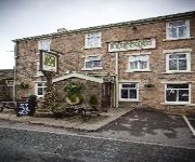
Millstone
Best Western Plus Samlesbury
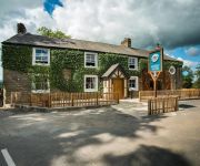
Derby Arms
Macdonald Tickled Trout
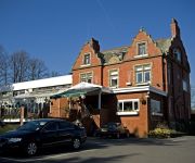
Pines Hotel
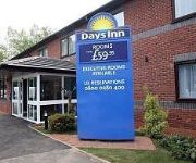
Days Inn Corley - NEC M6 J3/4 Northbound
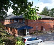
TRAVELODGE PRESTON CHORLEY
Ferrari's Country House
Blackburn Town Centre
Videos from this area
These are videos related to the place based on their proximity to this place.
Mountain biking fail... - Witton country park
James hung over doing a black section at Tricky Sixty, first and last attempt! filmed on a Go pro Hero 2 HD.
LMS 8F No. 48151 The Fellsman at Pleasington 9/7/14
Here we see LMS 8F No. 48151 passing Pleasington on a lovely warm evening on 9th July 2014 with The Fellsman run by Statesman Rail and West Coast Railway Company. Lovely evening for a ...
Braunton test run 16th July
34046, Braunton on her first loaded main line test run passes Pleasington on 16th July 2013.
Wreckless - 'Storm In The River' Wreckless original in the White Bull Longridge 28/09/12
Wreckless - 'Storm In The River' Wreckless original in the White Bull Longridge 28/09/12.
Jordan Naylor - Longridge Chils..
Just a few clips i put together to try get myself on the Fresh Scooters Team! Thanks for watching please comment, rate and subscribe!
Wreckless - Dakota (Stereophinics Cover)
Wreckless, Dakota (Stereophinics Cover) in the White Bull Longridge 28/09/12.
North West England 2007 & 2008
A selection of photographs from North West England - taken 2007 & 2008 and within about an hour's drive (at most) of my home in Longridge. There are pictures of Lancashire and also a few...
Videos provided by Youtube are under the copyright of their owners.
Attractions and noteworthy things
Distances are based on the centre of the city/town and sightseeing location. This list contains brief abstracts about monuments, holiday activities, national parcs, museums, organisations and more from the area as well as interesting facts about the region itself. Where available, you'll find the corresponding homepage. Otherwise the related wikipedia article.
Lancashire
Lancashire is a non-metropolitan county of historic origin in the North West of England. It takes its name from the city of Lancaster, and is sometimes known as the County of Lancaster. Although Lancaster is still considered to be the county town, Lancashire County Council is based in Preston. Lancashire is sometimes referred to by the abbreviation Lancs, as originally used by the Royal Mail. The population of the ceremonial county is 1,449,300. People from the county are known as Lancastrians.
Samlesbury Hall
Samlesbury Hall is an historic house in Samlesbury, Lancashire, England, some 10 km (6 miles) east of Preston. It was built in 1325 by Gilbert de Southworth (b. 1270) and was the primary home of the Southworth Family until the early 1600s. Samlesbury Hall was built possibly to replace an earlier building destroyed during a raid by the Scots in 1322.
Alston Hall
Alston Hall is a 19th century Victorian gothic style country mansion located in Longridge in Lancashire, England.
Hothersall
Hothersall is a civil parish in the Ribble Valley district, in Lancashire, England. The parish, which is on the north bank of the River Ribble, is rural and contains no major villages, and in the 2001 census had a population of 136. It is approximately 8 miles north-east of Preston, and has boundaries with Longridge to the north and west, and Ribchester to the east.
Osbaldeston
Osbaldeston is a village and civil parish at grid reference SD6432 in Lancashire, England about 8 kilometres northwest of Blackburn and 10 kilometres east of Preston. Osbaldeston is on the A59 road and lies on the south bank of the River Ribble opposite Ribchester. There is no Anglican place of worship but the Roman Catholic Church of St. Mary is at grid reference SD648318 in Longsight Road. The hamlet of Osbaldeston Green lies due north of the village.
97.4 Rock FM
97.4 Rock FM is an Independent Local Radio station broadcasting to Lancashire, North West England and some parts of North Wales. Its output is mainly contemporary pop and current chart hits. The station is owned & operated by Bauer Radio and forms part of Bauer's Place Network of stations. The total survey area of the station for RAJAR is broadly defined as western, southern and central Lancashire including parts of Greater Manchester and Merseyside.
St Mary's Church, Mellor
St Mary's Church, Mellor, is located in Church Lane, Mellor, Lancashire, England. It is an active Anglican parish church in the deanery of Whalley, the archdeaconry of Blackburn, and the diocese of Blackburn. The church is designated by English Heritage as a Grade II listed building. It was a Commissioners' church, having received a grant towards its construction from the Church Building Commission.
St Leonard's Church, Balderstone
St Leonard's Church, Balderstone, is located in the village of Balderstone, Lancashire, England. It is an active Anglican parish church in the deanery of Whalley, the archdeaconry of Blackburn, and the diocese of Blackburn. The church is designated by English Heritage as a Grade II listed building.


