Safety Score: 3,0 of 5.0 based on data from 9 authorites. Meaning we advice caution when travelling to United Kingdom.
Travel warnings are updated daily. Source: Travel Warning United Kingdom. Last Update: 2024-08-13 08:21:03
Discover Appley Bridge
Appley Bridge in Lancashire (England) with it's 5,270 citizens is a place in United Kingdom about 180 mi (or 289 km) north-west of London, the country's capital city.
Current time in Appley Bridge is now 06:31 PM (Tuesday). The local timezone is named Europe / London with an UTC offset of zero hours. We know of 9 airports near Appley Bridge, of which 4 are larger airports. The closest airport in United Kingdom is Liverpool John Lennon Airport in a distance of 18 mi (or 28 km), South. Besides the airports, there are other travel options available (check left side).
There are several Unesco world heritage sites nearby. The closest heritage site in United Kingdom is Pontcysyllte Aqueduct and Canal in a distance of 43 mi (or 69 km), South. Also, if you like playing golf, there are a few options in driving distance. We encountered 1 points of interest in the vicinity of this place. If you need a hotel, we compiled a list of available hotels close to the map centre further down the page.
While being here, you might want to pay a visit to some of the following locations: Wigan, Chorley, St Helens, Haigh and Eccleston. To further explore this place, just scroll down and browse the available info.
Local weather forecast
Todays Local Weather Conditions & Forecast: 5°C / 41 °F
| Morning Temperature | 3°C / 38 °F |
| Evening Temperature | 4°C / 39 °F |
| Night Temperature | 5°C / 41 °F |
| Chance of rainfall | 0% |
| Air Humidity | 85% |
| Air Pressure | 1023 hPa |
| Wind Speed | Light breeze with 4 km/h (3 mph) from North-West |
| Cloud Conditions | Broken clouds, covering 77% of sky |
| General Conditions | Broken clouds |
Wednesday, 4th of December 2024
6°C (43 °F)
9°C (49 °F)
Light rain, moderate breeze, overcast clouds.
Thursday, 5th of December 2024
11°C (53 °F)
9°C (48 °F)
Heavy intensity rain, fresh breeze, overcast clouds.
Friday, 6th of December 2024
8°C (46 °F)
9°C (48 °F)
Moderate rain, moderate breeze, overcast clouds.
Hotels and Places to Stay
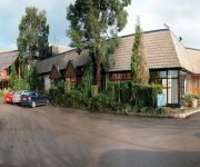
Macdonald Kilhey Court & Spa
Britannia Wigan
Best Western Park Hall Preston
Best Western Park Hall Village
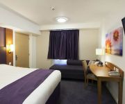
Travel Inn
Wigan (M6 Jct 27)
Holiday Inn Express WIGAN
J25) Wigan (M6
Videos from this area
These are videos related to the place based on their proximity to this place.
StattoSi Out and About Week 2
This week focuses on the trip to Leigh Sports VIllage to watch Leigh Centurions v Wigan Warriors in Paul Prescott's Testimonial.
Episode 17 Carp Fishing at Beacon View Fishery in Wigan Lancashire
In this episode Harry and Andy travel to Wigan in Lancashire to fish Beacon View Fishery. We meet up with a match angler and an old friend Steve who show's us how his method of using the pellet...
Chep and the Rugby Ball
Chep has fun with his Rugby Ball, deep in the heart of Skelmersdale. Lancashire.
Flying a kite with a ballbearing kite reel short video
Kite flying with a ballbearing kite line reel near Upholland in West Lancashire. Flying a kite with just a handle can be a bit tricky, so we bought a kite line winder reel and this is one...
Using a ballbearing kite line reel winder while kite flying near Upholland in West Lancashire
Kite flying with a ballbearing kite line reel at Beacon Fell in West Lancashire. My wife and I go kite flying at a great spot near Parbold in West Lancashire. It gets quite windy and as...
Heather kite flying near Upholland in West Lancashire
Kite flying with a ballbearing kite line reel at Beacon Fell in West Lancashire. My wife and I go kite flying at a great spot near Parbold in West Lancashire.
Smart Car 0.7 2003 Turbo 2012-09-05-13-23-45.mp4
Bought this Smart for £1400.00, Two burnt out valves & 1 piston ring, Spent £975.00 on it for the engine inc x1 dump valve for the turbo, x1 exhaust manifold & x1 wheel bearing. Yes I do...
Videos provided by Youtube are under the copyright of their owners.
Attractions and noteworthy things
Distances are based on the centre of the city/town and sightseeing location. This list contains brief abstracts about monuments, holiday activities, national parcs, museums, organisations and more from the area as well as interesting facts about the region itself. Where available, you'll find the corresponding homepage. Otherwise the related wikipedia article.
Gathurst railway station
On the outskirts of the Metropolitan Borough of Wigan, Greater Manchester, England, the semi-rural Gathurst is a two-platform station on the Southport line 2+⁄4 miles north west of Wigan Wallgate station. The station also serves the nearby village of Shevington, indeed until 1973 (see British Rail Timetable of 1972) was named Gathurst for Shevington.
Standish-with-Langtree
Standish-with-Langtree was, and to a limited extent remains, the name of a local government district centred on Standish, Greater Manchester, in North West England. Historically the name applied to an ancient township in the hundred of West Derby and county of Lancashire. This township became a local board of health area in 1872. Following the Local Government Act 1894, Standish-with-Langtree became an urban district of the administrative county of Lancashire.
Appley Bridge railway station
Appley Bridge railway station serves the villages of Appley Bridge and Shevington in England. The station is 4+⁄2 miles north west of Wigan Wallgate on the Manchester-Southport Line. The station itself is in the Lancashire side of the village, but it is supported by the Greater Manchester Passenger Transport Executive and as such within the GMPTE ticketing zone. Appley Bridge railway station was built by the Lancashire & Yorkshire Railway and opened on 9 April 1855.
Douglas Navigation
The Douglas Navigation was a canalised section of the River Douglas or Asland, in Lancashire, England, running from its confluence with the River Ribble to Wigan. Authorised in 1720, it opened in 1742, but its working life was short, as it was bought out by the Leeds and Liverpool Canal Company in 1772, to prevent a rival scheme to build a canal to Wigan.
St Joseph's College, Upholland
St Joseph's College, Upholland is a former Roman Catholic seminary, situated at Walthew Park, Upholland, Lancashire, England. The foundation of the large building was laid in April 1880 and college was opened in 1883. The buildings have recently been deconsecrated.
St John Rigby College, Wigan
St John Rigby College (abbreviated as St. JR, SJR or simply John Rigby) is a sixth form college in the Orrell district of the Metropolitan Borough of Wigan, Greater Manchester situated in a 30-acre estate overlooking the Lancashire countryside. As a college for students who intend to proceed into higher education, students are accepted from across the Metropolitan Borough of Wigan and Metropolitan Borough of Bolton areas of Greater Manchester as well as parts of Merseyside and Lancashire.
Upholland Priory
Upholland Priory was a Benedictine priory in Upholland, Lancashire, England. It was founded in 1319. The priory remains have received a Grade II listed building designation from English Heritage and the site is listed as a scheduled monument. The former chancel is now the nave of the Church of St Thomas the Martyr.
Church of St Thomas the Martyr, Upholland
The Church of St Thomas the Martyr is located in School Lane, Upholland, Lancashire, England. It is an active Anglican parish church in the deanery of Ormskirk, the archdeaconry of Warrington, and the diocese of Liverpool. The church is designated by English Heritage as a Grade I listed building.


