Safety Score: 3,0 of 5.0 based on data from 9 authorites. Meaning we advice caution when travelling to United Kingdom.
Travel warnings are updated daily. Source: Travel Warning United Kingdom. Last Update: 2024-08-13 08:21:03
Discover Moorside Edge
Moorside Edge in Kirklees (England) is a place in United Kingdom about 165 mi (or 265 km) north-west of London, the country's capital city.
Current time in Moorside Edge is now 09:43 PM (Sunday). The local timezone is named Europe / London with an UTC offset of zero hours. We know of 8 airports near Moorside Edge, of which 5 are larger airports. The closest airport in United Kingdom is Leeds Bradford Airport in a distance of 19 mi (or 30 km), North-East. Besides the airports, there are other travel options available (check left side).
There are several Unesco world heritage sites nearby. The closest heritage site in United Kingdom is Liverpool – Maritime Mercantile City in a distance of 40 mi (or 64 km), South-East. Also, if you like playing golf, there are a few options in driving distance. If you need a hotel, we compiled a list of available hotels close to the map centre further down the page.
While being here, you might want to pay a visit to some of the following locations: Meltham, Halifax, Huddersfield, Clayton and Mossley. To further explore this place, just scroll down and browse the available info.
Local weather forecast
Todays Local Weather Conditions & Forecast: 6°C / 42 °F
| Morning Temperature | 4°C / 40 °F |
| Evening Temperature | 4°C / 40 °F |
| Night Temperature | 4°C / 40 °F |
| Chance of rainfall | 2% |
| Air Humidity | 76% |
| Air Pressure | 1015 hPa |
| Wind Speed | Gentle Breeze with 8 km/h (5 mph) from East |
| Cloud Conditions | Scattered clouds, covering 48% of sky |
| General Conditions | Light rain |
Monday, 18th of November 2024
3°C (37 °F)
-1°C (30 °F)
Snow, moderate breeze, overcast clouds.
Tuesday, 19th of November 2024
-2°C (29 °F)
-7°C (20 °F)
Snow, moderate breeze, broken clouds.
Wednesday, 20th of November 2024
-0°C (31 °F)
-1°C (31 °F)
Snow, gentle breeze, scattered clouds.
Hotels and Places to Stay
The Three Acres Inn & Restaurant
The New Hobbit Hotel
Clarion Collection Cedar Court Hotel Huddersfield
Best Western Pennine Manor Hotel
Thorpe House
Durker Roods
Tower House Hotel
Briar Court Hotel
The Lindley Suite
Woods End Bed & Breakfast
Videos from this area
These are videos related to the place based on their proximity to this place.
TSU Airsoft - Halo Mill - 13/01/13 - Hotline Miami and the Rest
Second and final video from the Halo Mill trip on the 13/01/2013. Includes the whole of one of Halo Mill's stealth games Apologies beforehand for my voice. Filmed on GoPro3, Edited using...
Mark Ford Internet Marketing Mentoring Session
http://markfordsblog.com/mark-ford-on-goal-setting/ - sharing a video from Iain Campbell and Mark Ford, Six Figure Mentors Elite members, internet entrepreneurs and mentors about a two day...
Hacking out (RAW)
Hi everyone!, Just a nice video of me hacking out Jack. The girl on the brown and white horse is Steph and the girl infron tof us is Beth, Yeah I kind of bable on a bit bit but ahwell! Enjoy! XabbeyX.
The Dales Way - walking it in 5 days
Some videos and photos of Pete and Steve walking between Ilkley and Bowness on Windermere. We did the 80 miles over 5 days. Starting at Ilkley to Grassington, Grassington to Yockenthwait, ...
How To Clean & Prevent Rust Stains on Carpets
How to clean and prevent rust stains on carpets, shown here by Roses Cleaning Services of Huddersfield, UK. http://www.rosescleaning.co.uk Video by http://www.timetrapper-video-production.com.
SPICE NIGHTS - WEEK 4
The North Indian province of Punjab is a fertile region full of wonderful, rich ingredients. Its people love big flavours and their dishes are packed with onions, ginger, garlic, tomatoes and...
Videos provided by Youtube are under the copyright of their owners.
Attractions and noteworthy things
Distances are based on the centre of the city/town and sightseeing location. This list contains brief abstracts about monuments, holiday activities, national parcs, museums, organisations and more from the area as well as interesting facts about the region itself. Where available, you'll find the corresponding homepage. Otherwise the related wikipedia article.
A62 road
The A62 is a major road in Northern England that runs between the two major cities of Manchester and Leeds. The road is approximately 40 miles (65 km) long. It runs north east from Manchester (beginning as Oldham Street and Oldham Road) through Failsworth and Oldham then Saddleworth before crossing the Pennines at Standedge into West Yorkshire. Continuing through Marsden, Slaithwaite, Linthwaite, Huddersfield, Liversedge, Heckmondwike and Birstall.
Scammonden
Scammonden was a village close to Huddersfield, in the Dean Head Valley, England, before it was flooded in the 1960s to create the Scammonden Reservoir. The M62 motorway crosses the dam wall and then passes through a cutting to the west over which Scammonden Bridge carries a B-road. The Chapel of St Barthelomew still exists, as does the old vicarage, now a boat club.
Moorside Edge
The Moorside Edge is at grid reference SE070154 just north of Slaithwaite and about 8 km west of Huddersfield in the Kirklees District of West Yorkshire. It is the steeply sloping area of moorland being the descent from the relatively flat summit of Pole Moor into the valley of the River Colne. Just above the edge itself is the Moorside Edge transmitting station.
Moorside Edge transmitting station
Moorside Edge transmitting station was originally constructed in 1931 to radiate the BBC's "North Regional" (from May 17 on 626 kHz) and "National" programmes (from July 12 on 995 kHz). It has one of the most powerful mediumwave radio transmitters in Britain at 200 kW erp. Formed of two 158 metres steel lattice towers it is located just above Moorside Edge. Holme Moss is on a bearing of (168.17°, 11.56km) and Emley Moor is on a bearing of (99.41°, 15.4km).
Scammonden Reservoir
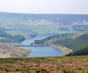
Scammonden Reservoir is a water reservoir in West Yorkshire, England. The area of the water surface when the reservoir is full is 42 hectares . The level of the bellmouth overflow above sea level is 252 metres . The reservoir holds 7800 million litres. Its length is 1.4 kilometres .
Black Brook, West Yorkshire
The Black Brook is a small river in Calderdale, West Yorkshire, England. The Black Brook rises near the border of Calderdale and Kirklees next to Scammonden Dam. It flows downwards through Stainland Dean, and then between Greetland and Stainland. Most of the river, at this point, forms a parish border between the parishes of Greetland and Stainland. The Holywell Brook flows into the Black Brook before flowing into West Vale and going on to join the River Calder.
Nettleton Hill
Nettleton Hill is a hamlet in the Kirklees District, in the English county of West Yorkshire. It is near the town of Huddersfield.
Wilberlee
Wilberlee is a hamlet in the Kirklees District, in the English county of West Yorkshire. It is near the town of Huddersfield and the village of Slaithwaite. Wilberlee has a school.


