Safety Score: 3,0 of 5.0 based on data from 9 authorites. Meaning we advice caution when travelling to United Kingdom.
Travel warnings are updated daily. Source: Travel Warning United Kingdom. Last Update: 2024-08-13 08:21:03
Discover Denby Dale
Denby Dale in Kirklees (England) with it's 3,043 citizens is a city in United Kingdom about 156 mi (or 252 km) north-west of London, the country's capital city.
Local time in Denby Dale is now 10:43 PM (Thursday). The local timezone is named Europe / London with an UTC offset of zero hours. We know of 9 airports in the vicinity of Denby Dale, of which 5 are larger airports. The closest airport in United Kingdom is Leeds Bradford Airport in a distance of 20 mi (or 33 km), North. Besides the airports, there are other travel options available (check left side).
There are several Unesco world heritage sites nearby. The closest heritage site in United Kingdom is Liverpool – Maritime Mercantile City in a distance of 29 mi (or 47 km), South-East. Also, if you like golfing, there are a few options in driving distance. Looking for a place to stay? we compiled a list of available hotels close to the map centre further down the page.
When in this area, you might want to pay a visit to some of the following locations: Penistone, Cawthorne, Mirfield, Huddersfield and Crigglestone. To further explore this place, just scroll down and browse the available info.
Local weather forecast
Todays Local Weather Conditions & Forecast: 3°C / 37 °F
| Morning Temperature | 1°C / 33 °F |
| Evening Temperature | 2°C / 36 °F |
| Night Temperature | 3°C / 38 °F |
| Chance of rainfall | 0% |
| Air Humidity | 72% |
| Air Pressure | 999 hPa |
| Wind Speed | Moderate breeze with 10 km/h (6 mph) from East |
| Cloud Conditions | Scattered clouds, covering 45% of sky |
| General Conditions | Scattered clouds |
Friday, 22nd of November 2024
4°C (39 °F)
2°C (35 °F)
Snow, moderate breeze, clear sky.
Saturday, 23rd of November 2024
5°C (40 °F)
13°C (56 °F)
Rain and snow, fresh breeze, overcast clouds.
Sunday, 24th of November 2024
15°C (58 °F)
10°C (50 °F)
Light rain, fresh breeze, overcast clouds.
Hotels and Places to Stay
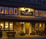
The Woodman Inn
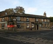
The Grove
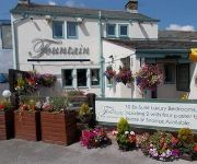
The Fountain Inn
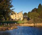
Bagden Hall Hotel
Videos from this area
These are videos related to the place based on their proximity to this place.
Kirklees Light Railway 2012 Gala Part 4
Final part for 2012 Gala at Kirklees light railway we catch the end of day sunlight at cocoo holt before seeing "Shelly or Bust" cavalcade, then we return via Lady of Wakefield to Clayton...
Kirklees Light Railway 2012 Gala Part 2
With the Gala intensive table table in full swing we travel up and down the length of the line as we follow guest engines Ursula & Synolda on the shuttle along with the K1 Garret, Lady wakefield...
Kirklees Light Railway Autumn Gala Part 5
More action from Kirklees autumn steam Gala finishing with the our first pass of the cavalcade, all 8 engines.
Kirklees Light Railway 2012 Gala Part 1
Kirklees Light Railway "Bendy Engines" gala weekend 2012. Running alongside the home based Kitson Meyer "Hawk" and Heisler "Owl" will be the former Bushmills Railway K1 Garratt, now based at...
Kirklees Light Railway Mixed Trafic Gala 2013
Thunder, Typhoon and Red Guantlet joindn the home fleet of Fox, Badger, Hawk, Owl, Jay and Tram No. 7 for the 2013 gala.
LMS 44871 & 45407 on The Tin Bath on Sun 17th March 2013 makes its way across Penistone viaduct
the tin bath hauled by 44871 & 45407 begins to exhilarate out of Pennistone station and across the viaduct. Part 1: http://www.youtube.com/watch?v=0geK-dNdBf0 Part 3: ...
Pen Steam
This video clip came to me from Braham Hughes, who had shot it in high-definition and I rendered it to low-definition. It shows a double-header steam train passing over Penistone viaduct...
4th Jan 2014 Pennine Trail Dog Walk
Paula, Len & Louise with Cezar, Susie, Dallas and Bruno go for a 9km odd walk along the Pennine Trail form Penistone.
Videos provided by Youtube are under the copyright of their owners.
Attractions and noteworthy things
Distances are based on the centre of the city/town and sightseeing location. This list contains brief abstracts about monuments, holiday activities, national parcs, museums, organisations and more from the area as well as interesting facts about the region itself. Where available, you'll find the corresponding homepage. Otherwise the related wikipedia article.
Shelley, West Yorkshire
Shelley is a village in the county of West Yorkshire, England, 3 miles (5 km) north of Holmfirth and 6 miles (9.5 km) south east of Huddersfield. It sometimes appears as Shelley Woodhouse and has a population of 3,059 (2001 census). http://www. kirklees. gov. uk/community/statistics/census-by-settlement/KS02settle2003. xls It is part of the Kirkburton ward of the local council. Road transport links are provided by the A629 and B6116.
Ingbirchworth
Ingbirchworth is a village in the Metropolitan Borough of Barnsley in South Yorkshire, England. Ingbirchworth has its own reservoir, the eldest of the three situated in the area, and currently has one local pub or inn - The Fountain Inn, a 4 star hotel as well as a restaurant and bar with an area for a family atmosphere. The village is in the civil parish of Gunthwaite and Ingbirchworth. At the 2001 census, the civil parish had a population of 400.
Lower Cumberworth
Lower Cumberworth is a village in the Borough of Kirklees in West Yorkshire, England, to the south east of Huddersfield. The civil parish of Denby Dale covers the village. The parish council gave the population of the villages of Upper and Lower Cumberworth as 1,222 in the 2001 Census. http://www. kirklees. gov. uk/community/statistics/census-by-settlement/KS02settle2003. xls The village consists of around 200 homes.
Cuckoos Nest railway station
Cuckoos Nest railway station is a station on the Kirklees Light Railway in West Yorkshire, England. Preceding station Heritage Railways Heritage railways Following station Skelmanthorpe Kirklees Light Railway Clayton West
Skelmanthorpe railway station
Skelmanthorpe railway station is a station that was previously on the national rail network, and is now a station on the Kirklees Light Railway. Situated in Skelmanthorpe, West Yorkshire, England.
Borj-e Sefid
Borj-e Sefid is a tower in Pasdaran, in Tehran, Iran. The Borj-e Sefid (meaning "White Tower" in English) is a skyscraper built along Pasdaran Ave. within which is contained a shopping center as well as many offices. The tower has cemented Pasdaran's status as an upscale suburb of Tehran, raising the area's profile and spurring a series of developments in the surrounding areas. It is home to the revolving restaurant of Borj-e Sefid at the top floor of the tower.
Roydhouse
Roydhouse is a hamlet in the Kirklees District, in the English county of West Yorkshire.
Emley Moor transmitting station
Emley Moor transmitting station is a telecommunications and broadcasting facility on Emley Moor, 1 mile west of Emley, in Kirklees, West Yorkshire, England . The station's most visible feature is its 1,084 feet (330 m) tall concrete tower, which is a Grade II listed building. It is the tallest freestanding structure in the United Kingdom, 7th tallest freestanding structure in the European Union, 4th tallest tower in the European Union, and 25th tallest tower in the world.


