Safety Score: 3,0 of 5.0 based on data from 9 authorites. Meaning we advice caution when travelling to United Kingdom.
Travel warnings are updated daily. Source: Travel Warning United Kingdom. Last Update: 2024-08-13 08:21:03
Discover Kennington
Kennington in Kent (England) with it's 4,178 citizens is a place in United Kingdom about 50 mi (or 80 km) south-east of London, the country's capital city.
Current time in Kennington is now 07:51 PM (Friday). The local timezone is named Europe / London with an UTC offset of zero hours. We know of 11 airports near Kennington, of which 5 are larger airports. The closest airport in United Kingdom is Lydd Airport in a distance of 15 mi (or 24 km), South. Besides the airports, there are other travel options available (check left side).
There are several Unesco world heritage sites nearby. The closest heritage site in United Kingdom is Canterbury Cathedral, St Augustine's Abbey, and St Martin's Church in a distance of 12 mi (or 19 km), North-East. Also, if you like playing golf, there are a few options in driving distance. If you need a hotel, we compiled a list of available hotels close to the map centre further down the page.
While being here, you might want to pay a visit to some of the following locations: Ashford, Boxley, Maidstone, Upper Stoke and Southend-on-Sea. To further explore this place, just scroll down and browse the available info.
Local weather forecast
Todays Local Weather Conditions & Forecast: 11°C / 51 °F
| Morning Temperature | 10°C / 49 °F |
| Evening Temperature | 7°C / 45 °F |
| Night Temperature | 5°C / 41 °F |
| Chance of rainfall | 0% |
| Air Humidity | 69% |
| Air Pressure | 1028 hPa |
| Wind Speed | Light breeze with 4 km/h (3 mph) from South-West |
| Cloud Conditions | Overcast clouds, covering 97% of sky |
| General Conditions | Overcast clouds |
Saturday, 16th of November 2024
9°C (49 °F)
9°C (48 °F)
Overcast clouds, gentle breeze.
Sunday, 17th of November 2024
9°C (47 °F)
3°C (38 °F)
Light rain, moderate breeze, broken clouds.
Monday, 18th of November 2024
10°C (50 °F)
11°C (52 °F)
Moderate rain, fresh breeze, overcast clouds.
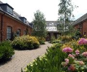
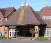
Hotels and Places to Stay
Eastwell Manor
ASHFORD INTERNATIONAL-QHOTELS
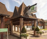
Holiday Inn ASHFORD - CENTRAL
Downsview Guest House
Holiday Inn ASHFORD - NORTH A20
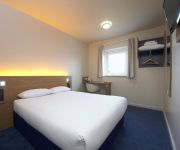
TRAVELODGE ASHFORD
Ashford North
Premier Inn Ashford Eureka Leisure Park
Ashford Central
Videos from this area
These are videos related to the place based on their proximity to this place.
Tour of the lifts at Ashford shopping center
Tour of the lifts at Ashford county sq shopping center. lots of ecodiscs. http://benobve.110mb.com.
Cladding Restoration Ashford
http://purple-rhino.co.uk/services/facade-and-cladding-cleaning Cladding & Window Frame Restoration by Purple Rhino 0800 1577484 If you have faded or chalky cladding or aluminium powder coated ...
Grandsire Triples at Ashford, st mary the virgin, Kent. 21/4/2013
The ending of a successful quarter peal of grandsire triples rung at Ashford, www.campanophile.com/view.aspx?159909 (http://www.ashfordbells.moonfruit.com/#/quarter-peals/4573616306) Tenor...
The Old Mill Ashford Kent - The Old Mill Kennington - 01233 661000
http://www.theoldmill.co - The Old Mill Ashford - The Old Mill Kennington - 01233 661000 The Old Mill Ashford recently opened this year after extensive refurbishment and has a range of good...
Eureka Fisheries Ashford
My local Lake good for Carp,Tench, Bream & Goldfish. Nothing big just good fun size fish. I know its a boring clip but i like it.
Downsview Guest House Ashford - 01233 621391
http://www.ashforddownsview.co.uk/ - Downsview Guest House Ashford - 01233 621391 Downsview Guesthouse offers Silver 4 Star, friendly and comfortable accommodation in Ashford, Kent. Though...
Hobbyzone SuperCub Onboard
Flying my Hobbyzone supercub at a park in Ashford, Kent. This was filmed at 9pm in low-light conditions so the picture is a bit grainy. This was my first fli...
Welsh 4x400m SIAB 2012 Ashford Kent
SIAB (Schools International Athletics Board) Championships Welsh Silver win in 4x400m.
Videos provided by Youtube are under the copyright of their owners.
Attractions and noteworthy things
Distances are based on the centre of the city/town and sightseeing location. This list contains brief abstracts about monuments, holiday activities, national parcs, museums, organisations and more from the area as well as interesting facts about the region itself. Where available, you'll find the corresponding homepage. Otherwise the related wikipedia article.
East Stour, Kent
The River East Stour is one of the tributaries of the Great Stour in Kent. The East Stour, 10.3 miles (16.5 km) long) rises on the Greensand ridge at Postling north of Hythe as a number of small streams. It then flows under the M20 motorway to continue in a westward direction: the river meanders across the Low Weald plain, passing Mersham on the way. The East Stour's confluence with the Great Stour is on both sides of Pledge’s Mill at the foot of East Hill, Ashford.
A28 road
The A28 is a trunk road in southern England. It runs south-west from the seaside resort of Margate in Kent via Westgate and Birchington, reaching open countryside at Sarre. The road continues via Upstreet and Hersden to Sturry, and on to the cathedral city of Canterbury.
County Square
County Square is a shopping centre in Ashford, Kent, England. It is one of three main shopping facilities in the town, others being Park Mall and the Ashford Designer Outlet.
Ashford Green Corridor
Ashford Green Corridor is a green space that runs through the town of Ashford in Kent, England. The Green Corridor is made up of parks, recreation grounds and other green spaces alongside the rivers that flow through Ashford. The town has been growing steadily since the early 19th century. As the town has expanded, land close to the rivers has not usually been built on, due to the risk of flooding because the Ashford Borough Council has protected it as green space.
Kennington Stream
Kennington Stream (or Penlee / Pen Lee) is a tributary of the Great Stour river in Ashford, Kent, England. The stream runs from its source near Kennington, 2.3 kilometres, past Penlee Point (the junction of the A28 and A251 roads) to the Great Stour, joining adjacent to the M20 motorway.
The Towers School
The Towers School and Sixth Form Centre is an academy school in Faversham Road, Kennington, Ashford, Kent. The school has around 1400 students, with a further 400 in sixth form. The current headteacher is Graham Ralph; the first headteacher was Geoff Foster. The school has 4 learning communities named after notable Ashford residents: Barton, named after Elizabeth Barton, Furley, named after Sir John Furley, Harvey, named after William Harvey, Weil, named after Simone Weil.
Ashford Police Training Centre
Ashford Police Training Centre (PTC) was the main training centre for police recruits from forces in the south east of England from 1973 to its closure in 2006. It was also known as Grosvenor Hall after the nineteenth-century building at the heart of the centre in Kennington, Ashford, Kent.
Saint Christopher's Church, Boughton Lees
Saint Christopher's Church is a medieaval Grade II listed church in Boughton Lees near Ashford, Kent, part of the Church of England. The building was originally a medieaval hall house. It was later a barn and the village school. In the 1950s, it was adopted as a chapel of ease. On 13 August 1984, the Church was placed on the Statutory List of Buildings of Special Architectural or Historic Interest, as a Grade II building.


