Safety Score: 3,0 of 5.0 based on data from 9 authorites. Meaning we advice caution when travelling to United Kingdom.
Travel warnings are updated daily. Source: Travel Warning United Kingdom. Last Update: 2024-08-13 08:21:03
Delve into Hersden
Hersden in Kent (England) is a city located in United Kingdom about 57 mi (or 92 km) east of London, the country's capital town.
Current time in Hersden is now 10:26 PM (Friday). The local timezone is named Europe / London with an UTC offset of zero hours. We know of 11 airports closer to Hersden, of which 4 are larger airports. The closest airport in United Kingdom is Kent International Airport in a distance of 8 mi (or 13 km), East. Besides the airports, there are other travel options available (check left side).
There are several Unesco world heritage sites nearby. The closest heritage site in United Kingdom is Canterbury Cathedral, St Augustine's Abbey, and St Martin's Church in a distance of 4 mi (or 7 km), South-West. Also, if you like playing golf, there are some options within driving distance. In need of a room? We compiled a list of available hotels close to the map centre further down the page.
Since you are here already, you might want to pay a visit to some of the following locations: Ashford, Southend-on-Sea, Upper Stoke, Leigh-on-Sea and Canvey Island. To further explore this place, just scroll down and browse the available info.
Local weather forecast
Todays Local Weather Conditions & Forecast: 10°C / 51 °F
| Morning Temperature | 10°C / 50 °F |
| Evening Temperature | 9°C / 48 °F |
| Night Temperature | 7°C / 45 °F |
| Chance of rainfall | 0% |
| Air Humidity | 77% |
| Air Pressure | 1027 hPa |
| Wind Speed | Gentle Breeze with 7 km/h (4 mph) from East |
| Cloud Conditions | Overcast clouds, covering 87% of sky |
| General Conditions | Overcast clouds |
Saturday, 16th of November 2024
10°C (49 °F)
10°C (50 °F)
Light rain, gentle breeze, overcast clouds.
Sunday, 17th of November 2024
9°C (48 °F)
6°C (43 °F)
Light rain, fresh breeze, overcast clouds.
Monday, 18th of November 2024
10°C (51 °F)
12°C (53 °F)
Moderate rain, strong breeze, overcast clouds.
Hotels and Places to Stay
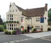
Woolpack Inn
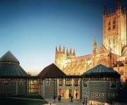
Canterbury Cathedral Lodge
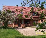
Westgrange House B&B
Best Western Abbots Barton Hotel
TRAVELODGE CANTERBURY CHAUCER CENTRAL
Sun Hotel
Upper Ansdore
Herne Bay
Canterbury City Centre
Videos from this area
These are videos related to the place based on their proximity to this place.
Minecraft Bukkit Plugin - Flappy Birds - Tutorial
Please SUBSCRIBE and LIKE! ☆ ▭▭▭▭▭▭▭▭▭▭▭▭▭ Info ▭▭▭▭▭▭▭▭▭▭▭▭▭▭ Plugin Thread: http://dev.bukkit.org/bukkit-plugins/flappybird/ Region...
Minecraft Bukkit Plugin - Zombie Escape - Tutorial
Please SUBSCRIBE and LIKE! ☆ ▭▭▭▭▭▭▭▭▭▭▭▭▭ Info ▭▭▭▭▭▭▭▭▭▭▭▭▭▭ Plugin Thread: http://dev.bukkit.org/bukkit-plugins/zombieescape/...
Minecraft - MW2 Rust Showcase/Download
MW2 Rust Remade in Minecraft☆ Download: http://www.planetminecraft.com/project/minecraft-call-of-duty-rust-remake/ ♫ Click to show more of the description ♫ My Minecraft Server Ip:...
Minecraft Plugin Tutorial - WorldGuard - Creating Regions
My Minecraft Server Ip: MCALNERCRAFT.TK Thread: http://dev.bukkit.org/bukkit-plugins/worldguard/ My Server Website: http://alnercraft.enjin.com Please Subscribe to my other channels: - http://www....
Minecraft Bukkit Plugin - Star Wars Hoth Generator - Tutorial
Help Me Get to 5000 SUBSCRIBERS! ☆ My Server IP: LTJIM.TK:25681 ▭▭▭▭▭▭▭▭▭▭▭▭▭ Info ▭▭▭▭▭▭▭▭▭▭▭▭▭▭ Plugin Thread: http://dev.bukkit.or...
Just Cause 2 Mod - Police Life - Showcase Tutorial
Link: http://www.justcause2mods.com/mods/other/Gameplay/JC2-Police-Life/ Please Subscribe to my other channel: ▻ http://www.youtube.com/user/RoyalBritishGaming FAQ: ○ What programs do...
Minecraft Bukkit Plugin - Grand Theft Diamond - GTA on your Server - Tutorial
Thread: http://dev.bukkit.org/bukkit-plugins/grand-theft-diamond/ UPDATED TUTORIAL: ...
Minecraft Bukkit Plugin - Meta Cycler - Tutorial
Subscribe for More Plugin Tutorials! ☆ ▭▭▭▭▭▭▭▭▭▭▭▭▭ Info ▭▭▭▭▭▭▭▭▭▭▭▭▭▭ Plugin Thread: http://dev.bukkit.org/bukkit-plugins/metacycl...
Minecraft Plugin Tutorial - WorldEdit - Useful Commands
My Minecraft Server Ip: MCALNERCRAFT.TK Thread: http://dev.bukkit.org/bukkit-plugins/worldedit/ My Server Website: http://alnercraft.enjin.com Please Subscribe to my other channels: - http://www.y...
Minecraft Bukkit Plugin - Grapple Hook - Tutorial
Subscribe for More Plugin Showcases and Dayz Videos! ☆ ▭▭▭▭▭▭▭▭▭▭▭▭▭ Info ▭▭▭▭▭▭▭▭▭▭▭▭▭▭ Plugin Thread: http://www.spigotmc.org/resou...
Videos provided by Youtube are under the copyright of their owners.
Attractions and noteworthy things
Distances are based on the centre of the city/town and sightseeing location. This list contains brief abstracts about monuments, holiday activities, national parcs, museums, organisations and more from the area as well as interesting facts about the region itself. Where available, you'll find the corresponding homepage. Otherwise the related wikipedia article.
Wingham River
The River Wingham is a tributary of the Little Stour in Kent, England. The river runs from its source near Ash, west, through Wingham to the Little Stour.
East Blean Woods
East Blean Woods is a National Nature Reserve south of Herne Bay in Kent in southeast England. The reserve covers 122 hectares of ancient semi-natural woodland situated on poorly drained London clay, with a small area of gravelly soil in the south. The underlying clay results in much surface water and mud in winter and wet summers.
Grove Ferry and Upstreet railway station
Grove Ferry and Upstreet was a railway station in east Kent. It was opened by South Eastern Railway (SER), on the Ashford to Ramsgate (via Canterbury West) line between Minster station and Sturry station. The buildings have been demolished and only a few traces remain of the platforms
Stodmarsh National Nature Reserve
Stodmarsh National Nature Reserve lies in the valley of the Great Stour river, between Westbere and Grove Ferry, in the county of Kent, and forms part of the extensive Stodmarsh SSSI. area that includes the adjacent Westbere Marshes.
Highstead
Highstead is a village near the A229 road, in the Canterbury District, in the English county of Kent. It is near the town of Herne Bay.
Grove Ferry Picnic Area
Grove Ferry is near Upstreet, in Kent, England. {{#invoke:Coordinates|coord}}{{#coordinates:51.3232|1.2085|region:GB|||||| |primary |name= }} Grove Ferry Picnic Area is located in KentGrove Ferry Picnic Area Grove Ferry Picnic Site shown within Kent This picnic site is maintained and managed by Kent County Council. It is beside the Grove Ferry Public House, built in 1831,. The pub took its name from a hand drawn ferry that crossed the River Stour, Kent in front of the building.
Church of St Mary the Virgin, Fordwich
The Church of St Mary the Virgin, Fordwich, is a redundant Anglican church in the small town of Fordwich, Kent, England. It has been designated by English Heritage as a Grade I listed building, and is under the care of the Churches Conservation Trust. The church stands near to the centre of Fordwich, some 3 miles northeast of Canterbury.
Spires Academy
The Spires Academy is a secondary school for students aged 11–16 in Canterbury, Kent. There is no sixth form. The school has dual specialist status in business and enterprise, and in visual, creative and performing arts. Spires is independently governed, but funded by the sponsors and the Department for Children, Schools and Families. The Academy is non-selective, welcoming students of all backgrounds and abilities, and it is free to attend.


