Safety Score: 3,0 of 5.0 based on data from 9 authorites. Meaning we advice caution when travelling to United Kingdom.
Travel warnings are updated daily. Source: Travel Warning United Kingdom. Last Update: 2024-08-13 08:21:03
Delve into Bredhurst
Bredhurst in Kent (England) is a town located in United Kingdom about 33 mi (or 53 km) east of London, the country's capital town.
Time in Bredhurst is now 02:56 PM (Friday). The local timezone is named Europe / London with an UTC offset of zero hours. We know of 11 airports closer to Bredhurst, of which 5 are larger airports. The closest airport in United Kingdom is Rochester Airport in a distance of 3 mi (or 6 km), North-West. Besides the airports, there are other travel options available (check left side).
There are several Unesco world heritage sites nearby. The closest heritage site in United Kingdom is Royal Botanic Gardens, Kew in a distance of 16 mi (or 26 km), North-West. Also, if you like the game of golf, there are some options within driving distance. We saw 1 points of interest near this location. In need of a room? We compiled a list of available hotels close to the map centre further down the page.
Since you are here already, you might want to pay a visit to some of the following locations: Boxley, Maidstone, Rochester, High Halstow and Upper Stoke. To further explore this place, just scroll down and browse the available info.
Local weather forecast
Todays Local Weather Conditions & Forecast: 9°C / 49 °F
| Morning Temperature | 7°C / 45 °F |
| Evening Temperature | 7°C / 45 °F |
| Night Temperature | 6°C / 42 °F |
| Chance of rainfall | 0% |
| Air Humidity | 75% |
| Air Pressure | 1028 hPa |
| Wind Speed | Light breeze with 4 km/h (3 mph) from North-East |
| Cloud Conditions | Overcast clouds, covering 96% of sky |
| General Conditions | Overcast clouds |
Saturday, 16th of November 2024
9°C (48 °F)
9°C (48 °F)
Light rain, gentle breeze, clear sky.
Sunday, 17th of November 2024
9°C (47 °F)
5°C (41 °F)
Light rain, moderate breeze, broken clouds.
Monday, 18th of November 2024
6°C (43 °F)
9°C (48 °F)
Light rain, gentle breeze, overcast clouds.
Hotels and Places to Stay
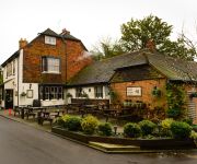
Black Horse Inn
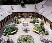
Hilton Maidstone
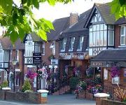
Tudor Park Marriott Hotel & Country Club
BRIDGEWOOD MANOR - QHOTELS
Detling Coachhouse Bed & Breakfast
TRAVELODGE CHATHAM MARITIME
Mercure Maidstone Great Danes Hotel
Grange Moor
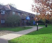
TRAVELODGE MAIDSTONE
Days Inn Maidstone
Videos from this area
These are videos related to the place based on their proximity to this place.
Bowater's - Tesco - Gillingham - Turn Right Towards the M2 (or Superstore)from Gillingham
Feel free to download my home made map, its not to scale but you might find it useful. http://mymail.pwp.blueyonder.co.uk/bowaters.jpg Click the link below to play all Tesco roundabout videos...
Bowater's - Tesco - Gillingham - Follow The Road Ahead Towards Twydall
You must use the centre lane for this one... Feel free to download my home made map, its not to scale but you might find it useful. http://mymail.pwp.blueyonder.co.uk/bowaters.jpg.
Russian Ice Stars Masterclass Silver Blades Gillingham
Russian Ice Stars take an afternoon out of their world tour to visit Silver Blades Ice Rink in Gillingham Kent. Dropping in ahead of their performances of Peter Pan on Ice at The Orchard Theatre...
Wigmore - Gillingham 3 Roundabouts In Quick Succession
There's 3 roundabouts ahead in quick succession, I'd like you to turn left at the first one, ahead at the 2nd and right at the 3rd, so thats left 1st exit, ahead 2nd exit and right 2nd exit....
Bowater's - Tesco - Gillingham - Turn Right Towards Rainham from Hoath Way
At the roundabout ahead I'd like you to turn right towards Rainham, thats your 3rd exit Feel free to download my home made map, its not to scale but you might find it useful. http://mymail.pwp.blue...
Bowater's - Tesco - Gillingham - 2nd Exit Towards the M2 from Rainham
Take the 2nd exit towards the M2... Feel free to download my home made map, its not to scale but you might find it useful. http://mymail.pwp.blueyonder.co.uk/bowaters.jpg.
Bowater's - Tesco - Gillingham - Courteney Road to Rainham/Sittingbourne
From the new test centre in Courteney Road towards Rainham. Most people miss the speed limit signs. Feel free to download my home made map, its not to scale but you might find it useful. http://mym...
Chatham Ski Centre - Main Slope Misting System
The new misting system installed Chatham Ski Centre for Summer 2012 Great feedback over the first few weeks of use. Experience the difference!
Toboggan / Cresta Run at Chatham Ski Centre
Ride the 750m long Cresta Run. The longest toboggan ride in the U.K. visit www.chathamskislope.co.uk for more info.
Videos provided by Youtube are under the copyright of their owners.
Attractions and noteworthy things
Distances are based on the centre of the city/town and sightseeing location. This list contains brief abstracts about monuments, holiday activities, national parcs, museums, organisations and more from the area as well as interesting facts about the region itself. Where available, you'll find the corresponding homepage. Otherwise the related wikipedia article.
Detling Hill
Detling Hill is a hill forming part of the North Downs in Kent, north-east of Maidstone, and is situated in the Kent Downs Area of Outstanding Natural Beauty. The typical southern escarpment of the North Downs is found here, and produces dramatic views over the Low Weald. The North Downs Way passes along the hill just south of the summit.
Lordswood F.C
Lordswood F.C. is a football club based in Lordswood, which is a suburb of Chatham, England. They joined the Kent League in 1996 and are members of the Kent League Premier Division for the 2012–13 season.
A278 road
The A278 is a road running north-south in north Kent, England. The whole length of the road is dual carriageway, within Medway Council but is a non-primary route.
Lordswood, Kent
Lordswood is a suburb of Chatham, Kent, located approximately 3 miles south of Chatham Town Centre. It is primarily in Medway UA but a small southern section is in Maidstone BC.
RAF Detling
RAF Detling was a station of the Royal Naval Air Service (RNAS) in World War I and the Royal Air Force (RAF) in World War II. Situated 600 feet above sea level, it is located near Detling, a village about three miles north-east of Maidstone, in Kent. RNAS Detling was used jointly by the Navy and Air Force between 1916 and 1919, and Fleet Air Arm aircraft also shared some facilities during the second World War. RAF Detling opened in 1939, was assigned to No 11 Group and closed in 1959.
Kent Showground
The Kent Showground, formerly (and still colloquially) known as the Kent County Showground is an area of land in Detling, Kent, England, north of the county town of Maidstone. Stretching along the north side of the A249 from the top of Detling Hill, formerly RAF Detling, it is home to the Kent County Agricultural Society who host the probably the venue's most well known event, the Kent County Show, each July.
Lidsing
Lidsing is a hamlet near the M2 motorway, in the Maidstone District, in the English county of Kent. It is south of the town of Gillingham.
Dunn Street, Maidstone
Dunn Street is a hamlet near the village of Bredhurst and the M2 motorway, in the Maidstone District, in the English county of Kent. It is south of the town of Gillingham.


