Safety Score: 3,0 of 5.0 based on data from 9 authorites. Meaning we advice caution when travelling to United Kingdom.
Travel warnings are updated daily. Source: Travel Warning United Kingdom. Last Update: 2024-08-13 08:21:03
Delve into Highfield
The district Highfield of in Hertfordshire (England) is a subburb in United Kingdom about 23 mi north-west of London, the country's capital town.
If you need a hotel, we compiled a list of available hotels close to the map centre further down the page.
While being here, you might want to pay a visit to some of the following locations: Caddington, Luton, Dunstable, Houghton Regis and Totternhoe. To further explore this place, just scroll down and browse the available info.
Local weather forecast
Todays Local Weather Conditions & Forecast: 2°C / 36 °F
| Morning Temperature | 0°C / 33 °F |
| Evening Temperature | 2°C / 35 °F |
| Night Temperature | 0°C / 33 °F |
| Chance of rainfall | 0% |
| Air Humidity | 73% |
| Air Pressure | 1000 hPa |
| Wind Speed | Moderate breeze with 12 km/h (7 mph) from East |
| Cloud Conditions | Overcast clouds, covering 94% of sky |
| General Conditions | Overcast clouds |
Friday, 22nd of November 2024
4°C (38 °F)
1°C (33 °F)
Broken clouds, fresh breeze.
Saturday, 23rd of November 2024
7°C (45 °F)
13°C (55 °F)
Moderate rain, strong breeze, overcast clouds.
Sunday, 24th of November 2024
14°C (57 °F)
12°C (54 °F)
Moderate rain, high wind, near gale, overcast clouds.
Hotels and Places to Stay
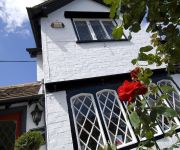
Mercure London North Watford Hunton Park Hotel
Aubrey Park
The Olde Kings Arms
TRAVELODGE HEMEL HEMPSTEAD GATEWAY
Boxmoor Lodge Hotel & Restaurant
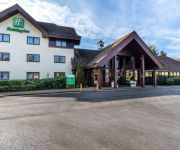
JCT. 8 Holiday Inn HEMEL HEMPSTEAD M1
JCT.9 Holiday Inn LUTON-SOUTH M1
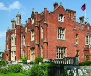
De Vere Latimer Estate
TRAVELODGE HEMEL HEMPSTEAD
Holiday Inn Express HEMEL HEMPSTEAD
Videos from this area
These are videos related to the place based on their proximity to this place.
Hemel Hempstead's Water Gardens
The last walk in that visit to Hemel from last July, taking Sophie down the water gardens.
Hemel Hempstead Snow Centre⎪04.11.12
The video is filmed on the GoPro HD Hero2 at The Hemel Hempstead Snow Centre. Filmed on the 4/11/12 between 8 and 10am. All Rights Reserved.
Benifits of acupuncture Hemel Hempstead
A variety of conditions can benefit from Acupuncture: •allergies•digestive problems•fertility problems•fibromyalgia symptoms•frozen shoulder pain•chronic back pain•heart disease•ho...
Just Nod, Hemel Hempstead Old Town Cellar Club, 21st March 2015
Led Zeppelin, Rock and Roll. Shot in 4K using a Nokia Lumia 930 smartphone. This clip doesn't look in tight focus - I was trying manual focus mode. Sound is good though considering how loud...
Hemel Hempstead Shopping Centre Christmas Display
New for 2014 this is the Christmas Display in the Marlows shopping centre Hemel Hempstead.
The Miserable Public Art of Hemel Hempstead - Revisited!
Some time ago a fellow you-tuber uploaded a hilarious piece entitled "the Miserable Art of Hemel Hempstead". This piece follows in the master's footsteps.
Onyx Snowboarding - Freestyle Snowboard Trampoline Camp June 2013. The Snow Centre, Hemel Hempstead
http://onyxsnowboarding.com/pages/tramp2snow.php Onyx Snowboarding's Tramp2Snow Camp fuses professional trampoline coaching with on snow freestyle instruction giving you the confidence to...
GoPro Hemel Hempstead JC & OC 29 05 14
Me and Ollie messing about with the GoPro at Hemel snow centre.
Olympic Torch Hemel Hempstead 8th July 2012
Watch the Olympic Torch procession approaching Hemel Hempstead town centre. We were on the dual carriageway, outside the "Wally World" complex. OK it was chucking it down with rain, and the...
MSC Racers at Hemel Hempstead 2011 Club National
Midland Ski Club slalom racers at the 2011 Hemel Hempstead Club National, held on 16th July 2011.
Videos provided by Youtube are under the copyright of their owners.
Attractions and noteworthy things
Distances are based on the centre of the city/town and sightseeing location. This list contains brief abstracts about monuments, holiday activities, national parcs, museums, organisations and more from the area as well as interesting facts about the region itself. Where available, you'll find the corresponding homepage. Otherwise the related wikipedia article.
Piers Gaveston, 1st Earl of Cornwall
Piers Gaveston, 1st Earl of Cornwall (c. 1284 – 19 June 1312) was an English nobleman of Gascon origin, and the favourite of King Edward II of England. At a young age he made a good impression on King Edward I "Longshanks", and was assigned to the household of the King's son, Edward of Caernarfon.
Magic Roundabout (Hemel Hempstead)
The Magic Roundabout in Hemel Hempstead, Hertfordshire, England is the familiar name given to the Plough roundabout. The familiar name comes from the children's television programme, and is also used for a similar junction in Swindon and the M40 junction in Denham. The official name relates to a former public house, called The Plough, which faced the junction between Lawn Lane and Two Waters Road.
Hemel Hempstead Town F.C
Hemel Hempstead Town are a football club based in Hemel Hempstead, Hertfordshire, England, who currently play in the Southern League Premier Division, the seventh tier of the English football league system. They are known as the Tudors and play their games at Vauxhall Road. They are managed by Dean Brennan who took over at Vauxhall Road in May 2012.
Apsley railway station
Apsley railway station is in Apsley, on the southern outskirts of Hemel Hempstead, Hertfordshire, England. The station isBad rounding here{{#invoke:Math|precision_format| 37*1,000/1,609.344 | 1-1 }} miles (37 km) north west of London Euston on the West Coast Main Line. Apsley is managed and train services are operated by London Midland.
Hemel Hempstead railway station
Hemel Hempstead railway station is on the West Coast Main Line, on the western edge of the town of Hemel Hempstead, Hertfordshire, England. The station is 24+⁄2 miles north-west of London Euston on the West Coast Main Line. Hemel Hempstead is managed by London Midland and train services are operated by London Midland and Southern. The railway station is in an area called Boxmoor. Bus services run from there to the town centre.
Westwick Row
Westwick Row is a place in Hertfordshire, in England. It is situated on the edge of Hemel Hempstead. Westwick Row today is a narrow rural lane in the village of Leverstock Green, part of it is within the jurisdiction of St Albans Rural District Council, and part with Dacorum Borough Council. It was originally within the parish of St Michael's, St Albans.
Heath Park Halt railway station
Heath Park Halt, in Hemel Hempstead, England, was the terminus for passenger services on the Nicky Line, which ran from here to Harpenden. Passenger services were withdrawn in 1947, and the station closed with the line in 1960. Nothing of the station now remains - its site is now occupied by the Plough Roundabout.
Buncefield fire
The Buncefield fire was a major conflagration caused by a series of explosions on 11 December 2005 at the Hertfordshire Oil Storage Terminal, an oil storage facility located near the M1 motorway by Hemel Hempstead in Hertfordshire, England. The terminal was the fifth largest oil-products storage depot in the United Kingdom, with a capacity of about 60,000,000 imperial gallons of fuel. The terminal is owned by TOTAL UK Limited (60%) and Texaco (40%).
Buncefield oil depot
Buncefield oil depot is operated by Hertfordshire Oil Storage Ltd (HOSL) and officially known as the Hertfordshire Oil Storage Terminal. It is an oil depot located on the edge of Hemel Hempstead to the north of London in the United Kingdom. In 2005 it exploded and became the location of the largest fire in Europe since World War II.
Leverstock Green
Leverstock Green is a suburb in Hemel Hempstead, in the English county of Hertfordshire. It is located on the eastern edge of the town. Leverstock Green contains a village school, village cricket club, village football club, village hall, village shops, village pubs and Holy Trinity church. Despite its recent amalgamation with Hemel Hempstead, the old names remain in memory of historical times.
Leverstock Green F.C
Leverstock Green F.C. are a football club based in Leverstock Green in Hemel Hempstead, England. They were established in 1895 and joined the Hertfordshire County League Division Two in 1954. For the 2012–13 season, they are members of the Spartan South Midlands Football League Premier Division.
Kings Langley F.C
Kings Langley F.C. is a football club based in Kings Langley, near Hemel Hempstead, England. After spending the majority of their history in the Herts County League, they joined the Spartan South Midlands League in 2001, and are currently members of Division One.
Hemel Hempstead Rural District
Hemel Hempstead was a rural district in Hertfordshire, England from 1894 to 1974. It was created in 1894 by the Local Government Act 1894, based on the Hemel Hempstead rural sanitary district. It originally included the town of Hemel Hempstead, which was made a municipal borough in 1898.
Gadebridge Park Roman Villa
Gadebridge Roman Villa is a ruined Roman villa near Hemel Hempstead, Hertfordshire, England. A chance discovery in 1962, it was excavated in 1963-68 under the direction of David S. Neal. A second excavation took place in 2000, also under the direction of Dr Neal. The site may have began as a pre Roman farm, but after the Roman invasion of AD43 its proximity to the Roman city of Verulamium seems to have precipitated its development into a sort of spa and resort. From the Antonine Period, c.
Rudolf Steiner School Kings Langley
Rudolf Steiner School Kings Langley is a Steiner School located in Kings Langley, Hertfordshire, England, formed in 1949. The school caters for pupils aged 3 to 19 years old, and has a capacity of 440 pupils. The School is set on 10 acres of grounds, on the site of Kings Langley Palace, a 13th century Plantagenet royal palace.
Collett School
The Collett School is unique in Hertfordshire, being the only Moderate Learning Difficulties school to have both primary and secondary pupils. We have 120 pupils between the ages of 4 and 16, each having complex needs. The Collett School is a purpose-built special school, designed and built in the 1960s. We are situated on a hill with great views across Hemel Hempstead. We have a large field and several well-kept playgrounds that enable our pupils to play safely and imaginatively.
Warner's End
Warners End is a neighbourhood or district of Hemel Hempstead, a new town in Hertfordshire, England. It was the fourth of the new districts built during the expansion of Hemel Hempstead into a new town with work on its construction commencing in 1953. The place name can be traced back to John Warner mentioned in land documents from 1609 and Warners End farm is notable on historic maps. Its site is now partly occupied by Fields End Junior School. Some of its buildings survive on Long Chaulden.
Gaddesden Place
Gaddesden Place, near Hemel Hempstead in Hertfordshire, England, was designed by architect James Wyatt and built between 1768 and 1773, and was the home of the noted Hertfordshire Halsey family. The Halseys moved to Great Gaddesden in 1458 and later became lessees of the Rectory of Gaddesden until March 12, 1545. When Henry VIII dissolved the monasteries during the Reformation, he granted the estate to William Halsey. Thomas Halsey MP (1731–1788) erected Gaddesden Place, to Wyatt's design.
Great Gaddesden
Great Gaddesden /ˈɡædzdən/ is a village and civil parish in Dacorum Hundred in Hertfordshire, England. It is located in the Chiltern Hills, north of Hemel Hempstead. The parish borders to Flamstead, Hemel Hempstead, Nettleden and Little Gaddesden and also to Studham in Bedfordshire. The Church St. John the Baptist was probably the site of a pre-Christian sanctuary. The church shows features of every period since the 12th century.
St Mary's Church, Hemel Hempstead
St Mary's Church, Hemel Hempstead in Hertfordshire, United Kingdom, is the parish church of the town and its oldest place of worship.
Chaulden
Chaulden is a residential district in Hemel Hempstead, Hertfordshire, England located west of the town centre and bordering on open countryside. It was an early development in the construction of Hemel Hempstead new town, commenced in 1953 and has its own neighbourhood shopping centre. The name Chaulden can be traced back to 1523 as a local field name and means a chalky valley. A country house and estate called Chaulden House occupied the area during the nineteenth century.
Westbrook Hay School
Westbrook Hay Prep School is a co-educational independent school which educates children from rising 3 –13 years. The school is primarily a day school but with flexi boarding. The school took on its present name at its present site in the 1960s, previously it had been a boarding school for boys called Gadebridge Park School in nearby Hemel Hempstead from 1914 until it was forced out of its premises, Gadebridge House by the Commission for New Towns as part of its development of the new town.
The Museum of Technology
The Museum of Technology, The Great War and WWII is a technology museum in the Old Town, Hemel Hempstead, Hertfordshire, England. The displayed objects present the evolution of electrical, electronic, and warfare technology from 1850 to 1980, including World War I and World War II. Viewing is by appointment.
King's Langley Priory
King's Langley Priory was a Dominican priory in Kings Langley, Hertfordshire, England. It was located adjacent to the Kings Langley Royal Palace, residence of the Plantagenet English kings.
Pennine Way stadium
Pennine Way is a multi-use sports stadium in Hemel Hempstead, Hertfordshire. It is the home of Hemel Stags rugby league club.


