Safety Score: 3,0 of 5.0 based on data from 9 authorites. Meaning we advice caution when travelling to United Kingdom.
Travel warnings are updated daily. Source: Travel Warning United Kingdom. Last Update: 2024-08-13 08:21:03
Touring Brimfield
Brimfield in Herefordshire (England) with it's 751 residents is a town located in United Kingdom about 123 mi (or 197 km) north-west of London, the country's capital place.
Time in Brimfield is now 08:13 PM (Thursday). The local timezone is named Europe / London with an UTC offset of zero hours. We know of 9 airports nearby Brimfield, of which 5 are larger airports. The closest airport in United Kingdom is Gloucestershire Airport in a distance of 36 mi (or 58 km), South-East. Besides the airports, there are other travel options available (check left side).
There are several Unesco world heritage sites nearby. The closest heritage site in United Kingdom is Blaenavon Industrial Landscape in a distance of 38 mi (or 61 km), South. Also, if you like the game of golf, there are several options within driving distance. Need some hints on where to stay? We compiled a list of available hotels close to the map centre further down the page.
Being here already, you might want to pay a visit to some of the following locations: Orleton, Kimbolton, Eyton, Bromfield and Elton. To further explore this place, just scroll down and browse the available info.
Local weather forecast
Todays Local Weather Conditions & Forecast: 1°C / 34 °F
| Morning Temperature | 1°C / 33 °F |
| Evening Temperature | -0°C / 31 °F |
| Night Temperature | 1°C / 34 °F |
| Chance of rainfall | 0% |
| Air Humidity | 88% |
| Air Pressure | 1000 hPa |
| Wind Speed | Moderate breeze with 11 km/h (7 mph) from East |
| Cloud Conditions | Broken clouds, covering 82% of sky |
| General Conditions | Broken clouds |
Friday, 22nd of November 2024
4°C (40 °F)
1°C (33 °F)
Light snow, fresh breeze, clear sky.
Saturday, 23rd of November 2024
9°C (48 °F)
14°C (57 °F)
Rain and snow, strong breeze, overcast clouds.
Sunday, 24th of November 2024
13°C (56 °F)
9°C (48 °F)
Moderate rain, strong breeze, overcast clouds.
Hotels and Places to Stay
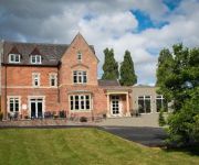
The Clive Restaurant with Rooms
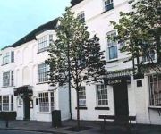
Feathers
The Cliffe at Dinham
Talbot
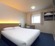
TRAVELODGE LUDLOW WOOFFERTON
TRAVELODGE LUDLOW
FISHMORE HALL
Hills Farm
Videos from this area
These are videos related to the place based on their proximity to this place.
Vision Project 2014 - St Laurence's Church, Ludlow, England
Shaun Ward, Clerk of Works at St. Laurence's, describes the recent restoration work on the church fabric and plans for the future.
Ludlow 2010 River Teme Town Weirs . . .
Cycle along the River Teme in Ludlow to check out the shape of the water at the reconstructed Town Weirs . . .
www.rallyesportescorts.co.uk Mex IT @ Ludlow Gravel Sprint 08 - MKII Escort RS Mexico RS1800 RS2000
www.rallyesportescorts.co.uk - Ricky Williams driving his MKI Mexico 1600cc 1st in class 19th overall at Hays Park competing in the Ludlow Gravel Sprintlow - MKII Escort RS Mexico RS1800 RS2000.
Trees blown down near Ludlow UK. Very early january 1976
We had a very mild and stormy winter in the uk in 2013-2014. However, just to remind you that we have had stormy weather like this before. Hope you enjoy this short video from my archives....
FAINTHEART - Video Diary - tues 13th nov
A trip down to the lovely town of Ludlow. Filming for the up and coming FAINTHEART, the MySpace generated film in conjunction with Film4 and Vertigo. Had a great day, fantastic experience,...
Sam & The Pacemakers - [COVER] Billy Idol - White Wedding
Performing at Stuarts 60th Birthday Party - Ludlow Brewery - 17.01.15 [apologies but my camera does not do justice to the sound quality of the performance]
Sam & The Pacemakers - [COVER] Bad Company; Just What I Needed
Performing at Stuarts 60th Birthday Party - Ludlow Brewery - 17.01.15 [apologies but my camera does not do justice to the sound quality of the performance]
Sam & The Pacemakers - [COVER] The Stranglers; Something Better Change
Performing at Stuarts 60th Birthday Party - Ludlow Brewery - 17.01.15 [apologies but my camera does not do justice to the sound quality of the performance]
Videos provided by Youtube are under the copyright of their owners.
Attractions and noteworthy things
Distances are based on the centre of the city/town and sightseeing location. This list contains brief abstracts about monuments, holiday activities, national parcs, museums, organisations and more from the area as well as interesting facts about the region itself. Where available, you'll find the corresponding homepage. Otherwise the related wikipedia article.
Leominster Canal
The Leominster Canal was an English canal which ran for just over 18 miles from Mamble to Leominster through 16 locks and a number of tunnels, some of which suffered engineering problems even before the canal opened. Originally the canal was part of a much more ambitious plan to run 46 miles from Stourport to Kington.
Little Hereford
Little Hereford is a village and civil parish in Herefordshire, England.
Berrington Hall
Berrington Hall http://www. geograph. org. uk/photo/43243 is a country house located near Leominster, Herefordshire, England. It is a neoclassical country house building http://www. geograph. org. uk/photo/641775 which was designed by Henry Holland in 1778-81 for Thomas Harley. It has a somewhat austere exterior http://www. geograph. org. uk/photo/224971, but the interiors are subtle and delicate.
Woofferton
Woofferton is a village to the south of Ludlow, Shropshire, England. It is one of Shropshire's most southerly villages and lies on the border with Herefordshire. It is part of the civil parish of Richard's Castle. The larger Herefordshire village of Brimfield is just over the border to the south.
Woofferton transmitting station
The Woofferton transmitting station is a shortwave broadcasting site at Woofferton, south of Ludlow, Shropshire, England. The station was originally built by the BBC during World War II to house additional shortwave broadcasting transmitters. It had six 50 kW RCA transmitters, obtained by lend-lease.
List of United Kingdom locations: Woof-Wy
Brimfield, Herefordshire
Brimfield is a village in Herefordshire, England. The village lies on the A49 road at the border with Shropshire. A nearby landmark is Titterstone Clee Hill. To the south, near the village of Ashton, excavations at the site of Ashton Castle have revealed traces of a large stone enclosure castle. Less than a mile to the north of this site are the earthwork remains of a medieval motte.
Wyson
Wyson is a village in Herefordshire, England, west of the A49 road near Brimfield.


!['Sam & The Pacemakers - [COVER] Billy Idol - White Wedding' preview picture of video 'Sam & The Pacemakers - [COVER] Billy Idol - White Wedding'](https://img.youtube.com/vi/afAIi66DB4c/mqdefault.jpg)
!['Sam & The Pacemakers - [COVER] Bad Company; Just What I Needed' preview picture of video 'Sam & The Pacemakers - [COVER] Bad Company; Just What I Needed'](https://img.youtube.com/vi/voucIs4WpuI/mqdefault.jpg)
!['Sam & The Pacemakers - [COVER] The Stranglers; Something Better Change' preview picture of video 'Sam & The Pacemakers - [COVER] The Stranglers; Something Better Change'](https://img.youtube.com/vi/AGa-bTSpjDY/mqdefault.jpg)