Safety Score: 3,0 of 5.0 based on data from 9 authorites. Meaning we advice caution when travelling to United Kingdom.
Travel warnings are updated daily. Source: Travel Warning United Kingdom. Last Update: 2024-08-13 08:21:03
Discover Stanmore
The district Stanmore of in Hampshire (England) is a subburb in United Kingdom about 61 mi south-west of London, the country's capital city.
If you need a hotel, we compiled a list of available hotels close to the map centre further down the page.
While being here, you might want to pay a visit to some of the following locations: Winchester, Southampton, Cowes, Gurnard and Northwood. To further explore this place, just scroll down and browse the available info.
Local weather forecast
Todays Local Weather Conditions & Forecast: 10°C / 51 °F
| Morning Temperature | 7°C / 44 °F |
| Evening Temperature | 13°C / 56 °F |
| Night Temperature | 14°C / 58 °F |
| Chance of rainfall | 21% |
| Air Humidity | 94% |
| Air Pressure | 999 hPa |
| Wind Speed | Strong breeze with 22 km/h (13 mph) from North |
| Cloud Conditions | Overcast clouds, covering 100% of sky |
| General Conditions | Moderate rain |
Sunday, 24th of November 2024
15°C (60 °F)
9°C (49 °F)
Moderate rain, strong breeze, overcast clouds.
Monday, 25th of November 2024
9°C (49 °F)
6°C (43 °F)
Moderate rain, moderate breeze, overcast clouds.
Tuesday, 26th of November 2024
8°C (47 °F)
6°C (43 °F)
Few clouds, moderate breeze.
Hotels and Places to Stay
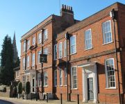
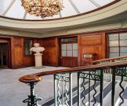
Hotel du Vin Winchester
Best Western Premier Collection Winchester Royal
The Winchester Hotel & Spa
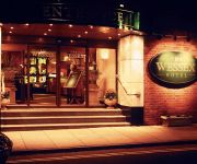
Mercure Winchester Wessex Hotel
Holiday Inn WINCHESTER
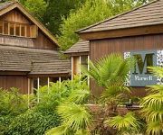
Marwell
JCT13 Holiday Inn SOUTHAMPTON-EASTLEIGH M3
The Potters Heron
TRAVELODGE SOUTHAMPTON EASTLEIGH
TRAVELODGE EASTLEIGH CENTRAL
Videos from this area
These are videos related to the place based on their proximity to this place.
Winchester Fives Nationals 2015 - Final (Full Match)
Here's the full match from the 2015 Winchester Fives National Finals. An epic three-gamer between 6 time Champions, Ellison & Mohammed and 2 of the top Rugby Fives doubles players in the country, ...
Roman Winchester
A workshop run by Winchester City Council Museums for children; to encourage and have a go at creating a short film.
Coffee Winchester : Baristas of Winchester Coffee Shop
http://baristasofwinchester.co.uk Baristas Coffee Winchester is an independent coffee shop serving its own blend of 100% Arabica beans. In addition to the comfortable cafe, Baristas of Winchester...
Baristas Coffee Winchester and Rocket Espresso Milano
http://baristasofwinchester.co.uk/ At Baristas Coffee Winchester we are very proud of our own blend 100% Arabica beans. We are also very proud of our beautiful Rocket Espresso Milano coffee...
Crofton House Studio - Serviced Apartment in Winchester Hampshire UK
Crofton House Studio - Sleeps 2 - Serviced Apartment in Winchester Hampshire UK Find out more http://www.a-d8.co.uk/Pages/CroftonHouseStudio.aspx 1 bedroom/livingroom - 1 bathroom - 1 kitchen.
No. 16(LGF) Clifton Hill - Serviced Apartment Winchester Hampshire UK
No. 16(LGF) Clifton Hill - Sleeps 2+1 - Serviced Apartment Winchester Hampshire UK Find Out More http://www.a-d8.co.uk/Pages/No16LGFCliftonHill.aspx 1 bedroom -1 bathroom - 1 sitting/dining...
Farnham U14 vs Winchester-Basingstoke B Jan08 Pt-4
Part-4 of Farnham Rugby Club U14's friendly match against Winchester/Basingstokes Development Squad on January 27th, 2008.
Videos provided by Youtube are under the copyright of their owners.
Attractions and noteworthy things
Distances are based on the centre of the city/town and sightseeing location. This list contains brief abstracts about monuments, holiday activities, national parcs, museums, organisations and more from the area as well as interesting facts about the region itself. Where available, you'll find the corresponding homepage. Otherwise the related wikipedia article.
City of Winchester
Winchester is a local government district in Hampshire, England, with city status. It covers an area of central Hampshire including the city of Winchester itself, and neighbouring towns and villages including New Alresford, Colden Common and Bishops Waltham. The current city boundaries were set on 1 April 1974 when the City of Winchester merged with Droxford Rural District and part of Winchester Rural District.
Winchester railway station
Winchester railway station is a railway station in Winchester in the county of Hampshire, England. It is on the South Western Main Line and was originally known as Winchester City to distinguish it from Winchester (Chesil) station. Despite its prominence (most passing passenger trains stop here), the station only has two platforms. One is on the western side, with the line running in a northerly direction via Basingstoke, Woking and Clapham Junction, towards the terminal of London Waterloo.
Royal Green Jackets Museum
The Royal Green Jackets Museum in Winchester, England showcases artifacts from British military history, specifically that of the Royal Green Jackets regiment and its preceding regiments. The spotlight on the Royal Green Jackets (1966) includes the Green Jackets Brigade (1958), the Oxfordshire Light Infantry, Buckinghamshire Light Infantry, The King's Royal Rifle Corps (1755), The Rifle Brigade, and other military organizations dating back to 1741.
Clarendon Way
The Clarendon Way is a recreational footpath in England. It starts beside the waters of the River Itchen in the centre of Winchester and ends near the River Avon at Salisbury Cathedral. The path passes through the Clarendon Estate and close to the 12th century ruins of Clarendon Palace. The path also passes through Farley Mount Country Park and the villages of Pitton, The Winterslows, Broughton and King's Somborne.
Pilgrims' Trail
The Pilgrims' Trail is a 155 mile long-distance footpath that connects Winchester Cathedral in Hampshire, England to Mont Saint-Michel in Normandy. The UK section of the footpath passes through the towns of Owslebury and Bishop's Waltham as well as the Forestry Commission owned Forest of Bere. It ends at the Portsmouth ferry terminal. The Hampshire section is waymarked with green disks attached to wooden and metal posts, trees and street furniture; the markers for the French section are blue.
Winchester (UK Parliament constituency)
Winchester is a parliamentary constituency represented in the House of Commons of the Parliament of the United Kingdom. It elects one Member of Parliament (MP) by the first past the post system of election.
King's House, Winchester
The King's House in Winchester was a late 17th century planned royal palace in the English county of Hampshire. Winchester had been the capital of Wessex and England in Anglo-Saxon times, but became a backwater after the Norman Conquest. Built for King Charles II of England by Sir Christopher Wren from 1683, the King's House stood on a site adjoining the castle it was to replace, and modelled after the Palace of Versailles, though on a somewhat smaller scale.
Royal Hampshire County Hospital
The Royal Hampshire County Hospital in Winchester is a District General Hospital serving much of central Hampshire. It is owned and run by the Hampshire Hospitals NHS Foundation Trust. It is commonly abbreviated to RHCH, or alternatively, Winchester Hospital (as opposed to the nearby St Paul's Hospital which closed in January 1998).
Venta Belgarum
Venta Belgarum was a town in the Roman province of Britannia Superior. Today it is known as Winchester and is situated in the English county of Hampshire.
Old Minster, Winchester
The Old Minster was the Anglo-Saxon cathedral for the diocese of Wessex and then Winchester from 660 to 1093. It stood on a site immediately north of and partially beneath its successor, Winchester Cathedral. The old legend that the Old Minster was built in the 2nd century for the non-existent King Lucius of Britain is erroneous. The stone minster was constructed in 648 for King Cenwalh of Wessex and Saint Birinus. It became the diocesan cathedral in 660.
Hospital of St Cross
The Hospital of St Cross and Almshouse of Noble Poverty is a medieval almshouse in Winchester, Hampshire, England, founded between 1133 and 1136. It is the oldest charitable institution in the United Kingdom. The founder was Henry de Blois, Bishop of Winchester, grandson of William the Conqueror, half brother to King Stephen of England.
Oram's Arbour
Oram's Arbour was a hill fort during the Iron Age, which eventually became Venta Belgarum, Britannia and then Winchester, Hampshire, England. Today it's a small grassy park in Winchester, and is used for the annual Winchester Hat Fair both as a picnic site and to stage outdoor theatre and acrobatics.
West Downs School
West Downs School, Romsey Road, Winchester, Hampshire, was an English independent preparatory school, which was established in 1897 and closed in 1988.
HM Prison Winchester
HM Prison Winchester is a Category B men's prison, located in Winchester, Hampshire, England. The prison is operated by Her Majesty's Prison Service.
Winchester College Ground
Winchester College Ground is a cricket ground in Winchester, Hampshire. The ground is based in the grounds of the historic Winchester College, with evidence suggesting cricket in Winchester dates back to the 17th century. The present ground, which is also known as New Field or Ridding Field, dates from 1869 when the then headmaster George Ridding bought land south of "Meads" and donated it to the College.
Green Jackets Ground
The Green Jackets Ground is a cricket ground in St Cross, Winchester, Hampshire used by St Cross Symondians Cricket Club. The ground was first used in 1859, when Winchester Garrison played I Zingari. The ground is currently owned by the trustees of the nearby ancient Hospital of St Cross. The ground was first leased to the Rifle Brigade and since 1885 it has been leased to the Green Jackets Club. Only one first-class match was played at the ground, which saw Hampshire play Sussex in 1875.
Carmelite Friary, Winchester
Carmelite Friary, Winchester was a friary in Hampshire, England.
Franciscan Friary, Winchester
Franciscan Friary, Winchester was a friary in Hampshire, England. 40x40pxThis article may require cleanup to meet Wikipedia's quality standards. No cleanup reason has been specified. Please help improve this article if you can. The location, there are no remains, is thought to be somewhere between Lower Brook Street and Middle Brook Street. Founded by Albert of Pisa in 1237. Dissolved in 1538. It was dedicated to St. Francis.
Win 107.2
Win FM, the on-air name of Winchester Independent Radio, was a local radio station for Winchester, in Hampshire, England, and surrounding areas. After two one-month trial broadcasts in 1996 and 1997 it won a permanent licence and began to broadcast on 3 October 1999. It closed on 2 October 2007. The trial broadcasts were made from temporary studios in Winchester High Street. The permanent station broadcast from studios on the top floor of the Brooks Shopping Centre, Winchester.
Kingsgate, Winchester
Kingsgate is one of two surviving medieval gates to the city of Winchester, England (the other is the Westgate). The name was first recorded in 1148. The gate is on, or near, the site of one of the Roman gates to the city, and was the entrance to the royal palace before the Cathedral Close was enclosed in the 10th century. The present gate is probably 14th century, with 18th-century pedestrian walkways. Above the gate is the small church of St Swithun-upon-Kingsgate.
St Swithun-upon-Kingsgate Church
St Swithun upon Kingsgate is an Anglican parish church in Winchester, Hampshire, England, built in the Middle Ages in the Early English style. Located above the medieval Kingsgate, one of the principal entrances to the city, the church is unusual in forming a part of the fabric of the old city walls. St Swithun's first appears in 13th century records and achieved some literary fame, under the fictional name of St Cuthberts, in Anthony Trollope's novel The Warden.
Westgate, Winchester
The Westgate is one of two surviving fortified gateways in Winchester, England (the other is Kingsgate). The earliest surviving fabric is of Anglo-Saxon character. The gate was rebuilt in the 12th century and modified in the 13th and late 14th centuries, the latter including a portcullis in the western façade and two inverted-keyhole gunports (for use with hand-held cannon), the earliest in the country. The gate was in use until 1959 when the High Street was routed around it.
St Lawrence Church, Winchester
St Lawrence Church is a town church, just off the High Street, in Winchester, England. It is probably of Norman origin, and is said to have been the chapel of William the Conqueror's palace (built 1069-70, destroyed 1141). The church is now almost wholly surrounded by adjacent buildings. It is recorded as being restored in 1475-7, in 1672 (the present roof dates from this restoration), 1847-8, 1881, and 1979-80.
Peninsula Barracks
The Peninsula Barracks are a group of buildings in Winchester, Hampshire.
St Faith's Church, Winchester
St Faith's Church was the parish church of St Cross, a village just south of Winchester, Hampshire, England. It was situated on the northern side of what is now Kingsgate Road at its junction with what is now St Cross Road. The church's graveyard is still there today. The church was demolished in 1507, and St Cross Church, part of the Hospital of St Cross, became the parish church.


